Preparation for Disasters

Provo’s location makes it a great place to live, but it also comes with some inherent risks.

The Wasatch Mountains and Wasatch Fault bring the potential for earthquakes, landslides, debris flows, and wildfires. Utah Lake, the Provo River, and local soil conditions create risks of flooding and liquefaction. A major railroad corridor and a growing airport add to the possibility of transportation accidents.

Some disasters are more likely than others. Severe weather and wildfires occur relatively often in Utah County, while major earthquakes and dam failures are much less common but could have devastating consequences.

We may not be able to prevent every disaster, but we can prepare for them. Understanding Provo's risks is an important first step toward protecting ourselves, our families, and our community.

About This Information

The information on this page is provided for educational and emergency preparedness purposes. Hazard ratings are based primarily on the 2022 Pre-Disaster Mitigation Plan for Summit, Utah, and Wasatch Counties, supplemented by authoritative government sources.

Historical examples do not necessarily indicate future risk, and modeled disaster scenarios are not predictions of future events.

During an emergency, always follow official warnings and instructions from public safety authorities.


Disasters​

Disasters can result from natural processes, severe weather, infrastructure failures, accidents, or human actions. Many disasters can have a domino effect. An earthquake, for example, can cause liquefaction, landslides, tsunamis, or dam failure.

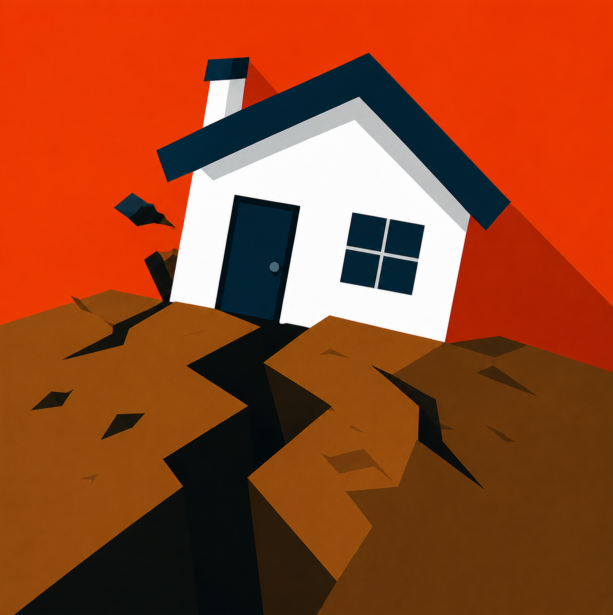
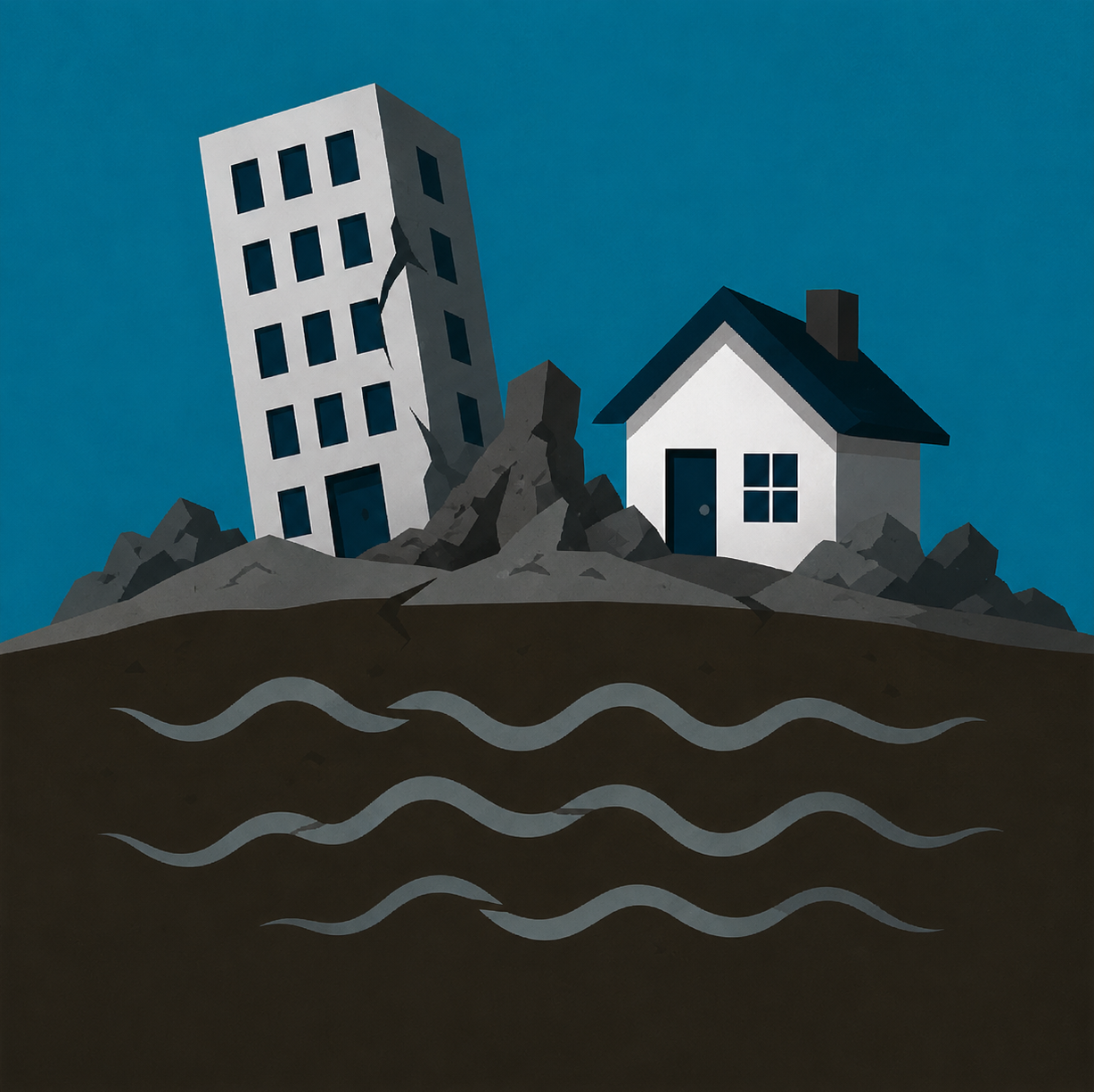
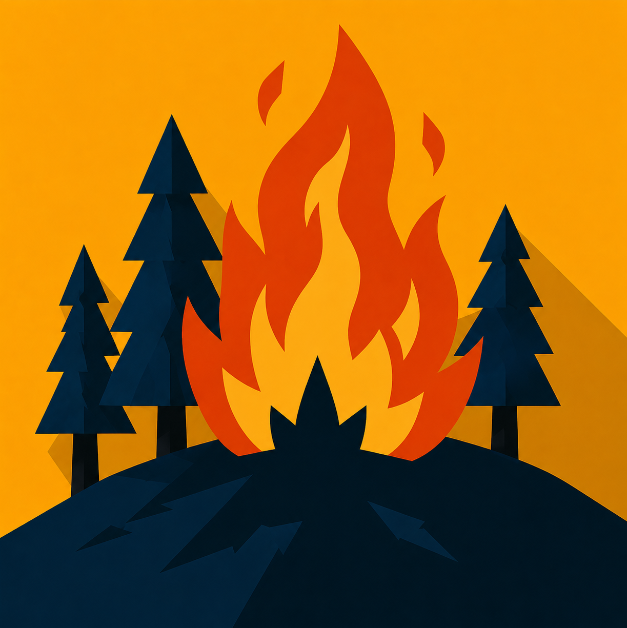
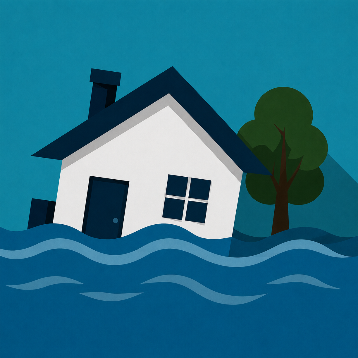
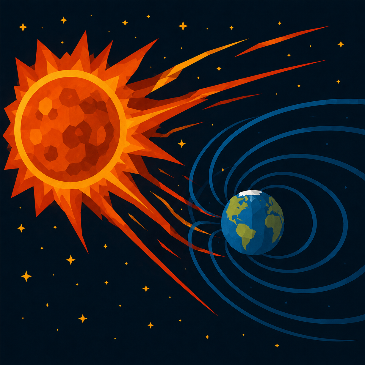
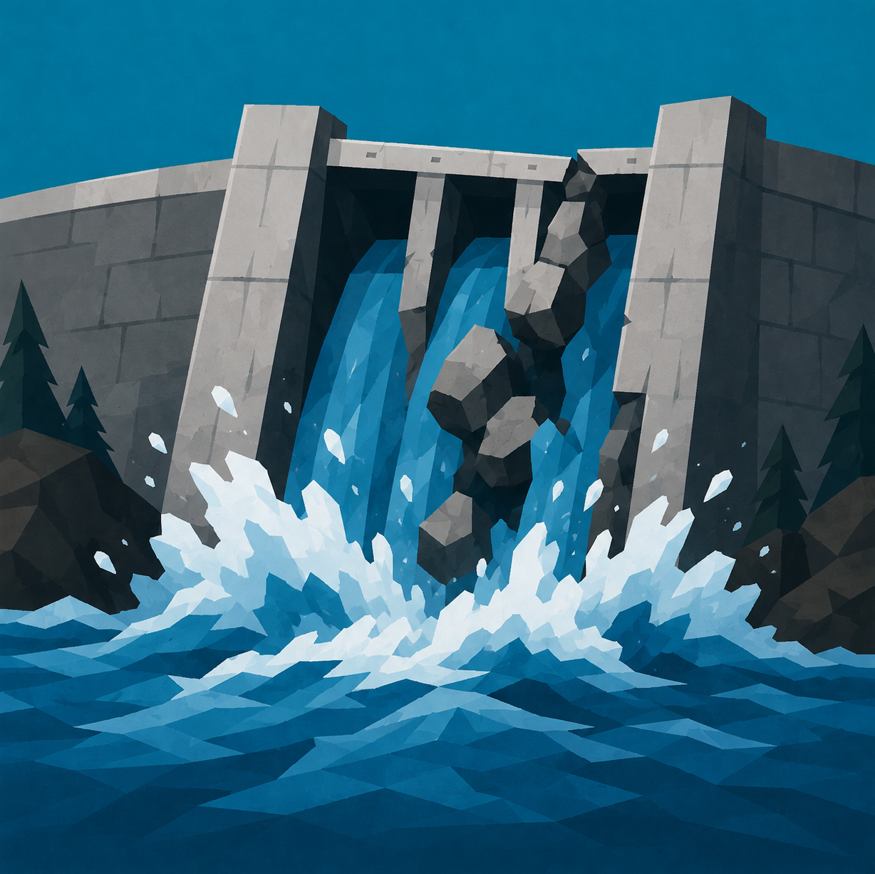
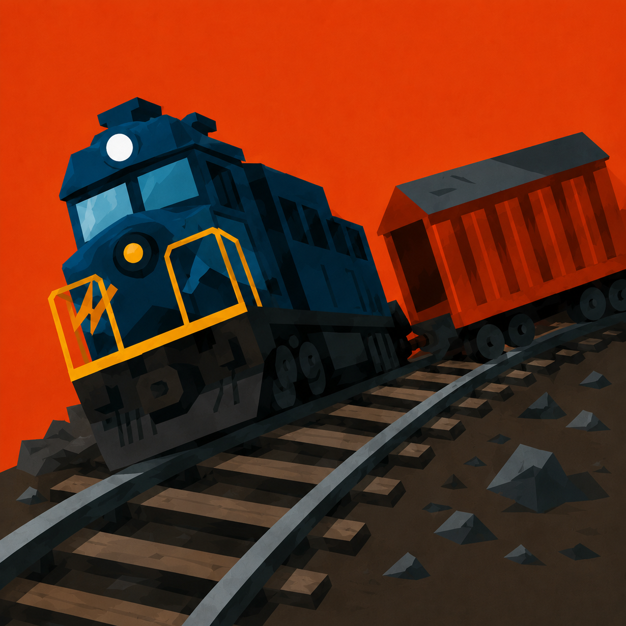
The icons below represent some of the disasters found around the world.

Natural Disasters​

Human-Caused Disasters​


Understanding Provo's Risks​

The 2022 Pre-Disaster Mitigation Plan, prepared by the Mountainland Association of Governments, compares disasters in Utah County by their probability and severity.

  • Probability — how likely a disaster is to occur.
  • Severity — how serious its impacts could be.

Together, these factors help show which disasters pose the greatest risk to our community. The matrix below shows how each disaster compares.

Utah County Hazard Matrix

Likelihood

Highly Likely

Hail

Fire
Winter Weather
Wind
Avalanche

Likely

Lightning
Tornado

Flood
Drought

Landslide
Debris Flow

Possible
Unlikely

Earthquake
Dam Failure

Negligible

Limited

Critical

Catastrophic

Magnitude / Severity

How to read the matrix

Potential Magnitude / Severity

  • Catastrophic: More than 50% of the community affected; many lives and a great deal of property potentially affected.
  • Critical: 25–50% affected; multiple lives and/or multiple properties potentially affected.
  • Limited: 10–25% affected; some property loss and fewer than three lives potentially lost.
  • Negligible: Less than 10% affected; some property impact and no expected loss of life.

Probability

  • Highly Likely: Near 100% probability within the next year.
  • Likely: 10–100% probability in the next year, or at least one occurrence in the next 10 years.
  • Possible: 1–10% probability in the next year, or at least one occurrence in the next 100 years.
  • Unlikely: Less than 1% probability in the next 100 years.

What Could Be Affected in Provo?​

The 2022 Pre-Disaster Mitigation Plan estimates how many buildings in Provo could be exposed to several major disasters. These estimates show that even less frequent events could affect a significant portion of our community.

DisasterBuildings Potentially ExposedEstimated Building Value
Dam Failure16,883$5,531,865,000
Fire Risk — High652$364,479,000
Fire Risk — Moderate227$76,906,000
Flood — 1% Annual Probability48$23,058,000
Landslide290$108,752,000
Liquefaction — Moderate to High19,338$6,140,581,000
Earthquake — Pre-1990 Buildings15,358$4,386,424,000

Risk Maps​

The number of buildings potentially exposed only tells part of the story. Risk maps help show where some of these threats are concentrated throughout Provo.


Preparing for Disasters​

Preparing for emergencies can help protect you, your family, and your community when normal services are disrupted. The following steps provide a foundation for emergency preparedness.

  1. Stay Informed: Sign up for emergency alerts and know where to find official information during a disaster.

  2. Make an Emergency Plan: Identify evacuation routes, establish family meeting locations, and decide how to communicate if phone networks become unavailable.

  3. Build an Emergency Kit: Store enough water, nonperishable food, medications, first aid supplies, flashlights, and other essentials for at least 72 hours. Consider additional supplies for extended emergencies.

  4. Prepare Your Home: Secure heavy furniture, maintain smoke and carbon monoxide alarms, and learn how to safely shut off utilities when necessary.

  5. Know Your Community: Understand hazards in your neighborhood, identify alternate transportation routes, and consider neighbors who may need assistance.

  6. Practice Your Plan: Review emergency procedures, check supplies, and practice evacuation and family communication plans regularly.

EMERGENCY NOTIFICATIONS

Sign up for local emergency notification systems to receive timely warnings and instructions from public safety agencies. During an emergency, follow official guidance from Provo City, Utah County, and other responding authorities.

TRANSPORTATION & ACCESS DURING AN EMERGENCY

Provo's geography can complicate transportation and evacuation during a major disaster. Utah Lake, the Wasatch Mountains, the Provo River, Interstate 15, and the railroad corridor can limit available routes.

The 2022 Pre-Disaster Mitigation Plan identifies relatively few crossings between areas west of I-15 and the rest of the city. Road closures, damaged infrastructure, or heavy traffic could further restrict access during an emergency.

Residents should become familiar with alternate routes and follow official evacuation instructions.

For additional preparedness guidance, visit Be Ready Utah.


Disasters​

The cards below provide information about different types of disasters, including how they occur, the impacts they can cause, and how they may affect Provo and Utah County.

Earthquake
LikelihoodUnlikely
MagnitudeCatastrophic
Potential Impacts
Health & Safety
Buildings & Infrastructure
Utilities
Communications
Transportation

Earthquake

Earthquakes occur when accumulated stress in the Earth's crust causes rocks to suddenly slip along a fault, releasing energy in the form of seismic waves that shake the ground. Depending on their magnitude, depth, and location, earthquakes can cause anything from minor tremors to widespread destruction.

Provo is located near the Wasatch Fault, an active fault system capable of producing major earthquakes. A large earthquake along the fault could cause intense ground shaking throughout Utah Valley, potentially damaging buildings, roads, and critical infrastructure. Older buildings, particularly those constructed without modern seismic reinforcement, are especially vulnerable.

Severe ground shaking could damage or collapse buildings, compromise roads and bridges, and disrupt critical infrastructure. Widespread interruptions to electricity, natural gas, water, transportation, and communications could complicate emergency response and recovery efforts.

Regional Example2020 — Magna Earthquake

On March 18, 2020, a magnitude 5.7 earthquake struck near Magna. Shaking was felt across the Wasatch Front, including Utah Valley, and damaged buildings and utilities near the epicenter.

About Earthquakes

Earthquake Magnitude​

Earthquake magnitude measures the size of an earthquake at its source. Although commonly called the Richter scale, most modern earthquakes are measured using the Moment Magnitude Scale (Mw), which provides more reliable measurements of large earthquakes.

The scale is logarithmic. Each whole-number increase represents approximately 10 times the measured seismic wave amplitude and 32 times the energy released.

MagnitudeClassification
2.0–3.9Minor
4.0–4.9Light
5.0–5.9Moderate
6.0–6.9Strong
7.0–7.9Major
8.0+Great

Magnitude vs. Intensity​

Magnitude measures the overall size of an earthquake, while intensity describes how strongly the ground shakes at a particular location.

The Modified Mercalli Intensity Scale uses Roman numerals from I (not felt) to XII (total destruction) to describe observed shaking and damage.

Two communities can experience different shaking intensities from the same earthquake because of their distance from the fault, local geology, and other factors.

How Earthquakes Cause Damage​

  • Ground Shaking: Seismic waves cause the ground and structures to move. Strong shaking can damage foundations, walls, and other structural components.

  • Surface Rupture: Movement along a fault can displace the ground surface, potentially damaging buildings, roads, and utilities constructed across the fault.

  • Building Vulnerability: Older buildings, particularly those constructed with unreinforced masonry, are often more susceptible to earthquake damage than structures designed to modern seismic standards.

  • Infrastructure Disruption: Earthquakes can damage roads, bridges, power lines, water mains, and natural gas pipelines, interrupting essential services and complicating emergency response.

Earthquake damage depends on more than magnitude alone. The depth of the earthquake, distance from the fault, local ground conditions, and construction quality all influence the severity of its impacts.

Learn More: USGS — Earthquake Magnitude, Energy Release, and Shaking Intensity


Liquefaction
LikelihoodNot Rated
MagnitudeNot Rated
Potential Impacts
Buildings & Infrastructure
Utilities
Communications
Transportation
Risk Map

Liquefaction

Liquefaction occurs when loose, water-saturated soil temporarily loses its strength during strong earthquake shaking. As pressure builds between soil particles, the ground can behave more like a liquid than a solid, losing its ability to support buildings and other structures.

Utah Valley is particularly susceptible to liquefaction because much of the valley floor consists of sediments deposited by ancient Lake Bonneville and local rivers. Areas near Utah Lake, the Provo River, and locations with shallow groundwater are especially vulnerable when strong ground shaking occurs.

Liquefaction can cause buildings to sink or tilt, roads to buckle, and underground utilities to rupture. Ground settlement and horizontal movement can damage foundations, bridges, pipelines, and other infrastructure, even when structures survive the initial earthquake shaking.

Regional Example2020 — Magna Earthquake Liquefaction

The March 18, 2020, Magna earthquake caused liquefaction near the Jordan River and Great Salt Lake, including sand boils and ground movement.

About Liquefaction

How Liquefaction Occurs​

Under normal conditions, soil particles press against one another, allowing the ground to support the weight of buildings, roads, and other structures.

When loose, saturated soil experiences strong earthquake shaking, the particles attempt to rearrange into a more compact configuration. Because water occupies the spaces between the particles, the shaking can cause pore-water pressure to increase.

As this pressure rises, the contact forces between soil particles decrease, reducing the soil's strength. If enough strength is lost, the soil temporarily behaves more like a liquid than a solid.

Liquefaction does not mean the ground literally turns into water. Instead, the soil loses much of its ability to support loads and resist movement.

Conditions That Contribute to Liquefaction​

Three primary conditions make liquefaction more likely:

  • Loose Soil: Sandy or silty soils with loosely packed particles are particularly susceptible.

  • Water Saturation: Groundwater fills the spaces between soil particles, allowing pore-water pressure to increase during shaking.

  • Strong Ground Shaking: Earthquake vibrations disturb the soil structure and can cause it to lose strength.

These conditions frequently occur in river valleys, former lakebeds, and areas with relatively shallow groundwater.

Types of Liquefaction Damage​

Liquefaction can produce several types of ground deformation:

  • Ground Settlement: Soil compacts or shifts, causing the ground surface to sink unevenly. Buildings may settle or tilt as their foundations lose support.

  • Lateral Spreading: Large sections of ground move horizontally over liquefied soil, sometimes toward rivers, slopes, or other areas with less lateral support.

  • Loss of Bearing Strength: Soil beneath a structure becomes unable to support its weight, potentially causing foundations to sink or shift.

  • Sand Boils: Water and sediment are forced upward through cracks in the ground, depositing sand or silt at the surface.

  • Underground Infrastructure Damage: Soil movement can break water mains, sewer lines, natural gas pipelines, and other buried utilities.

Why Utah Valley Is Vulnerable​

Much of Utah Valley was once covered by Lake Bonneville, a large prehistoric lake that deposited extensive layers of sediment across the valley floor.

These deposits, along with sediment carried by rivers and streams, created areas of loose, sandy, and silty soils.

In locations where groundwater is relatively close to the surface, these soil conditions can become susceptible to liquefaction during strong earthquakes.

Liquefaction potential varies significantly across Provo. Actual susceptibility depends on local soil composition, groundwater depth, and the intensity of earthquake shaking.

Learn More: Utah Geological Survey — Liquefaction


Wildfire
LikelihoodHighly Likely
MagnitudeLimited
Potential Impacts
Health & Safety
Housing & Displacement
Air Quality
Communications
Environment
Risk Map

Wildfire

Wildfires are uncontrolled fires that spread through vegetation such as grass, brush, and forests. They can ignite naturally through lightning or result from human activities, including unattended fires, equipment use, and electrical failures. Under hot, dry, and windy conditions, wildfires can spread rapidly and become difficult to contain.

Provo's location along the Wasatch Mountains places portions of the city near the wildland-urban interface, where homes and developed areas meet natural vegetation. Dry summers, seasonal winds, and steep foothill terrain can create conditions favorable for wildfire ignition and rapid fire spread.

Wildfires can destroy homes, damage utilities and transportation infrastructure, and force residents to evacuate. Smoke and airborne particles can also affect air quality across Utah Valley, even when fires are burning far from populated areas. Large wildfires can strain emergency response resources and disrupt essential services for extended periods.

Local Example2025 — Buckley Draw Fire

The 2025 Buckley Draw Fire burned vegetation on hillsides above southeast Provo, leaving a burn scar that was later affected by heavy rainfall.

About Wildfire

The Fire Triangle​

Fire requires three essential elements to ignite and continue burning:

  • Heat: An ignition source, such as lightning, sparks, flames, or hot equipment, provides the energy needed to start combustion.

  • Fuel: Combustible materials, including dry grass, shrubs, trees, and other vegetation, provide material for the fire to consume.

  • Oxygen: Oxygen in the surrounding air supports the combustion process.

Together, these elements form the Fire Triangle. Removing any one of them can stop combustion.

The Fire Behavior Triangle​

Once a wildfire starts, three primary factors determine how quickly it spreads and how intensely it burns:

  • Fuel: The type, amount, arrangement, and moisture content of vegetation affect how readily a fire ignites and spreads. Dry grasses can carry flames rapidly, while larger vegetation can sustain intense fires for longer periods.

  • Weather: Wind, temperature, humidity, and precipitation strongly influence wildfire behavior. Strong winds can push flames toward unburned vegetation, while hot temperatures and low humidity can dry out available fuels.

  • Topography: Slope steepness, elevation, and terrain shape influence fire movement. Fires generally spread faster uphill because rising heat and flames preheat vegetation above them.

These three factors form the Fire Behavior Triangle and help explain why wildfires can behave differently as they move through changing landscapes and weather conditions.

How Wildfires Spread​

Wildfires spread through several processes:

  • Surface Fires: Burn through grasses, shrubs, fallen leaves, and other vegetation near the ground.

  • Crown Fires: Spread through the upper branches and foliage of trees, often producing intense flames and rapid fire growth.

  • Ground Fires: Burn through organic material beneath the surface, sometimes smoldering for extended periods.

  • Spot Fires: Develop when burning embers are carried by wind or rising air currents and ignite vegetation or structures ahead of the main fire.

Spotting is particularly dangerous because embers can cross roads, firebreaks, and other barriers that might otherwise slow the spread of a wildfire.

Why Wildfires Can Spread Rapidly​

Several environmental conditions can combine to produce extreme fire behavior:

  • Strong Winds: Push flames toward unburned vegetation and carry embers ahead of the main fire.

  • Low Humidity: Allows vegetation to dry more easily, increasing its susceptibility to ignition.

  • High Temperatures: Can contribute to drying vegetation and reducing fuel moisture.

  • Steep Slopes: Allow rising heat to preheat vegetation uphill, often increasing the rate of fire spread.

  • Continuous Vegetation: Unbroken areas of grass, brush, or forest can allow fires to spread across large distances.

Changes in wind direction or terrain can cause sudden shifts in fire behavior, making wildfire movement difficult to predict.

Learn More: National Park Service — Wildland Fire Behavior


Flooding
LikelihoodLikely
MagnitudeLimited
Potential Impacts
Health & Safety
Housing & Displacement
Buildings & Infrastructure
Utilities
Communications
Risk Map

Flooding

Flooding occurs when water accumulates or flows into areas that are normally dry. It can result from prolonged rainfall, intense thunderstorms, rapid snowmelt, overflowing rivers, or drainage systems becoming overwhelmed. Flooding can develop gradually over several days or occur suddenly with little warning.

Provo's location between the Wasatch Mountains and Utah Lake creates several potential flooding hazards. Snowmelt and heavy precipitation can increase flows in the Provo River and other waterways, while steep mountain terrain can channel runoff rapidly toward developed areas. Low-lying neighborhoods and locations with limited drainage capacity may be especially susceptible to flooding.

Flooding can damage homes, businesses, roads, bridges, and underground utilities. Rising water can make transportation routes impassable, overwhelm stormwater infrastructure, and threaten public safety. Significant flooding may require evacuations and disrupt essential services while damaged infrastructure is repaired.

Local Example2013 — Provo Flooding

On September 7, 2013, intense thunderstorms flooded homes, roads, and public areas in Provo. Runoff washed out part of Grand Avenue near 900 North.

About Flooding

Types of Flooding​

Flooding can occur through several different processes:

  • River Flooding: Occurs when water levels rise above the banks of a river or stream, inundating surrounding land. Prolonged rainfall and melting snowpack can increase river flows beyond the capacity of the channel.

  • Flash Flooding: Develops rapidly, often within minutes or hours of intense rainfall. Flash floods can produce powerful currents with little warning, particularly in mountainous terrain, narrow canyons, and urban areas.

  • Snowmelt Flooding: Occurs when rising temperatures cause accumulated snow to melt faster than rivers, streams, and drainage systems can accommodate the resulting runoff. Rapid warming or rainfall on an existing snowpack can increase the risk.

  • Urban Flooding: Occurs when rainwater accumulates on streets, parking lots, and other developed surfaces because storm drains and drainage channels cannot carry it away quickly enough.

How Flooding Develops​

Flooding occurs when water enters an area faster than the surrounding environment or drainage infrastructure can accommodate it.

Several factors influence how quickly floodwaters accumulate:

  • Precipitation Intensity: Heavy rainfall over a short period can overwhelm drainage systems and cause rapid runoff.

  • Soil Saturation: When soil is already saturated, less additional water can infiltrate the ground, increasing surface runoff.

  • Snowpack and Temperature: Rapid warming can release large volumes of water stored in mountain snowpack, increasing streamflow.

  • Topography: Steep slopes accelerate runoff, while valleys and low-lying areas can concentrate accumulating floodwaters.

  • Urban Development: Roads, buildings, and paved surfaces reduce the amount of water that can soak into the ground, increasing runoff into stormwater systems.

These factors can combine, causing flooding even when precipitation occurs outside the area ultimately affected.

Understanding Floodplains​

A floodplain is an area of land adjacent to a river, stream, or other waterway that may become inundated when water levels exceed the normal channel.

Floodplains are a natural part of river systems. During periods of high flow, water spreads beyond the riverbanks into surrounding low-lying areas.

Development within floodplains can increase the potential for damage when flooding occurs. Floodplain maps identify areas with modeled flood hazards and help communities understand where significant flooding may occur.

However, flooding is not limited to designated floodplains. Heavy rainfall, drainage failures, and localized runoff can cause flooding in areas outside mapped flood zones.

Understanding the 100-Year Flood​

Flood risk is often described using statistical probabilities.

A 100-year flood does not mean that a flood occurs only once every 100 years. Instead, it describes a flood magnitude with a 1% chance of being equaled or exceeded in any given year.

Common flood probability classifications include:

Flood ClassificationAnnual Probability
10-Year Flood10%
25-Year Flood4%
50-Year Flood2%
100-Year Flood1%
500-Year Flood0.2%

Each year's probability is independent of previous years. Therefore, a 100-year flood could occur in consecutive years or multiple times within a relatively short period.

Over a 30-year period, an area exposed to a 1% annual-chance flood has approximately a 26% chance of experiencing at least one flood of that magnitude or greater, assuming the annual probability remains constant.

Understanding these probabilities helps explain why significant flooding remains possible even in locations where major floods are relatively uncommon.

Learn More: National Weather Service — Flood Hazards


Landslide
LikelihoodLikely
MagnitudeCritical
Potential Impacts
Health & Safety
Housing & Displacement
Buildings & Infrastructure
Transportation
Communications
Risk Map

Landslide

Landslides occur when soil, rock, or other earth materials move downhill under the influence of gravity. They develop when the forces pulling material downslope exceed the strength holding it in place. Landslides can occur suddenly or develop gradually, with some continuing to move over months or years.

Provo's location along the Wasatch Mountains creates areas of elevated landslide susceptibility, particularly along steep foothills and slopes containing unstable geologic materials. Groundwater, heavy precipitation, erosion, and changes to natural slopes can contribute to instability. Previous landslide activity in developed neighborhoods demonstrates that these hazards are not limited to undeveloped mountainsides.

Landslides can damage or destroy homes, roads, retaining walls, and underground utilities as the ground shifts beneath them. Even slow movement can crack foundations, distort structures, and compromise essential infrastructure. Significant landslides may force evacuations, restrict access to neighborhoods, and create costly, long-term recovery challenges.

Local Example2005 — Sherwood Hills Landslide

Following an unusually wet winter in 2005, increased groundwater contributed to renewed landslide movement in Provo’s Sherwood Hills neighborhood, damaging homes and infrastructure. Some homes were condemned.

About Landslide

How Landslides Occur​

Gravity continuously pulls soil and rock downhill. Under stable conditions, the strength of the earth materials and the friction between them resist this movement.

A landslide occurs when the forces pulling material downhill become greater than the forces holding the slope in place.

This can happen when a slope becomes overloaded, its supporting material is removed, or the strength of the underlying soil and rock decreases.

Water is one of the most important factors influencing slope stability. As groundwater accumulates, it can increase the weight of slope materials and reduce the friction and strength that help keep them in place.

Types of Landslides​

Landslides can take several forms depending on the materials involved and how they move:

  • Rotational Slides: Soil or rock moves along a curved failure surface, often causing the upper portion of the sliding mass to tilt backward. These movements can create steep scarps and uneven ground surfaces.

  • Translational Slides: Material moves downhill along a relatively flat or planar surface. Large sections of soil or rock may shift together while remaining partially intact.

  • Rockfalls: Individual rocks or larger rock masses detach from steep slopes or cliffs and fall, bounce, or roll downhill. Rockfalls can occur rapidly and travel considerable distances.

  • Slope Creep: Extremely slow movement of soil or rock downhill over long periods. Creep may gradually deform roads, fences, retaining walls, and building foundations.

The speed and scale of landslide movement can vary greatly. Some landslides move only a few inches over several years, while others can travel downhill in seconds.

What Triggers Landslides?​

Several natural and human-related factors can cause slopes to become unstable:

  • Heavy Precipitation: Rainwater infiltrates the ground, increasing soil moisture and groundwater pressure.

  • Snowmelt: Rapid melting can introduce substantial amounts of water into hillsides, particularly following winters with significant snow accumulation.

  • Groundwater Changes: Rising groundwater levels can reduce the strength of soil and rock, allowing existing landslides to reactivate.

  • Erosion: Streams, runoff, or excavation can remove material supporting the base of a slope.

  • Earthquake Shaking: Ground vibrations can temporarily increase forces acting on unstable slopes and trigger movement.

  • Human Activity: Construction, grading, irrigation, excavation, and changes to drainage patterns can alter slope stability.

Landslides often result from several contributing factors rather than a single cause.

Understanding Slow-Moving Landslides​

Not all landslides occur suddenly. Some move gradually over months, years, or even decades.

Slow-moving landslides can remain relatively stable for long periods before becoming active again when groundwater levels rise or other conditions change.

As the ground moves, buildings and infrastructure can experience uneven displacement, causing:

  • Cracks in foundations, walls, and pavement.
  • Doors and windows to become misaligned.
  • Retaining walls and fences to tilt or separate.
  • Underground water, sewer, and utility lines to break.
  • Roads and sidewalks to shift or buckle.

The Sherwood Hills landslides in Provo demonstrate how repeated slope movement can affect developed neighborhoods over extended periods.

Learn More: USGS — Landslide Types and Processes


Mudslide and Debris Flow
LikelihoodLikely
MagnitudeCritical
Potential Impacts
Health & Safety
Buildings & Infrastructure
Transportation
Utilities
Communications

Mudslides & Debris Flows

Mudslides and debris flows occur when water mixes with loose soil, rocks, sediment, and vegetation, creating a moving mass that travels downhill under the force of gravity. Unlike ordinary flooding, debris flows contain large amounts of solid material and can carry boulders, trees, and other heavy objects. These flows can develop rapidly and travel with tremendous force.

Provo's steep foothills and mountain drainages create conditions where debris flows can occur, particularly following intense rainfall or wildfire. Areas below recently burned watersheds are especially vulnerable because vegetation loss and changes to soil conditions can increase runoff and erosion. Drainages along the eastern benches can channel debris toward developed neighborhoods.

Debris flows can bury roads, damage or destroy buildings, overwhelm drainage systems, and sever underground utilities. Their combination of water, sediment, and large debris makes them especially destructive. Flows can develop with little warning, threatening residents and infrastructure located along drainage channels and at the base of steep slopes.

Local Example2025 — Buckley Draw Debris Flow

On August 27, 2025, intense rainfall over the Buckley Draw burn scar triggered a debris flow in southeast Provo. Mud and debris damaged buildings and roads.

About Mudslides & Debris Flows

How Debris Flows Form​

Debris flows develop when loose earth materials become mobilized by water and begin moving downhill.

Heavy rainfall can produce rapid runoff that erodes soil and picks up loose sediment, rocks, and vegetation. As more material becomes incorporated into the moving water, it can transform into a thick, debris-laden flow.

Unlike ordinary streamflow, debris flows contain enough sediment and rock to behave as a dense, moving mixture. The concentration of solid material allows them to transport large objects that flowing water alone might not be able to move.

Debris flows often travel through existing stream channels, gullies, and mountain drainages before spreading outward onto flatter terrain.

Mudslides vs. Debris Flows​

Although the terms are frequently used interchangeably, they can describe different types of earth movement.

  • Mudflows: Flows consisting primarily of water and fine-grained materials such as clay, silt, and mud. They generally contain fewer large rocks than typical debris flows.

  • Debris Flows: Rapidly moving mixtures of water, mud, sand, gravel, rocks, and vegetation. They can carry large boulders and trees over considerable distances.

  • Debris Avalanches: Extremely rapid movements of loose earth materials that may travel long distances down steep terrain, sometimes with relatively little water compared with debris flows.

The term "mudslide" is commonly used to describe several types of moving mud or sediment, but debris flow is generally the more precise scientific term when referring to fast-moving mixtures of water and coarse material.

Why Wildfires Increase Debris Flow Risk​

Wildfires can significantly change how water moves across a watershed.

Under normal conditions, vegetation intercepts rainfall, root systems help stabilize soil, and organic material slows surface runoff.

Following a wildfire, several changes may occur:

  • Vegetation Loss: Burned vegetation provides less protection against rainfall and surface erosion.

  • Reduced Soil Absorption: Fire can contribute to water-repellent soil conditions, reducing the amount of rainwater that infiltrates the ground.

  • Increased Surface Runoff: Rainfall can move more rapidly across exposed slopes and into drainage channels.

  • Sediment Mobilization: Runoff can pick up loose soil, ash, rocks, and other material, increasing the volume and destructive force of the flow.

These conditions can allow relatively short, intense rainstorms to generate destructive debris flows.

The risk is often greatest during the first rainy season following a wildfire, although elevated runoff and erosion hazards may persist as the landscape recovers.

How Debris Flows Travel​

Debris flows behave differently from ordinary floodwater because they contain a high concentration of sediment and other solid materials.

As a debris flow moves downhill, it may:

  • Accelerate on Steep Slopes: Gravity increases the speed and momentum of the moving material.

  • Follow Drainage Channels: Existing gullies and streambeds can concentrate and direct the flow.

  • Increase in Volume: The flow can collect additional sediment, rocks, and vegetation as it travels.

  • Spread onto Alluvial Fans: When a flow exits a narrow canyon and reaches flatter ground, it can spread outward and deposit large amounts of debris.

  • Block or Change Drainage Paths: Accumulated debris can obstruct channels, redirecting subsequent water and sediment into new areas.

These characteristics make debris flows particularly dangerous near canyon mouths and developed areas below steep mountain drainages.

Understanding Debris Flow Mitigation​

Because debris flows can carry enormous amounts of sediment and rock, communities sometimes construct specialized infrastructure to reduce their impacts.

Common engineering approaches include:

  • Debris Basins: Designed to capture and temporarily store sediment and other debris carried downhill.

  • Diversion Channels: Direct flows toward designated areas and away from vulnerable buildings.

  • Deflection Berms: Earthen barriers that redirect moving material away from structures.

  • Check Dams: Small barriers placed within channels to reduce erosion and retain portions of transported sediment.

These structures can reduce damage but cannot eliminate the risk, particularly when flows exceed their engineered design capacity.

Provo's Buckley Draw watershed demonstrates both the effectiveness and limitations of debris flow mitigation. Following a 2002 wildfire, a diversion channel and protective barriers were constructed in 2003.

These structures helped contain the 2003 mudflow and continued to provide protection during the much larger 2025 event, although portions of the 2025 flow exceeded the available protective capacity.

Learn More: USGS — Post-Fire Flooding and Debris Flow

Local Study: Provo City — Buckley Draw Debris Flow Forensic Study


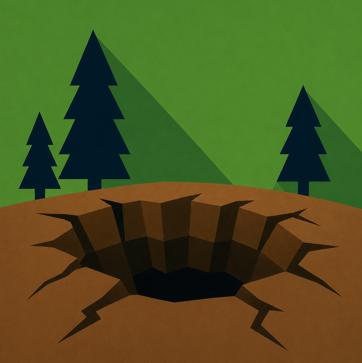
Sinkhole
LikelihoodNot Rated
MagnitudeNot Rated
Potential Impacts
Health & Safety
Buildings & Infrastructure
Utilities
Transportation

Sinkhole

Sinkholes are depressions or openings in the ground that form when underlying material can no longer support the surface above it. They commonly develop when groundwater gradually dissolves soluble bedrock, creating underground voids that may eventually collapse. Sinkholes can form slowly over many years or appear suddenly when the ground gives way.

In Utah, natural sinkholes are associated primarily with areas containing soluble rock formations such as limestone, gypsum, and salt. Sinkholes are not identified as a major Provo-specific hazard in the regional mitigation plan, although localized ground collapse can occur where underground erosion or other subsurface conditions remove support from the ground above.

Sinkholes and other localized ground collapses can damage buildings, roads, sidewalks, and underground utilities. Sudden collapses can create dangerous openings in developed areas, while gradual ground movement may cause foundations and pavement to crack or settle. The severity of damage depends on the size, depth, and location of the collapse.

Regional ExampleHole-in-the-Ground Sinkhole, Utah

Hole-in-the-Ground is a natural sinkhole in Utah formed by collapse of subsurface material.

About Sinkhole

How Sinkholes Form​

Most natural sinkholes develop through a geological process known as dissolution, in which water gradually dissolves certain types of bedrock.

Rainwater absorbs small amounts of carbon dioxide from the atmosphere and soil, forming a weak carbonic acid. As this water moves underground, it can slowly dissolve susceptible rocks such as limestone.

Over time, several changes may occur:

  1. Rock Dissolution: Groundwater gradually dissolves portions of the underlying bedrock.

  2. Cavity Formation: Small fractures and openings expand into larger underground spaces.

  3. Loss of Support: The material above the cavity becomes increasingly unstable as the void grows.

  4. Ground Collapse: When the overlying material can no longer support its own weight, it may settle or collapse into the cavity.

This process can take hundreds or thousands of years, although the final collapse may occur suddenly.

Landscapes shaped by the dissolution of soluble bedrock are known as karst terrain.

Types of Sinkholes​

Geologists generally recognize three common types of natural sinkholes:

  • Dissolution Sinkholes: Form where soluble bedrock is exposed or covered by only a thin layer of soil. Water gradually dissolves the rock, creating shallow depressions at the surface.

  • Cover-Subsidence Sinkholes: Develop when loose sediment gradually moves downward into openings within the underlying bedrock. These sinkholes typically form slowly and may produce broad, shallow depressions.

  • Cover-Collapse Sinkholes: Occur when a layer of cohesive soil or sediment temporarily bridges an underground cavity before suddenly collapsing. These events can create deep, steep-sided holes with little visible warning.

The type of sinkhole that develops depends on the underlying geology, groundwater conditions, and characteristics of the overlying soil.

Natural vs. Human-Caused Ground Collapse​

Not every sudden opening in the ground is a geological sinkhole.

Ground collapse can also result from human activity or failures in underground infrastructure.

Examples include:

  • Underground Erosion: Flowing water can transport soil through underground openings, gradually creating voids beneath the surface.

  • Broken Water or Sewer Lines: Leaking pipes can wash away surrounding soil, removing support beneath roads, sidewalks, or structures.

  • Underground Excavation: Abandoned mines, tunnels, or other subsurface excavations can collapse when supporting materials deteriorate.

  • Groundwater Withdrawal: Lowering groundwater levels can contribute to subsidence or trigger collapse in areas already susceptible to sinkhole formation.

Although these processes can produce similar surface damage, their underlying causes differ. A pavement collapse caused by a broken water main, for example, is not necessarily a natural geological sinkhole.

Sinkholes in Utah​

Utah contains several types of soluble bedrock, including limestone, gypsum, and salt deposits.

Where groundwater interacts with these materials, dissolution can create underground cavities and surface depressions.

One documented example is Hole-in-the-Ground in Snake Valley, Millard County. This natural sinkhole formed in limestone bedrock and provides a visible example of how underground dissolution can produce a large surface collapse.

However, sinkhole susceptibility varies considerably across Utah and depends on local geology.

The presence of sinkholes elsewhere in Utah does not necessarily indicate that similar conditions exist beneath Provo.

Learn More: USGS — Sinkholes

Utah Example: Utah Geological Survey — Hole-in-the-Ground, Snake Valley


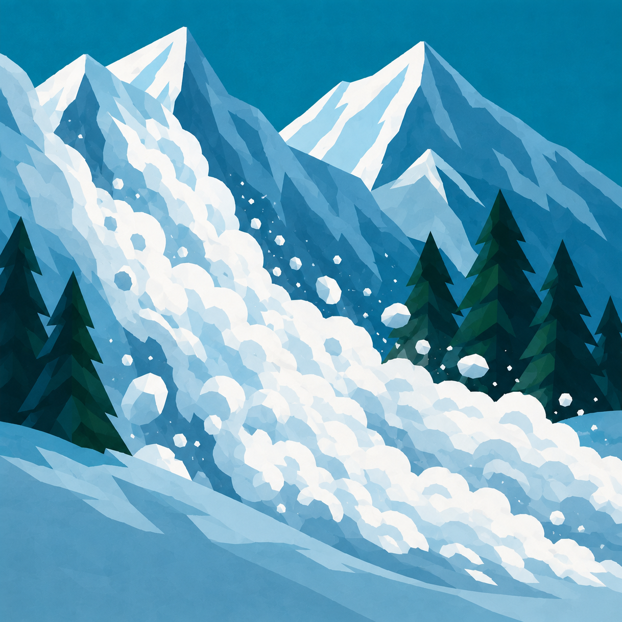
Avalanche
LikelihoodHighly Likely
MagnitudeLimited
Potential Impacts
Health & Safety
Transportation
Communications
Public Services

Avalanche

Avalanches occur when a mass of snow suddenly breaks loose and moves downhill under the force of gravity. They develop when the forces pulling snow downslope exceed the strength holding the snowpack together. Avalanches can travel at high speeds, carrying enormous amounts of snow and debris down mountain slopes.

Provo's proximity to the Wasatch Mountains creates significant avalanche hazards in nearby mountainous areas, particularly Provo Canyon and the surrounding high-elevation terrain. Heavy snowfall, wind, changing temperatures, and steep slopes can create unstable snow conditions. Although most developed areas of Provo are not directly exposed, nearby mountain roads and recreational areas can be vulnerable.

Avalanches can bury or injure people, damage infrastructure, and block transportation routes. Large avalanches may deposit substantial amounts of snow and debris across roadways, temporarily isolating communities or restricting access through mountain corridors. Avalanche hazards can also complicate emergency response and transportation during severe winter conditions.

Local Example2024 — Rock Canyon Avalanche

In February 2024, an avalanche crossed the Rock Canyon trail east of Provo, burying part of the trail and a bridge beneath deep snow.

About Avalanche

How Avalanches Form​

An avalanche occurs when the force pulling snow downhill becomes greater than the strength holding the snowpack in place.

Snow accumulates in layers throughout the winter. Each snowfall can create a new layer with different characteristics, including density, temperature, moisture content, and crystal structure.

Some layers bond strongly together, while others contain weak or poorly bonded snow crystals.

When a stronger, cohesive layer of snow rests on a weaker layer, the snowpack can become unstable. If the weak layer fails, the overlying snow may fracture and slide downhill.

Four important ingredients contribute to many avalanches:

  1. Snow: Enough accumulated snow to form a moving mass.
  2. Slope: Terrain steep enough for gravity to pull the snow downhill.
  3. Instability: Weak layers or insufficient bonding within the snowpack.
  4. Trigger: An additional force or change that causes the unstable snow to release.

Different avalanche types can form through different processes, but all involve snow moving downhill under the influence of gravity.

Types of Avalanches​

Avalanches are classified according to how the snow releases and the characteristics of the moving material.

  • Slab Avalanches: Occur when a cohesive layer of snow fractures and slides over a weaker layer beneath it. Slab avalanches can release across large areas and are responsible for most fatal avalanche accidents.

  • Loose Snow Avalanches: Begin at a single point and spread outward as they move downhill, creating a fan-shaped path. They occur when loose, unconsolidated snow loses its stability.

  • Wet Snow Avalanches: Develop when liquid water weakens bonds between snow grains. They are often associated with warming temperatures, rain, or melting snow.

  • Dry Snow Avalanches: Involve relatively dry snow and can move rapidly, sometimes producing large airborne clouds of snow particles.

These classifications can overlap. For example, a slab avalanche may involve either wet or dry snow.

What Triggers Avalanches?​

Snowpack stability can change rapidly as environmental conditions evolve.

Common contributing factors include:

  • Heavy Snowfall: Rapid accumulation adds weight to existing snow layers, potentially exceeding their ability to support the additional load.

  • Wind Loading: Strong winds transport snow from exposed slopes and deposit it on sheltered slopes, forming dense wind slabs.

  • Temperature Changes: Warming and melting can weaken snow bonds, particularly when liquid water enters the snowpack.

  • Rain on Snow: Rain adds weight and liquid water to the snowpack, potentially reducing stability.

  • Human Activity: Skiers, snowboarders, snowmobilers, and other travelers can apply additional stress that triggers an unstable snow layer.

  • Natural Releases: Avalanches can occur without direct human involvement when accumulated stress exceeds snowpack strength.

In many avalanche accidents, the avalanche is triggered by the person involved or someone traveling nearby.

Understanding Avalanche Terrain​

Terrain plays an important role in determining where avalanches begin and how far they travel.

Most slab avalanches initiate on slopes between approximately 30 and 45 degrees, although avalanches can occur on steeper terrain.

Important terrain characteristics include:

  • Slope Angle: Slopes steeper than about 30 degrees are more likely to produce slab avalanches when unstable snow is present.

  • Slope Aspect: The direction a slope faces affects sunlight exposure, temperature, and wind-deposited snow.

  • Elevation: Snow accumulation, temperature, and wind conditions can differ significantly between lower and higher elevations.

  • Terrain Traps: Gullies, creek beds, and depressions can concentrate moving snow, increasing burial depth.

  • Avalanche Runout Zones: Areas below avalanche starting zones where moving snow can travel and eventually accumulate.

Avalanches can travel into relatively flat terrain below the slopes where they originate. Consequently, locations beneath steep slopes may still be exposed to avalanche hazards.

Understanding Avalanche Control​

Transportation agencies and mountain communities use several techniques to reduce the risk that avalanches pose to developed areas.

Common methods include:

  • Controlled Avalanche Releases: Explosives or specialized systems are used to deliberately release unstable snow under controlled conditions.

  • Snow Sheds: Protective structures built over roads to allow moving snow to pass above the roadway.

  • Avalanche Fencing: Specialized barriers designed to stabilize snow accumulation or influence how snow is deposited.

  • Temporary Road Closures: Roads may be closed during periods of elevated avalanche danger or while avalanche-control operations are underway.

  • Monitoring and Forecasting: Weather observations, snowpack measurements, and avalanche forecasts help specialists evaluate changing conditions.

Provo Canyon is an example of a transportation corridor where avalanche mitigation helps reduce the risk to motorists and maintain access through mountainous terrain.

Learn More: Utah Avalanche Center — Avalanche Education

Local Resource: UDOT — Avalanche Safety


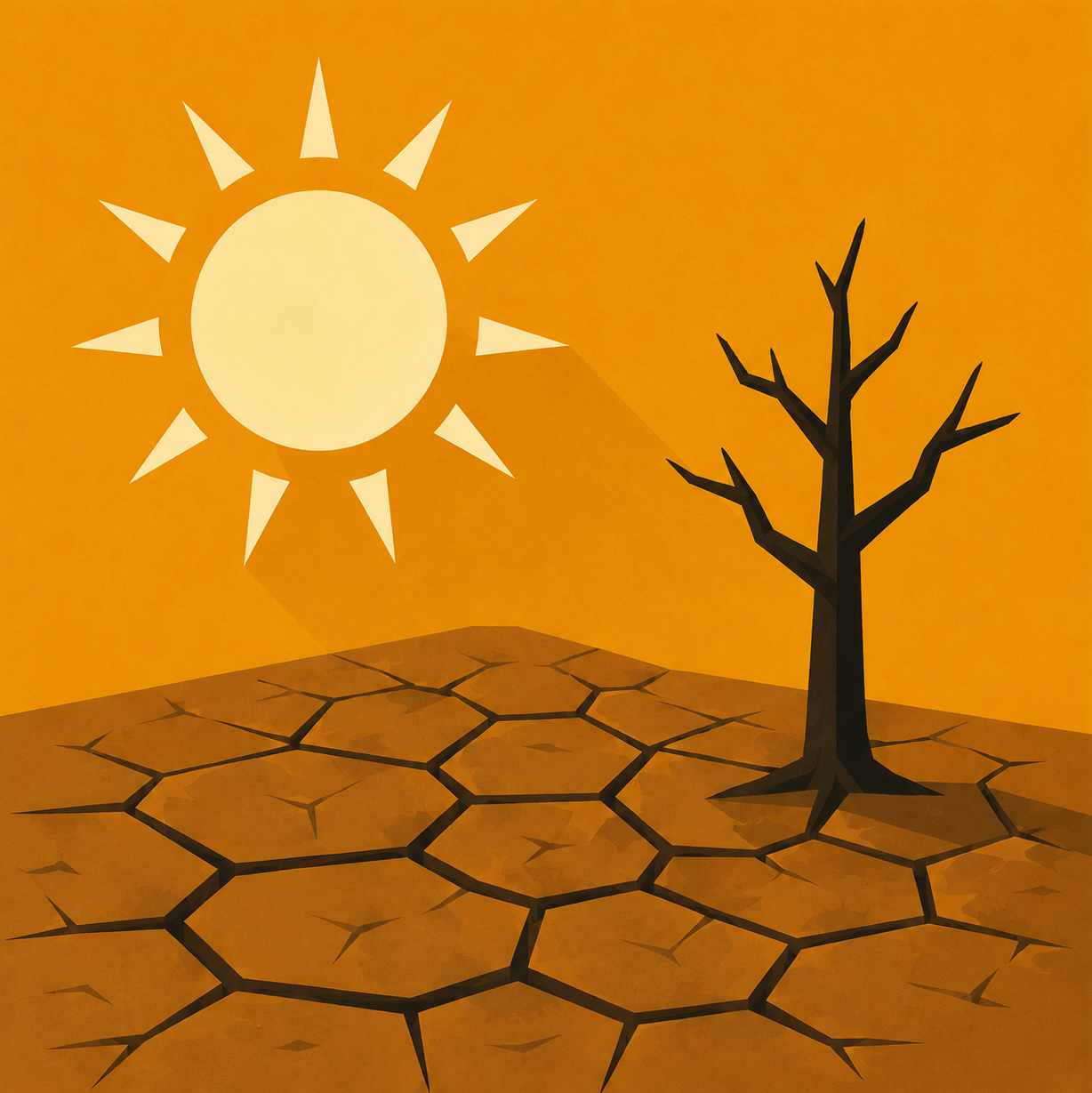
Drought
LikelihoodLikely
MagnitudeLimited
Potential Impacts
Water Supply
Agriculture & Food
Environment
Economic Activity
Fire Risk

Drought

Drought is an extended period of unusually dry conditions that results in a shortage of available water. It develops when precipitation remains below normal levels over time, often compounded by high temperatures and increased evaporation. Unlike sudden disasters, drought typically develops gradually and may persist for months or years.

Provo's water supply depends on precipitation, mountain snowpack, local springs, and groundwater resources. Reduced winter snowfall and prolonged dry conditions can decrease runoff, limit groundwater replenishment, and place additional pressure on available water supplies. Utah's naturally dry climate makes the region particularly sensitive to extended periods of below-normal precipitation.

Drought can reduce water availability for homes, agriculture, businesses, and natural ecosystems. Extended dry conditions can lower reservoir levels, affect groundwater supplies, damage vegetation, and increase demand on existing water infrastructure. Severe drought may also result in water restrictions, economic losses, and long-term environmental impacts.

Local Example2026 — Utah Drought Conditions

Utah experienced drought conditions during 2026, with effects on water availability and vegetation across parts of the state.

About Drought

How Drought Develops​

Drought occurs when an area receives less precipitation than normal over an extended period, creating a growing imbalance between water supply and demand. Several environmental factors influence how drought develops and intensifies:

  • Reduced Precipitation: Extended periods of below-normal rainfall or snowfall decrease the amount of water entering rivers, reservoirs, and groundwater systems.

  • High Temperatures: Warmer conditions increase evaporation from soil and surface water and can increase water loss through vegetation.

  • Low Snowpack: Reduced mountain snowfall limits the amount of water available from spring and summer snowmelt.

  • Soil Moisture Deficits: Dry soils can absorb precipitation that might otherwise contribute to runoff and streamflow.

  • Water Demand: Agricultural, residential, commercial, and industrial water use can increase pressure on limited supplies.

Drought severity depends on how much precipitation is missing, how long the shortage continues, and how water availability compares with demand.

Types of Drought​

Scientists generally recognize four types of drought, each describing a different aspect of water scarcity.

  • Meteorological Drought: Occurs when precipitation remains below normal for a particular region over an extended period.

  • Agricultural Drought: Develops when insufficient soil moisture or irrigation water affects crops, livestock, and agricultural production.

  • Hydrological Drought: Occurs when water shortages become evident in rivers, streams, lakes, reservoirs, and groundwater supplies.

  • Socioeconomic Drought: Develops when water shortages affect the availability of goods and services, creating economic or societal impacts.

These classifications are closely related. A prolonged meteorological drought, for example, can eventually develop into hydrological drought as reservoirs and groundwater supplies decline.

Understanding Utah's Snowpack​

Mountain snowpack serves as one of Utah's most important natural water-storage systems.

During winter, snow accumulates in the mountains, storing precipitation until temperatures rise during spring and summer.

As the snow melts, water flows into rivers, streams, reservoirs, and groundwater systems, helping sustain water supplies during Utah's typically hot and dry summer months.

Several snowpack characteristics influence the amount of water available:

  • Snow Accumulation: The total amount of snowfall during the winter season.

  • Snow Water Equivalent (SWE): The amount of liquid water contained within the snowpack if all the snow were melted.

  • Snowmelt Timing: When snow begins melting and how quickly the stored water is released.

  • Soil Moisture: Dry soils can absorb a significant portion of snowmelt before runoff reaches streams and reservoirs.

  • Temperature: Warmer conditions can accelerate melting and increase water losses before runoff reaches storage systems.

A winter with below-normal snowpack can create water supply challenges even if rainfall during other parts of the year remains relatively normal.

How Drought Is Measured​

Drought severity is commonly communicated using the U.S. Drought Monitor, which evaluates precipitation, soil moisture, streamflow, and other environmental indicators. The monitor uses five categories:

ClassificationDescription
D0 — Abnormally DryDry conditions that may precede or follow drought
D1 — Moderate DroughtDeveloping water shortages and vegetation stress
D2 — Severe DroughtIncreased water shortages and agricultural impacts
D3 — Extreme DroughtMajor water shortages and significant environmental impacts
D4 — Exceptional DroughtWidespread and potentially devastating drought impacts

The categories reflect the relative severity of drought conditions rather than a fixed amount of missing rainfall.

D0 represents abnormally dry conditions and is not classified as drought itself.

Why Drought Can Persist​

The end of a dry period does not necessarily mean that all drought impacts disappear.

Different parts of the water system respond to precipitation at different rates.

  • Soil Moisture: Rainfall may improve surface soil conditions relatively quickly, depending on the severity of the deficit.

  • Streams and Rivers: Streamflow may recover when rainfall and snowmelt increase, although recovery depends on watershed conditions.

  • Reservoirs: Large reservoirs may require multiple seasons of above-normal runoff to recover from significant deficits.

  • Groundwater: Aquifers can respond much more slowly because replenishment depends on water gradually infiltrating underground.

As a result, meteorological drought may end before hydrological drought conditions have fully recovered.

Learn More: NOAA — Understanding Drought

Utah Resource: Utah Division of Water Resources — Drought in Utah


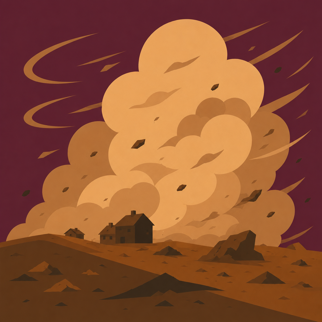
Dust Bowl
LikelihoodNot Rated
MagnitudeNot Rated
Potential Impacts
Air Quality
Health & Safety
Transportation
Agriculture & Food

Dust Bowl

Dust Bowl conditions develop when prolonged drought, high winds, and the loss of protective vegetation allow large amounts of exposed soil to erode and become airborne. Repeated dust storms can remove fertile topsoil, damage agricultural land, and contribute to widespread environmental degradation. Unlike an isolated dust storm, a Dust Bowl involves persistent conditions affecting an extensive region.

Utah's arid climate, exposed lakebeds, and desert landscapes create conditions where wind erosion and dust storms can occur. Strong winds can transport dust into Utah Valley from distant source regions, particularly during dry periods. However, Provo is not identified as having a major Dust Bowl hazard in the regional mitigation plan.

Severe dust storms can reduce visibility, disrupt transportation, and introduce large amounts of airborne particulate matter. Prolonged wind erosion can also degrade soil quality, damage agricultural resources, and reduce vegetation cover. These impacts can extend beyond the areas where dust originates, affecting communities many miles downwind.

Regional Example1935 — Grantsville Dust Bowl

During the 1930s, prolonged drought and overgrazing contributed to severe dust storms around Grantsville, Utah. In 1935, an especially intense dust storm killed livestock and threatened the community. Conditions became so severe that federal soil conservation efforts began in 1938.

About Dust Bowl

How Dust Bowl Conditions Develop​

Dust Bowl conditions occur when environmental and land-use factors combine to make large areas of soil vulnerable to wind erosion.

Several conditions contribute to their development:

  • Prolonged Drought: Extended dry conditions reduce soil moisture and weaken vegetation that normally protects the ground.

  • Vegetation Loss: Without grasses, crops, and other plants, the soil becomes more exposed to wind.

  • High Winds: Strong or persistent winds can dislodge and transport loose soil particles.

  • Soil Disturbance: Intensive cultivation, overgrazing, and other land disturbances can reduce soil stability and increase erosion.

When these conditions persist, wind can repeatedly remove topsoil faster than it is naturally replaced.

How Wind Erosion Works​

Wind erosion occurs when moving air lifts or pushes soil particles across the ground.

Scientists generally describe three methods of soil transport:

  • Suspension: Very small particles, such as dust and fine silt, become airborne and can travel hundreds or thousands of miles.

  • Saltation: Sand-sized particles bounce along the ground as wind lifts them briefly before they fall back to the surface.

  • Surface Creep: Larger particles roll or slide along the ground, often after being struck by bouncing particles.

These processes can occur simultaneously, gradually removing soil from exposed landscapes.

Fine airborne particles can remain suspended long after a dust storm has passed its original source area.

Dust Storms vs. Dust Bowls​

Although closely related, dust storms and Dust Bowl conditions are not the same.

  • Dust Storm: A weather event in which strong winds lift large amounts of dust or sand into the atmosphere, reducing visibility and potentially affecting air quality.

  • Dust Bowl: A prolonged environmental condition characterized by repeated dust storms, widespread soil erosion, drought, and extensive land degradation.

A single dust storm may last only minutes or hours, while Dust Bowl conditions can persist for years.

Dust storms can occur without a Dust Bowl, particularly in desert regions and areas with exposed dry lakebeds.

The Dust Bowl of the 1930s​

The most famous Dust Bowl occurred across portions of the Great Plains during the 1930s.

During the preceding decades, extensive areas of native grassland had been converted into farmland.

When severe drought developed, crops failed and large areas of exposed soil were left vulnerable to powerful winds.

Repeated dust storms carried enormous quantities of topsoil across the region. Some storms transported dust across much of the United States, reaching the East Coast.

The disaster caused widespread agricultural losses, economic hardship, and the displacement of thousands of farming families.

The Dust Bowl demonstrated how prolonged drought, combined with unsustainable land management, can transform a regional environmental problem into a major disaster.

It also contributed to the development of modern soil conservation programs and practices intended to reduce erosion and protect agricultural land.

Learn More: USGS — Wind Erosion and Dust Emissions

Utah Resource: Utah Geological Survey — What's With All This Dust?


Lightning
LikelihoodLikely
MagnitudeNegligible
Potential Impacts
Health & Safety
Fire Risk
Utilities
Communications

Lightning

Lightning is a powerful electrical discharge that occurs within thunderstorms, between clouds, or between a cloud and the ground. It develops when electrical charges build up within a storm and the difference between those charges becomes large enough to overcome the insulating properties of the surrounding air.

Provo experiences thunderstorms, particularly during the warmer months when atmospheric instability and mountain terrain contribute to storm development. Lightning is especially relevant in exposed locations such as mountain trails, open fields, parks, and other outdoor areas. Lightning can also strike locations several miles from the heaviest rainfall.

Lightning strikes can cause serious injuries or fatalities, ignite fires, and damage buildings, electrical equipment, and utility infrastructure. Electrical surges can disrupt power and communications systems, while strikes to trees or other objects can create additional hazards. Even relatively isolated lightning events can have significant consequences for individuals and affected facilities.

Local Context2020 — Lightning Activity in Utah County

A lightning detection report recorded 49,360 lightning pulses in Utah County on 55 days in 2020. The total includes in-cloud lightning, not just cloud-to-ground strikes.

About Lightning

How Lightning Forms​

Lightning develops when electrical charges become separated within a thunderstorm.

Inside a developing storm, strong upward and downward air currents cause ice crystals, supercooled water droplets, and soft hail particles known as graupel to collide.

These collisions help transfer electrical charges between particles, causing different regions of the storm to develop positive and negative charges.

Typically, positive charges accumulate near the upper portion of the storm, while negative charges become concentrated in the middle and lower portions.

As the difference between these charges increases, the electric field becomes strong enough to overcome the insulating properties of the surrounding air.

A conductive pathway begins to form, allowing a rapid electrical discharge to occur.

This discharge is what we observe as lightning.

Types of Lightning​

Lightning can occur in several different ways, depending on where electrical charges are released.

  • Intracloud Lightning: Occurs between regions of opposite electrical charge within the same cloud. This is the most common type of lightning and often illuminates large portions of a thunderstorm.

  • Cloud-to-Cloud Lightning: Occurs when an electrical discharge travels between two separate clouds containing regions of opposite charge.

  • Cloud-to-Ground Lightning: Occurs when an electrical discharge connects a thunderstorm with the Earth's surface. This type presents a direct danger to people, buildings, trees, and infrastructure.

  • Cloud-to-Air Lightning: Occurs when a discharge extends from a charged cloud into the surrounding atmosphere without connecting to another cloud or the ground.

Some lightning appears as a broad flash illuminating an entire cloud. This is commonly called sheet lightning and usually results from lightning occurring within or behind clouds.

Positive vs. Negative Lightning​

Cloud-to-ground lightning can transfer either negative or positive electrical charge.

  • Negative Lightning: The most common type of cloud-to-ground lightning. It typically originates from negatively charged regions in the middle or lower portion of a thunderstorm.

  • Positive Lightning: Less common and often originates from positively charged regions near the upper portion or anvil of a storm. Positive lightning can transfer substantial electrical charge and may strike farther from the main storm.

Both types can cause serious injuries, fires, and infrastructure damage.

Positive lightning is particularly noteworthy because it can occur well outside the areas experiencing heavy rainfall.

Understanding Thunder​

Thunder is the sound produced by the rapid heating and expansion of air surrounding a lightning discharge.

A lightning channel can heat the surrounding air to approximately 50,000°F (27,800°C), several times hotter than the surface of the Sun.

This intense heating causes the air to expand explosively, creating a shock wave that travels outward as sound.

Because light travels much faster than sound, lightning is usually seen before thunder is heard.

The approximate distance to a lightning discharge can be estimated by counting the seconds between the flash and the thunder.

Time Between Flash and ThunderApproximate Distance
5 seconds1 mile
10 seconds2 miles
15 seconds3 miles
20 seconds4 miles
30 seconds6 miles

This estimate provides only the approximate distance to the lightning discharge and does not establish whether a location is safe.

Lightning Beyond the Storm​

Lightning does not always strike directly beneath the darkest clouds or heaviest rain.

Some cloud-to-ground discharges travel horizontally away from a thunderstorm before descending toward the ground.

These events are sometimes called bolts from the blue because they can strike areas beneath relatively clear skies.

Lightning has been documented striking more than 10 miles from its parent thunderstorm, with some exceptional strikes traveling even farther.

Consequently, lightning can threaten locations that are not experiencing rainfall or other obvious storm conditions.

Learn More: National Weather Service — Understanding Lightning

Additional Resource: National Weather Service — Bolts from the Blue


Heavy Rain
LikelihoodNot Rated
MagnitudeNot Rated
Potential Impacts
Health & Safety
Transportation
Buildings & Infrastructure
Utilities
Communications

Heavy Rain

Heavy rain occurs when atmospheric conditions produce large amounts of precipitation over a relatively short period or sustained rainfall over an extended duration. It develops when moisture-rich air rises, cools, and condenses into clouds, allowing water droplets to grow until they become heavy enough to fall as rain. Intense thunderstorms can produce exceptionally high rainfall rates within a small geographic area.

Provo's location along the Wasatch Mountains influences local precipitation patterns. Moist air can be lifted by mountain terrain, enhancing cloud development and precipitation under favorable conditions. Seasonal thunderstorms and occasional surges of monsoonal moisture can produce intense rainfall across Utah Valley, particularly during the warmer months.

Heavy rainfall can overwhelm stormwater systems, reduce visibility, damage roads and infrastructure, and disrupt transportation and outdoor activities. Intense precipitation can also produce rapidly changing conditions across nearby communities, creating challenges for emergency response and infrastructure management.

Local Example2025 — Heavy Rain at Buckley Draw

On August 27, 2025, intense rain fell over the Buckley Draw burn scar in southeast Provo, triggering a debris flow that damaged nearby buildings and roads.

About Heavy Rain

How Heavy Rain Forms​

Rain develops when moisture in the atmosphere condenses into cloud droplets that eventually grow large enough to fall toward the ground.

Several atmospheric conditions contribute to heavy rainfall:

  • Atmospheric Moisture: Water vapor provides the moisture needed for cloud formation and precipitation. Air containing more water vapor can support greater rainfall amounts when conditions are favorable.

  • Rising Air: Air must generally rise and cool for water vapor to condense into cloud droplets.

  • Atmospheric Instability: Warm, moist air rising through cooler surrounding air can produce strong upward currents and deep thunderstorm clouds.

  • Sustained Moisture Supply: Continued movement of moist air into a storm can allow precipitation to persist or intensify.

Inside clouds, tiny water droplets grow through collisions and other processes. When droplets become large enough, they fall as precipitation.

Heavy rainfall can occur when storms produce precipitation efficiently or repeatedly affect the same location.

Types of Heavy Rainfall​

Heavy rainfall can develop through several different atmospheric processes:

  • Convective Rainfall: Produced by rising air within showers and thunderstorms. Convective storms can generate intense, localized rainfall over short periods.

  • Stratiform Rainfall: Associated with widespread cloud systems that produce precipitation across large geographic areas. These events generally have lower rainfall rates than intense thunderstorms but can continue for many hours.

  • Orographic Rainfall: Occurs when moist air is forced upward over mountains, cooling and producing precipitation.

  • Monsoonal Rainfall: Associated with seasonal changes in atmospheric circulation that transport additional moisture into a region, often supporting the development of thunderstorms.

These processes can overlap. For example, monsoonal moisture can fuel convective thunderstorms that are enhanced by mountain terrain.

How Mountains Influence Rainfall​

Mountain ranges can strongly influence where precipitation develops and how much rain reaches the ground.

When moist air encounters a mountain barrier, it may be forced upward along the terrain.

As the air rises, atmospheric pressure decreases, allowing the air to expand and cool.

If the rising air cools sufficiently, water vapor condenses into cloud droplets and precipitation may develop.

This process is known as orographic lift.

Several effects can occur:

  • Enhanced Precipitation: Rising air can increase cloud development and precipitation along windward mountain slopes.

  • Localized Storm Development: Mountain heating and terrain-driven air movement can contribute to thunderstorm formation.

  • Rain Shadows: Air descending on the opposite side of a mountain range generally warms and becomes relatively drier, sometimes reducing precipitation.

  • Variable Rainfall: Nearby locations can receive substantially different amounts of rain depending on elevation, storm movement, and terrain.

The Wasatch Mountains influence weather patterns in Utah Valley, helping create differences in precipitation across relatively short distances.

Rainfall Intensity vs. Accumulation​

Meteorologists evaluate rainfall using both its total accumulation and the rate at which it falls.

  • Rainfall Accumulation: The total amount of precipitation received during a specified period, usually measured in inches.

  • Rainfall Intensity: The rate at which precipitation falls, commonly expressed in inches per hour.

For example:

Rainfall EventEquivalent Average Rate
0.25 inches in 15 minutes1 inch/hour
0.50 inches in 15 minutes2 inches/hour
1.00 inch in 30 minutes2 inches/hour
2.00 inches in 1 hour2 inches/hour

These examples demonstrate why rainfall duration matters.

A storm producing one inch of rain in fifteen minutes has a much higher average rainfall intensity than a storm producing the same amount over several hours.

The consequences of rainfall depend on the intensity, duration, and conditions of the affected area.

Why Some Storms Produce Extreme Rainfall​

Certain atmospheric conditions allow storms to produce unusually large amounts of precipitation. Important factors include:

  • Deep Atmospheric Moisture: Large amounts of water vapor provide additional moisture for precipitation.

  • Strong Updrafts: Rising air can sustain thunderstorm development and support continued precipitation.

  • Slow Storm Movement: A thunderstorm that remains over one location can produce large rainfall totals.

  • Training Thunderstorms: Multiple storms move repeatedly over the same location, similar to train cars following the same track.

  • Persistent Moisture Transport: Winds continually supply moist air to a developing storm system.

  • Terrain Enhancement: Mountains can force moist air upward and intensify precipitation in favorable atmospheric conditions.

These factors can combine to produce extreme rainfall rates and unusually large precipitation totals, sometimes affecting only a small portion of a larger region.

Learn More: National Weather Service — North American Monsoon

Additional Resource: National Weather Service — Orographic Lifting


High Wind
LikelihoodHighly Likely
MagnitudeLimited
Potential Impacts
Health & Safety
Utilities
Communications
Transportation
Buildings & Infrastructure

High Wind

High winds occur when air moves rapidly through the atmosphere, generally in response to differences in atmospheric pressure. Strong winds can develop from large weather systems, thunderstorms, or air flowing across mountainous terrain. Sudden gusts can produce damaging forces even when average wind speeds are relatively moderate.

Provo's location along the Wasatch Mountains influences local wind patterns. Mountain slopes, canyons, and nearby valleys can redirect or accelerate airflow, sometimes producing strong downslope or canyon winds. Thunderstorms and passing weather systems can also generate powerful winds across Utah Valley throughout the year.

High winds can uproot trees, damage roofs and buildings, overturn unsecured objects, and bring down power lines. Flying debris can threaten public safety, while damaged utility infrastructure may cause widespread power and communications outages. Severe wind events can also disrupt transportation and complicate emergency response.

Local Example2006 — Provo Windstorm

On August 1, 2006, severe thunderstorm winds damaged roofs, trees, and utility poles in Provo. A gust of up to 106 mph was reported in the affected area.

About High Wind

How Wind Forms​

Wind is the movement of air caused primarily by differences in atmospheric pressure.

Uneven heating of the Earth's surface creates differences in air temperature and density, contributing to areas of relatively high and low atmospheric pressure. Air accelerates in response to the pressure gradient force, which pushes air from higher toward lower pressure.

Several factors influence the resulting wind:

  • Pressure Gradient: Larger pressure differences over shorter distances generally produce stronger winds.

  • Coriolis Effect: Earth's rotation deflects moving air, influencing wind direction over large distances.

  • Surface Friction: Trees, buildings, and terrain slow winds near the ground and create turbulence.

  • Topography: Mountains, valleys, and canyons can redirect and locally accelerate airflow.

Wind speed and direction result from the combined influence of these forces.

Types of High Wind Events​

Strong winds can develop through several different atmospheric processes:

  • Gradient Winds: Winds associated with broad atmospheric pressure patterns. Strong pressure differences between weather systems can produce widespread windy conditions.

  • Downslope Winds: Develop when air descends a mountain slope. Under certain atmospheric conditions, mountain waves can produce particularly strong and damaging winds near the base of a range.

  • Canyon Winds: Winds influenced by airflow through mountain canyons. Local pressure and temperature differences, combined with terrain, can produce strong winds near canyon mouths.

  • Thunderstorm Outflow: Winds produced when cooler, denser air descends within a thunderstorm and spreads outward after reaching the ground.

  • Downbursts: Concentrated areas of strong descending air within thunderstorms. When the air reaches the surface, it spreads outward and can produce damaging straight-line winds.

These processes can occur independently or combine to increase local wind speeds.

How Mountains Influence Wind​

Mountainous terrain can significantly alter the speed and direction of airflow.

Along the Wasatch Front, strong winds can develop when atmospheric conditions force air across the Wasatch Mountains and down toward the valleys.

Several processes can influence wind behavior near mountains:

  • Downslope Acceleration: Air flowing over mountain ridges can accelerate as it descends under favorable atmospheric conditions.

  • Mountain Waves: Stable air flowing across a mountain range can develop wave-like motions. Some mountain-wave patterns produce powerful descending winds on the leeward side.

  • Canyon Channeling: Terrain can concentrate and redirect airflow, sometimes increasing wind speeds near canyon entrances.

  • Turbulence: Mountains, buildings, and other obstacles disrupt airflow, creating irregular changes in wind speed and direction.

These effects help explain why wind conditions can vary significantly between locations only a few miles apart.

Sustained Winds vs. Wind Gusts​

Wind is commonly described using two different measurements.

  • Sustained Wind: The average wind speed measured over a specified period. The National Weather Service commonly uses a two-minute averaging period for surface observations.

  • Wind Gust: A brief increase in wind speed above the prevailing average wind. Gusts may be considerably stronger than sustained winds.

For example, a storm might produce sustained winds of 30 mph with occasional gusts reaching 60 mph.

These short bursts can exert substantial forces on trees, roofs, signs, and other exposed structures.

The force exerted by wind increases approximately with the square of its speed.

This means that, under otherwise similar conditions, doubling the wind speed can produce roughly four times the wind pressure.

Understanding Wind Speeds​

The Beaufort Wind Scale is a standardized system originally developed to describe wind strength using observable effects.

It remains useful for understanding how different wind speeds can affect the surrounding environment.

Wind SpeedBeaufort ClassificationTypical Effects
13–18 mphModerate BreezeSmall branches move
19–24 mphFresh BreezeSmall trees begin swaying
25–31 mphStrong BreezeLarge branches move
32–38 mphNear GaleWhole trees sway
39–46 mphGaleTwigs may break
47–54 mphStrong GaleMinor structural damage possible
55–63 mphStormTrees may be uprooted
64–73 mphViolent StormSignificant wind damage possible
74+ mphHurricane ForcePotential for extensive damage

These descriptions represent general wind effects rather than precise thresholds at which damage will occur.

Actual damage depends on factors including exposure, building construction, tree condition, and wind duration.

The National Weather Service generally classifies thunderstorm wind gusts of 58 mph or greater as severe.

Learn More: National Weather Service — Wind Safety

Additional Resource: National Weather Service — Beaufort Wind Scale


Hail
LikelihoodHighly Likely
MagnitudeNegligible
Potential Impacts
Health & Safety
Buildings & Infrastructure
Agriculture & Food
Transportation

Hail

Hail is a form of frozen precipitation consisting of balls or irregular lumps of ice that develop inside thunderstorms. Hailstones form when strong upward air currents carry water droplets into extremely cold regions of a storm, where they freeze and accumulate additional layers of ice. When the hailstones become too heavy for the storm's updrafts to support, they fall toward the ground.

Utah County experiences thunderstorms capable of producing hail, particularly during the warmer months. Provo's location near the Wasatch Mountains can contribute to localized thunderstorm development when atmospheric conditions are favorable. Although most hailstorms produce relatively small hailstones, stronger thunderstorms can generate larger hail capable of causing significant damage.

Hail can damage roofs, windows, vehicles, crops, and other exposed property. Larger hailstones can injure people and animals, while intense hailstorms may disrupt transportation and outdoor activities. Damage generally increases with hailstone size, impact speed, and the vulnerability of affected structures and materials.

Regional Example2024 — Orem and Lindon Hailstorm

On August 13, 2024, a thunderstorm produced hail reported up to 1.75 inches in diameter in nearby Orem and Lindon.

About Hail

How Hail Forms​

Hail develops inside thunderstorms containing strong upward air currents known as updrafts.

These updrafts carry water droplets into regions of the atmosphere where temperatures are below freezing.

Some droplets remain liquid despite being below 32°F (0°C). These are called supercooled water droplets.

When supercooled droplets encounter an ice particle, they freeze onto its surface, gradually increasing its size.

Hail formation generally involves several stages:

  1. Initial Ice Formation: A small ice particle develops within a thunderstorm.

  2. Upward Transport: Strong updrafts carry the particle into regions containing supercooled water droplets.

  3. Ice Accumulation: Water droplets freeze onto the particle, increasing its size.

  4. Continued Growth: The hailstone may remain suspended or move through different regions of the storm, collecting additional ice.

  5. Descent: When the hailstone can no longer be supported by the updraft, it falls toward the ground.

Some hailstones partially or completely melt while falling through warmer air below the thunderstorm.

How Hailstones Grow​

Hailstones often contain multiple layers of ice, somewhat resembling the rings found inside an onion.

These layers develop as hailstones encounter different temperature and moisture conditions while moving through a thunderstorm.

Two important growth processes include:

  • Dry Growth: Supercooled water droplets freeze almost immediately upon contacting the hailstone. Air bubbles may become trapped within the ice, producing a cloudy or opaque appearance.

  • Wet Growth: Water collects on the hailstone's surface faster than it can freeze immediately. The water subsequently freezes, often forming clearer layers of ice.

Alternating periods of wet and dry growth can create the distinct layered structure visible inside some hailstones.

The number of layers does not necessarily indicate how many times a hailstone has traveled upward and downward through a thunderstorm.

Understanding Hail Size​

The National Weather Service commonly describes hailstones by comparing their diameter to familiar objects.

Hail DiameterSize Comparison
0.25 inchesPea
0.50 inchesMarble
0.75 inchesPenny
0.88 inchesNickel
1.00 inchQuarter
1.25 inchesHalf Dollar
1.50 inchesPing-Pong Ball
1.75 inchesGolf Ball
2.00 inchesHen Egg
2.50 inchesTennis Ball
2.75 inchesBaseball
4.00 inchesGrapefruit
4.50 inchesSoftball

The National Weather Service classifies a thunderstorm as severe when it produces hail at least one inch in diameter, wind gusts of at least 58 mph, or a tornado.

Although smaller hailstones can cause damage, larger hail generally presents a greater threat to buildings, vehicles, and exposed property.

Why Some Thunderstorms Produce Larger Hail​

The size of a hailstone depends largely on the conditions inside the thunderstorm.

Several factors influence hail growth:

  • Updraft Strength: Stronger upward air currents can support larger hailstones and allow additional time for ice accumulation.

  • Supercooled Water: Greater amounts of available liquid water below freezing can support more rapid hailstone growth.

  • Storm Organization: Long-lived, organized thunderstorms can maintain strong updrafts for extended periods.

  • Temperature Structure: The depth of cold air within the storm and the amount of warm air below it influence hail growth and melting.

  • Time Within the Storm: Hailstones that remain in favorable growth regions longer can accumulate additional ice.

Particularly large hail is often associated with supercell thunderstorms, which contain persistent, rotating updrafts.

These powerful updrafts can support hailstone growth for extended periods, allowing some stones to reach several inches in diameter.

Hail vs. Sleet​

Although hail and sleet are both forms of frozen precipitation, they form through different processes.

  • Hail: Develops inside thunderstorms when strong updrafts support the growth of ice particles through the accumulation of supercooled water droplets.

  • Sleet: Consists of small ice pellets that generally form when snowflakes melt while falling through a layer of warmer air and then refreeze in a sufficiently deep layer of freezing air near the ground.

Hail is most commonly associated with thunderstorms during warmer seasons, while sleet typically occurs during winter precipitation events.

Unlike sleet, hail can form even when temperatures at the ground are relatively warm.

Learn More: NOAA — Thunderstorm Hazards: Hail

Additional Resource: NOAA — Hail Size Classifications


Heavy Snow
LikelihoodHighly Likely
MagnitudeLimited
Potential Impacts
Health & Safety
Transportation
Utilities
Communications
Public Services

Heavy Snow

Heavy snow occurs when atmospheric conditions produce substantial accumulations of frozen precipitation over a relatively short period or through prolonged snowfall. Snow develops when ice crystals form within clouds and grow into snowflakes that reach the ground without completely melting. Heavy snowstorms can produce rapidly accumulating snow, reduced visibility, and significant disruptions to daily activities.

Provo's location along the Wasatch Mountains creates conditions favorable for winter snowfall, particularly when moist air is lifted over mountainous terrain. Snowfall amounts can vary considerably with elevation, with mountain communities and canyon corridors often receiving substantially more snow than the valley floor. Winter storm systems can also produce significant accumulation throughout developed areas of Provo.

Heavy snow can make roads impassable, disrupt transportation, damage trees and power lines, and interrupt essential services. Accumulated snow can place substantial weight on roofs and other structures, particularly when the snow is dense or contains significant moisture. Major snowstorms can restrict emergency vehicle access and delay the restoration of affected infrastructure.

Local Example2010 — Heavy Snow in Provo

On December 21, 2010, a Provo weather station recorded approximately 11 inches of snowfall in one day.

About Heavy Snow

How Snow Forms​

Snow forms when water vapor in the atmosphere deposits onto tiny ice particles within clouds.

As additional water vapor freezes onto these particles, ice crystals grow into different shapes depending on the surrounding temperature and moisture conditions.

Under favorable conditions, individual ice crystals can collide and stick together, forming larger snowflakes.

Snow formation generally involves several stages:

  1. Ice Crystal Formation: Water vapor deposits onto ice particles within sufficiently cold clouds.

  2. Crystal Growth: Additional water vapor accumulates, allowing ice crystals to grow.

  3. Snowflake Development: Individual ice crystals may combine into larger, more complex snowflakes.

  4. Descent: Snowflakes fall toward the ground as they become large enough to overcome upward air currents.

  5. Surface Accumulation: If snowflakes remain sufficiently frozen during their descent, they can reach the ground and accumulate.

Snow can sometimes reach the ground even when surface temperatures are slightly above freezing, particularly when the warmer layer is relatively shallow and snowfall is intense.

Types of Snow​

Snow can have very different physical characteristics depending on temperature, moisture content, and atmospheric conditions.

  • Dry Powder Snow: Contains relatively little liquid-water equivalent for its depth. The snow is generally light, fluffy, and less densely packed.

  • Wet Snow: Contains more liquid-water equivalent for a given depth and is typically denser and heavier. Wet snow can cling to trees, power lines, and other exposed surfaces.

  • Compacted Snow: Develops when existing snow settles or becomes compressed. Compaction increases density and reduces snow depth without necessarily removing much of its water content.

  • Crusted Snow: Forms when the upper portion of a snowpack melts and refreezes, creating a harder surface layer.

These differences help explain why two snowstorms producing the same accumulation depth can have significantly different impacts.

Understanding Snow-to-Liquid Ratios​

Snow-to-liquid ratio describes the relationship between the depth of accumulated snow and the amount of liquid water it would produce if completely melted.

A commonly used approximation is a 10:1 ratio, meaning ten inches of snow would produce approximately one inch of liquid water.

However, actual ratios can vary substantially depending on snow density.

Snow-to-Liquid RatioSnow from 1 Inch of WaterGeneral Description
5:15 inchesVery wet, dense snow
8:18 inchesWet, heavy snow
10:110 inchesCommon approximation
15:115 inchesRelatively dry snow
20:120 inchesLight, fluffy snow

These are illustrative classifications, not fixed thresholds. Snow density can vary within the same storm.

For example, six inches of snow with a 5:1 ratio contains approximately 1.2 inches of liquid-water equivalent, while twelve inches of snow with a 20:1 ratio contains only 0.6 inches.

Consequently, the shallower wet snow contains approximately twice as much water and weighs roughly twice as much per unit area as the deeper dry snow.

How Heavy Snowstorms Develop​

Significant snowstorms generally require sufficient atmospheric moisture, cold temperatures, and a process that lifts air to produce precipitation.

Several conditions can contribute to heavy snowfall:

  • Atmospheric Moisture: Moisture provides the water vapor needed for ice crystal formation and growth.

  • Rising Air: Weather systems and atmospheric disturbances lift air, allowing it to cool and produce clouds and precipitation.

  • Favorable Temperatures: Cold atmospheric layers support the development and preservation of snowflakes.

  • Orographic Lift: Mountains force approaching air upward, potentially enhancing snowfall along elevated terrain.

  • Persistent Storm Systems: Slow-moving storms or repeated periods of snowfall can produce large accumulations.

  • Snow Bands: Narrow areas of enhanced atmospheric lift can produce particularly intense snowfall rates over relatively small geographic areas.

These conditions can cause large differences in snowfall accumulation between nearby locations.

Understanding Snow Loads​

Snow accumulation places additional weight on roofs, canopies, and other structures.

The weight of snow depends primarily on its water content rather than its depth alone.

One inch of liquid water spread over one square foot weighs approximately 5.2 pounds.

This means that snow containing one inch of liquid-water equivalent creates a load of approximately 5.2 pounds per square foot, before accounting for other factors.

For example:

Liquid-Water EquivalentApproximate Load
1 inch5.2 lb/ft²
2 inches10.4 lb/ft²
3 inches15.6 lb/ft²
4 inches20.8 lb/ft²

Additional snowfall, rain absorbed by existing snow, and drifting can increase the weight placed on individual portions of a roof.

Snow loads may also be distributed unevenly because of wind, roof shape, and surrounding structures.

Actual structural risk depends on building design, roof geometry, local building requirements, and the distribution of accumulated snow.

Learn More: National Weather Service — Winter Weather

Additional Resource: National Weather Service — Understanding Snow-to-Liquid Ratios


Extreme Cold
LikelihoodHighly Likely
MagnitudeLimited
Potential Impacts
Health & Safety
Utilities
Transportation
Communications

Extreme Cold

Extreme cold occurs when temperatures fall significantly below normal for a particular region, creating hazardous conditions for people, animals, and infrastructure. Cold outbreaks often develop when large masses of Arctic or polar air move into lower latitudes. Strong winds can accelerate heat loss, making already cold conditions feel substantially colder.

Provo experiences freezing temperatures throughout the winter, with occasional outbreaks of extreme cold. The surrounding Wasatch Mountains and Utah Valley influence local temperature patterns, particularly when cold air becomes trapped near the valley floor. Prolonged periods of subfreezing temperatures can affect developed neighborhoods, transportation corridors, and exposed infrastructure.

Extreme cold can cause hypothermia, frostbite, and other cold-related injuries. Freezing temperatures can damage water pipes, affect vehicles and mechanical equipment, and increase demand for heating and electricity. Extended cold outbreaks may disrupt utilities, transportation, and essential services, particularly when accompanied by power outages or other winter-weather hazards.

Local Example1924 — Provo Record Cold

On December 27, 1924, Provo recorded a temperature of −30°F in historical weather records.

About Extreme Cold

How Extreme Cold Develops​

Extreme cold often occurs when large masses of cold, dense air move southward from Arctic or polar regions.

These air masses develop over areas where limited solar heating and prolonged winter darkness allow temperatures to fall significantly.

Several atmospheric conditions contribute to extreme cold events:

  • Arctic Air Masses: Large regions of very cold air form over northern latitudes and can spread southward into the United States.

  • Jet Stream Patterns: Changes in the position and shape of the jet stream can allow cold polar air to move farther south than usual.

  • High-Pressure Systems: Strong areas of high atmospheric pressure can produce clear skies, light winds, and conditions favorable for cooling.

  • Radiational Cooling: At night, the Earth's surface releases heat through infrared radiation. Clear skies and light winds can allow temperatures near the ground to fall rapidly.

  • Snow Cover: Snow reflects much of the Sun's incoming energy and can help maintain colder surface temperatures.

Extreme cold can occur without substantial snowfall or strong winds.

Understanding Wind Chill​

Wind chill describes how cold conditions feel to exposed human skin when wind increases the rate of heat loss.

Under calm conditions, a thin layer of air warmed by the body forms near the skin's surface.

Wind removes this relatively warm layer, allowing heat to escape more rapidly.

The National Weather Service uses a wind chill index to estimate the combined effects of air temperature and wind speed.

For example:

Air TemperatureWind SpeedApproximate Wind Chill
30°F10 mph21°F
20°F15 mph6°F
10°F20 mph-9°F
0°F15 mph-19°F
-10°F20 mph-35°F

Wind chill does not represent a change in actual air temperature.

Importantly, wind chill does not cause inanimate objects to become colder than the surrounding air.

A water pipe exposed to 10°F air and a wind chill of -9°F can cool more quickly because of the wind, but it will not become colder than the actual 10°F air solely because of wind chill.

Temperature Inversions and Cold-Air Pooling​

Under normal atmospheric conditions, air temperature generally decreases with increasing elevation.

A temperature inversion occurs when a layer of warmer air sits above colder air near the surface.

During clear, calm winter nights, the ground loses heat through radiation, cooling the air immediately above it.

Because cold air is relatively dense, it can flow downhill and accumulate in valleys and other low-lying areas.

This process is known as cold-air pooling.

Several factors can help maintain a valley temperature inversion:

  • Surrounding Mountains: Mountain terrain can restrict the horizontal movement of trapped cold air.

  • Stable Atmospheric Conditions: High-pressure systems and weak winds can limit vertical mixing.

  • Clear Nights: Strong radiational cooling lowers temperatures near the ground.

  • Snow-Covered Ground: Snow cover can reinforce low surface temperatures by reflecting sunlight.

These conditions can sometimes cause valley temperatures to be colder than temperatures at higher elevations.

Utah Valley's geography makes temperature inversions and cold-air pooling particularly relevant to Provo.

How Extreme Cold Affects the Human Body​

The human body maintains an internal temperature of approximately 98.6°F (37°C) through metabolic heat production and temperature regulation.

When heat loss exceeds the body's ability to produce heat, body temperature begins to fall.

Heat escapes through several processes:

  • Radiation: The body emits heat toward cooler surroundings.

  • Conduction: Heat transfers directly to colder surfaces through physical contact.

  • Convection: Moving air or water carries heat away from the body.

  • Evaporation: Moisture evaporating from the skin removes heat.

Prolonged or severe cold exposure can produce two major medical conditions:

  • Hypothermia: Occurs when core body temperature falls below 95°F (35°C). It can impair coordination, judgment, and normal bodily functions and may become fatal.

  • Frostbite: Occurs when skin and underlying tissues freeze, potentially damaging cells and blood vessels. Fingers, toes, ears, and the nose are particularly vulnerable.

The risk depends on temperature, wind, moisture, clothing, exposure duration, and individual circumstances.

How Freezing Temperatures Affect Infrastructure​

Extreme cold can affect buildings, utilities, transportation systems, and mechanical equipment.

Several physical processes contribute to cold-weather damage:

  • Water Expansion: Water expands by approximately 9% when it freezes. Ice formation inside confined plumbing can create pressures capable of rupturing pipes and fittings.

  • Thermal Contraction: Many materials contract as temperatures decrease. Temperature changes can place stress on joints, seals, and structural components.

  • Reduced Battery Performance: Cold temperatures slow electrochemical reactions, reducing the available power and starting capability of some batteries.

  • Changes in Material Properties: Some materials become more brittle or less flexible at very low temperatures.

  • Increased Energy Demand: Heating systems require more energy as the difference between indoor and outdoor temperatures increases.

Water pipes are particularly vulnerable when located in unheated spaces or exposed to prolonged freezing conditions.

Pipe failure may not become apparent until temperatures rise and accumulated ice melts, allowing water to escape through damaged sections.

Learn More: National Weather Service — Cold Weather Safety

Additional Resource: National Weather Service — Understanding Wind Chill


Extreme Heat
LikelihoodNot Rated
MagnitudeNot Rated
Potential Impacts
Health & Safety
Utilities
Water Supply
Public Services

Extreme Heat

Extreme heat occurs when temperatures rise significantly above normal levels for a particular region, often persisting for several consecutive days. Heat waves commonly develop when high-pressure systems create stable atmospheric conditions that favor strong surface heating and suppress cloud formation. Prolonged periods of high temperatures can become dangerous even without other severe weather.

Provo experiences hot, relatively dry summers, with temperatures periodically exceeding 100°F. The city's location within Utah Valley and the presence of buildings, roads, and other developed surfaces can contribute to localized heat retention. Extended periods of high daytime temperatures, particularly when accompanied by warm nights, can increase heat exposure throughout the community.

Extreme heat can cause dehydration, heat exhaustion, heatstroke, and other heat-related illnesses. Prolonged high temperatures can also increase electricity demand, strain cooling systems, affect transportation infrastructure, and place additional stress on vulnerable populations. Consecutive hot days without adequate overnight cooling can increase the severity of these impacts.

Local Example2026 — Extreme Heat in Provo

On July 12, 2026, Provo reached approximately 107°F.

About Extreme Heat

How Extreme Heat Develops​

Extreme heat often develops when atmospheric conditions allow temperatures to remain unusually high over several consecutive days.

Large areas of high atmospheric pressure can create conditions favorable for prolonged warming.

These systems can cause air to descend through the atmosphere, where it compresses and warms.

Several factors contribute to extreme heat events:

  • High-Pressure Systems: Large regions of high pressure can produce relatively stable weather, reduced cloud cover, and strong daytime heating.

  • Heat Domes: Persistent high-pressure patterns can maintain unusually hot conditions over large geographic areas for extended periods.

  • Strong Solar Heating: Clear skies allow substantial solar radiation to reach and warm the Earth's surface.

  • Dry Soil Conditions: When soil moisture is limited, less incoming energy is used for evaporation, allowing more energy to contribute to surface warming.

  • Persistent Weather Patterns: Slowly changing atmospheric circulation can allow hot conditions to remain over the same region for several days or longer.

Heat waves can vary considerably in duration and severity.

A temperature considered extreme in one geographic region may be relatively common in another.

Understanding the Heat Index​

The Heat Index, sometimes called the apparent temperature, describes how hot the air feels to the human body when relative humidity is considered alongside air temperature.

The body primarily cools itself through the evaporation of sweat.

When humidity is high, the surrounding air contains more moisture, reducing the rate at which sweat evaporates.

As a result, the body may have greater difficulty releasing excess heat.

For example:

Air TemperatureRelative HumidityApproximate Heat Index
90°F40%91°F
90°F70%106°F
95°F50%107°F
100°F40%109°F
100°F50%118°F

These values illustrate how increasing humidity can substantially increase the apparent temperature.

The National Weather Service calculates the standard Heat Index for shaded locations with light winds.

Exposure to direct sunlight can increase the apparent heat stress beyond the standard Heat Index.

In relatively dry climates such as Utah's, the Heat Index may sometimes be lower than the actual air temperature. However, intense sunlight, physical activity, and limited evaporative cooling can still produce dangerous heat exposure.

Understanding Urban Heat Islands​

Urban areas can experience higher temperatures than surrounding rural or undeveloped locations.

This phenomenon is known as the Urban Heat Island Effect.

Several characteristics of developed areas contribute to this effect:

  • Heat-Absorbing Surfaces: Asphalt, concrete, and buildings absorb solar energy during the day and release stored heat later.

  • Limited Vegetation: Fewer trees and plants reduce shade and evaporative cooling.

  • Building Density: Closely spaced structures can restrict airflow and influence how heat escapes from developed areas.

  • Human Activities: Vehicles, industrial equipment, and air-conditioning systems release additional heat into the environment.

  • Reduced Nighttime Cooling: Roads and buildings can continue releasing stored heat after sunset.

Urban heat islands can be particularly noticeable during the evening and overnight hours.

As a result, developed neighborhoods may remain warmer than nearby parks or less-developed areas.

How Extreme Heat Affects the Human Body​

The human body maintains a relatively stable internal temperature by balancing heat production and heat loss.

When environmental temperatures become elevated, the body relies increasingly on two processes:

  • Sweating: Evaporation of moisture from the skin removes heat from the body.

  • Increased Skin Blood Flow: Blood vessels near the skin expand, allowing additional body heat to transfer toward the environment.

When heat exposure exceeds the body's ability to regulate its temperature, heat-related illness can develop.

Several conditions may occur:

  • Heat Cramps: Painful muscle spasms that can develop during strenuous activity in hot conditions, often associated with heavy sweating.

  • Heat Exhaustion: Develops when the body struggles to regulate temperature and maintain adequate circulation, often producing heavy sweating, weakness, dizziness, and nausea.

  • Heatstroke: A life-threatening condition in which the body's temperature regulation fails, producing severe overheating and central nervous system dysfunction, such as confusion, seizures, or unconsciousness.

Heatstroke is a medical emergency and can cause permanent organ damage or death.

The risk of heat-related illness depends on environmental conditions, physical activity, hydration, individual health, and the duration of exposure.

Why Prolonged Heat Is Dangerous​

A single hot afternoon can create dangerous conditions, but extended heat waves present additional challenges.

Repeated exposure to high temperatures can place cumulative stress on the human body and community infrastructure.

Several factors contribute to these increased impacts:

  • Warm Overnight Temperatures: Limited nighttime cooling can prevent people and buildings from recovering from daytime heat.

  • Cumulative Heat Exposure: Consecutive hot days increase the duration of thermal stress experienced by residents.

  • Increased Electricity Demand: Greater use of air conditioning increases demand on electricity generation and distribution systems.

  • Infrastructure Stress: Prolonged heat can affect pavement, rail infrastructure, electrical equipment, and mechanical systems.

  • Reduced Cooling Opportunities: Buildings without effective cooling may accumulate heat over several consecutive days.

  • Vulnerable Populations: Older adults, young children, people with certain medical conditions, and individuals without access to effective cooling may face elevated risks.

Warm nighttime temperatures are especially important because they limit opportunities for the body and built environment to release accumulated heat.

Learn More: National Weather Service — Heat Safety

Additional Resource: NOAA — Heat Index


Tornado
LikelihoodLikely
MagnitudeNegligible
Potential Impacts
Health & Safety
Buildings & Infrastructure
Housing & Displacement
Utilities
Communications

Tornado

Tornadoes are rapidly rotating columns of air extending from a thunderstorm to the ground. They develop when atmospheric conditions produce concentrated rotation within a storm, sometimes creating a visible funnel-shaped cloud. Tornadoes vary considerably in size, duration, and intensity, with the strongest producing extremely destructive winds.

Although tornadoes occur less frequently in Utah than in the central United States, they are a documented hazard in Utah County. Thunderstorms developing over Utah Valley can occasionally produce tornadoes, including waterspouts that form over Utah Lake and move onto surrounding land. Provo's mountainous surroundings do not eliminate the possibility of tornado formation.

Tornadoes can damage buildings, uproot trees, overturn vehicles, and destroy exposed infrastructure. Their rotating winds can lift and propel debris, creating significant hazards for people and property. Even relatively weak tornadoes can cause localized damage, while stronger events may produce widespread destruction along their paths.

Local Example1982 — Provo Airport Tornado

On September 13, 1982, a waterspout over Utah Lake moved ashore near Provo Municipal Airport as a tornado.

About Tornado

How Tornadoes Form​

Tornadoes develop when atmospheric conditions allow concentrated rotation to form within a thunderstorm and extend to the ground.

Many significant tornadoes develop within powerful thunderstorms known as supercells.

Several atmospheric conditions contribute to tornado formation:

  • Atmospheric Instability: Warm, moist air near the surface can rise rapidly when surrounded by cooler air aloft.

  • Wind Shear: Changes in wind speed or direction with height can create horizontal rotation within the atmosphere.

  • Strong Updrafts: Rising air within a thunderstorm can tilt and stretch rotating air into a more vertical orientation.

  • Storm Rotation: In some thunderstorms, organized rotation develops within the updraft, forming a mesocyclone.

  • Near-Surface Rotation: Under favorable conditions, concentrated rotation can develop near the ground and connect with the circulation within the storm.

Not every rotating thunderstorm produces a tornado. The exact processes that determine whether a tornado develops remain an active area of meteorological research.

Types of Tornadoes​

Tornadoes can form through different atmospheric processes.

  • Supercell Tornadoes: Develop within organized thunderstorms containing persistent rotating updrafts known as mesocyclones. These tornadoes can become particularly large and destructive.

  • Landspouts: Generally develop when a growing thunderstorm updraft stretches existing rotation near the ground. Unlike typical supercell tornadoes, landspouts do not require a rotating mesocyclone.

  • Waterspouts: Rotating columns of air that occur over water. Fair-weather waterspouts typically develop through processes similar to landspouts, while tornadic waterspouts are associated with rotating thunderstorms.

  • Multiple-Vortex Tornadoes: Contain two or more smaller rotating vortices moving around a common center. These smaller vortices can produce concentrated areas of particularly intense damage.

Waterspouts are especially relevant to Utah County because they have been documented over Utah Lake.

A waterspout that moves onto land may continue as a tornado.

Understanding the Enhanced Fujita Scale​

The Enhanced Fujita Scale (EF Scale) is used in the United States to classify tornado intensity based on the damage a tornado causes. The National Weather Service evaluates damage to buildings, trees, and other structures to estimate the wind speeds responsible.

The scale contains six categories:

RatingEstimated Wind SpeedClassification
EF065–85 mphWeak
EF186–110 mphWeak
EF2111–135 mphStrong
EF3136–165 mphStrong
EF4166–200 mphViolent
EF5Over 200 mphViolent

The scale became operational in the United States in 2007, replacing the original Fujita Scale.

Important: EF ratings are primarily based on damage assessments, not direct measurements of tornado winds.

The actual wind speeds within a tornado can vary considerably along its path.

Tornado size also does not reliably indicate intensity. A relatively narrow tornado can produce extremely destructive winds.

Tornadoes vs. Straight-Line Winds​

Tornadoes and damaging straight-line winds can both occur during severe thunderstorms.

However, their wind patterns are fundamentally different.

  • Tornadoes: Produce concentrated rotating winds around a relatively narrow circulation.

  • Straight-Line Winds: Generally flow outward from thunderstorm downdrafts, without the organized rotating circulation of a tornado.

  • Downbursts: Occur when strong descending air reaches the ground and spreads outward, producing potentially destructive straight-line winds.

Tornadoes often produce damage patterns that reflect converging or rotating airflow.

Straight-line winds more commonly produce damage oriented in similar directions across an affected area.

However, damage patterns can be complex, and trained meteorologists evaluate multiple types of evidence when determining the cause.

Tornadoes in Utah​

Tornadoes occur in Utah, although they are less common than in regions such as the central Great Plains.

The National Weather Service documented nine tornadoes in Utah County between 1950 and 2012.

Several noteworthy local incidents include:

  • 1965 — Provo Canyon: A tornado touched down near Vivian Park, toppling large trees and damaging a tent.

  • 1966 — Springville: A tornado uprooted a tree and removed part of a home's roof.

  • 1982 — Provo Airport: A waterspout moved ashore from Utah Lake, damaging airport property and overturning a small aircraft.

  • 2003 — Payson: An F0 tornado damaged fencing and moved a small aluminum boat.

Although Utah tornadoes are generally less frequent and often weaker than those observed in the Great Plains, significant tornadoes are possible.

For example, an F2 tornado struck downtown Salt Lake City on August 11, 1999, killing one person, injuring more than 80 others, and causing extensive property damage.

This event demonstrates that destructive tornadoes can occur along the Wasatch Front.

Learn More: NOAA — How Tornadoes Form

Additional Resource: National Weather Service — Enhanced Fujita Scale

Utah History: National Weather Service — Tornadoes in Utah


Infestation
LikelihoodNot Rated
MagnitudeNot Rated
Potential Impacts
Agriculture & Food
Environment
Economic Activity

Infestation

Infestations occur when populations of insects, plants, or other harmful organisms increase or spread to levels that threaten agriculture, natural ecosystems, property, or public health. They may involve unusually large populations of native pests or invasive species introduced from other regions. Infestations can develop gradually and persist for months or years if conditions support continued reproduction.

Provo and Utah County contain agricultural land, residential landscapes, urban forests, and natural ecosystems that can be affected by pest outbreaks. Seasonal temperatures, vegetation availability, and environmental conditions influence which organisms can survive and reproduce. Human transportation of plants, soil, and other materials can also introduce invasive species into the region.

Infestations can damage crops, weaken or kill trees, reduce agricultural productivity, and disrupt natural ecosystems. Large pest populations may create substantial economic losses and require extensive management efforts. Some organisms can also transmit diseases to humans, animals, or plants, creating additional consequences beyond direct damage to vegetation.

Regional Example2006 — Japanese Beetle Infestation in Orem

Japanese beetles were discovered in nearby Orem in 2006, prompting a coordinated eradication effort.

About Infestation

How Infestations Develop​

Under normal conditions, populations of insects and other organisms are influenced by food availability, climate, predators, diseases, and competition.

These factors help regulate population growth within an ecosystem.

An infestation can develop when favorable conditions allow a pest population to increase substantially or when an introduced organism becomes established in a new environment.

Several factors can contribute to infestations:

  • Favorable Temperatures: Warm conditions can accelerate the development and reproduction of certain insects.

  • Abundant Food Sources: Large areas of suitable crops, trees, or vegetation can support expanding pest populations.

  • Reduced Natural Predation: A lack of predators, parasites, or diseases may allow pest populations to grow.

  • Environmental Stress: Drought, disease, and other environmental conditions can weaken vegetation, increasing its susceptibility to certain pests.

  • Introduction of New Species: Organisms transported into unfamiliar ecosystems may establish populations where natural controls are limited.

Infestations often develop through a combination of environmental and biological factors rather than a single cause.

Native Pests vs. Invasive Species​

Not all organisms responsible for infestations are invasive species.

An important distinction exists between native organisms experiencing population outbreaks and organisms introduced from other regions.

  • Native Pests: Organisms naturally occurring within an ecosystem that can cause damage when their populations become unusually large. Examples include certain grasshoppers and bark beetles.

  • Introduced Species: Organisms transported outside their natural geographic range through human activity, either intentionally or accidentally.

  • Invasive Species: Introduced organisms that become established and cause, or are likely to cause, ecological, economic, or other harm.

An introduced species is not necessarily invasive. Many introduced organisms do not spread aggressively or cause significant damage.

Conversely, native species can still produce destructive outbreaks when environmental conditions allow their populations to expand.

Types of Infestations​

Infestations can affect several different environments and resources.

  • Agricultural Pests: Insects such as grasshoppers, Mormon crickets, and crop-feeding beetles can damage fields, orchards, and agricultural production.

  • Forest Pests: Bark beetles and other insects can attack trees, weakening or killing large numbers of them during severe outbreaks.

  • Invasive Plants: Non-native plants can spread into natural habitats, displacing native vegetation and altering ecosystem conditions.

  • Urban Landscape Pests: Insects such as Japanese beetles can damage residential lawns, ornamental plants, and urban trees.

  • Disease Vectors: Organisms such as mosquitoes and ticks can carry pathogens that cause disease in humans or animals.

Different infestations have different ecological and economic consequences.

Some primarily affect vegetation, while others can threaten agriculture, wildlife, or public health.

How Infestations Spread​

The spread of an infestation depends on the organism's biology, available habitat, and environmental conditions.

Several processes can allow pests and invasive species to expand:

  • Natural Reproduction: Rapid reproductive cycles can allow populations to increase substantially within a short period.

  • Migration and Dispersal: Flying insects, windborne seeds, and mobile organisms can spread into surrounding areas.

  • Human Transportation: Plants, firewood, soil, agricultural products, and vehicles can unintentionally transport pests into new locations.

  • Suitable Habitat: Areas containing appropriate food sources, shelter, and environmental conditions can support new populations.

  • Limited Natural Controls: Invasive organisms may spread more successfully when predators, diseases, or competitors are absent.

Once an organism becomes established across a large geographic area, eliminating it can become increasingly difficult.

Why Infestations Are Difficult to Control​

Infestations can present significant management challenges because organisms reproduce, disperse, and interact with surrounding ecosystems.

Several factors complicate control efforts:

  • Rapid Population Growth: Some insects produce multiple generations within a single growing season.

  • Early Detection Challenges: Small populations may remain unnoticed until damage becomes visible.

  • Large Geographic Areas: Pests can spread across private property, agricultural land, and natural habitats with different management practices.

  • Hidden Life Stages: Eggs, larvae, and organisms living underground may be difficult to detect.

  • Environmental Consequences: Broad pest-control methods can affect beneficial insects and other non-target organisms.

  • Reintroduction: Even after successful eradication, pests may be transported into the region again.

These challenges help explain why monitoring and early detection are important parts of invasive-species management.

The Japanese beetle eradication program in Orem illustrates how sustained monitoring and coordinated treatment can eliminate an established invasive pest population.

Learn More: USDA APHIS — Plant Pests and Diseases in Utah

Local Resource: Utah State University Extension — Japanese Beetle


Volcano
LikelihoodNot Rated
MagnitudeNot Rated
Potential Impacts
Air Quality
Health & Safety
Transportation
Agriculture & Food
Communications

Volcano

Volcanoes are openings in the Earth's crust through which molten rock, gases, and other volcanic materials reach the surface. Eruptions occur when magma rises from beneath the Earth's surface, sometimes producing flowing lava, volcanic ash, or explosive releases of gas and fragmented rock. Volcanic activity can range from relatively gentle lava flows to highly destructive explosive eruptions.

Utah has experienced volcanic activity throughout its geologic history, including relatively recent eruptions in the Black Rock Desert of central Utah. However, Provo is not located near an identified active volcanic system, and the 2022 Pre-Disaster Mitigation Plan does not classify volcanic eruptions as a significant local hazard.

Volcanic eruptions can destroy nearby infrastructure through lava flows, ash accumulation, and other volcanic hazards. Large explosive eruptions may also disrupt aviation, transportation, and regional infrastructure far beyond the immediate eruption area. For Provo, indirect impacts from a distant major eruption are more plausible than damage from nearby volcanic activity.

Regional ExampleIce Springs Volcanic Eruption

The Ice Springs volcanic field in Millard County experienced an eruption approximately 660 years ago.

About Volcano

How Volcanoes Form​

Volcanoes develop when molten or partially molten rock, known as magma, forms beneath the Earth's surface and moves upward through the crust.

Magma can form through several processes, including decompression melting, the addition of water to hot rock, and changes in temperature.

Because magma can be less dense than surrounding rock, buoyancy and pressure differences can contribute to its upward movement.

Several processes are involved in volcanic activity:

  1. Magma Generation: Rock partially melts beneath the Earth's surface, producing magma.

  2. Magma Movement: Magma rises through fractures and other pathways in the crust.

  3. Magma Storage: Some magma accumulates in underground reservoirs before erupting.

  4. Volcanic Eruption: Magma, gases, and fragmented rock may escape through openings called volcanic vents.

  5. Volcanic Landform Development: Repeated eruptions can gradually build volcanic mountains, cones, or extensive lava fields.

Once magma reaches the Earth's surface, it is called lava.

Volcanoes commonly occur near tectonic plate boundaries, although some develop within tectonic plates.

Types of Volcanoes​

Volcanoes develop different shapes and structures depending on the composition of their magma and the characteristics of their eruptions.

  • Shield Volcanoes: Broad volcanoes with relatively gentle slopes, built primarily by repeated flows of fluid basaltic lava. Hawaii's Mauna Loa is a well-known example.

  • Stratovolcanoes: Also called composite volcanoes, these are generally steep-sided mountains built from alternating layers of lava flows and fragmented volcanic materials. Mount St. Helens and Mount Rainier are examples.

  • Cinder Cones: Relatively small, steep-sided volcanoes formed when fragments of molten rock are ejected from a vent and accumulate around it. Cinder cones occur in several volcanic fields throughout Utah.

  • Lava Domes: Form when thick, highly viscous lava accumulates near a volcanic vent rather than flowing long distances. Growing lava domes can become unstable and collapse.

A single volcanic system may contain several volcanic landforms, depending on its eruption history.

Types of Volcanic Eruptions​

Volcanic eruptions vary considerably in their intensity and behavior.

Two broad categories describe how volcanic material reaches the surface:

  • Effusive Eruptions: Occur when relatively fluid lava flows onto the surface without extensive explosive fragmentation. These eruptions can produce extensive lava fields.

  • Explosive Eruptions: Occur when rapidly expanding gases fragment magma and propel ash, rock, and other volcanic material into the atmosphere.

The behavior of an eruption depends on several important factors:

  • Magma Viscosity: Describes how strongly magma resists flowing. Highly viscous magma generally moves less easily than low-viscosity magma.

  • Gas Content: Dissolved gases can expand as magma rises and pressure decreases.

  • Magma Composition: The chemical composition, particularly silica content, influences viscosity and eruption behavior.

  • Interaction With Water: Contact between hot volcanic material and water can produce steam explosions and additional fragmentation.

A volcano can produce different eruption styles during separate periods of activity.

Understanding Volcanic Hazards​

Volcanic eruptions can create several distinct hazards.

  • Lava Flows: Streams or sheets of molten rock moving across the ground. Lava can burn, bury, or destroy structures along its path.

  • Volcanic Ash: Tiny fragments of volcanic glass, rock, and minerals produced during explosive eruptions. Ash can travel substantial distances through the atmosphere.

  • Pyroclastic Flows: Extremely hot, rapidly moving mixtures of volcanic gases, ash, and rock fragments that travel along the ground.

  • Volcanic Gases: Volcanoes release gases such as water vapor, carbon dioxide, and sulfur dioxide, which can affect the atmosphere and nearby environments.

  • Lahars: Volcanic mudflows formed when water mixes with loose volcanic material. Lahars can travel through river valleys and bury developed areas.

  • Volcanic Projectiles: Explosive eruptions can eject large fragments of rock or molten material near the volcanic vent.

The hazards produced by an eruption depend on the type of volcano, eruption characteristics, and surrounding geography.

Volcanic Activity in Utah​

Utah contains numerous volcanic landforms representing millions of years of geologic activity.

One of the most significant areas is the Black Rock Desert volcanic field in Millard County.

This volcanic field contains lava flows, cinder cones, and other features produced by repeated eruptions.

Several notable volcanic features include:

  • Pavant Butte: A volcanic landform created when an eruption interacted with the waters of ancient Lake Bonneville approximately 15,300 years ago.

  • Tabernacle Hill: A volcanic feature formed approximately 14,500 years ago during the Lake Bonneville period.

  • Ice Springs: The site of Utah's youngest known volcanic eruption, approximately 660 years ago.

These volcanic features demonstrate that Utah has experienced eruptions during relatively recent geologic history.

However, volcanic activity is not evenly distributed across the state.

Provo and Utah Valley are not located within the Black Rock Desert volcanic field, and no significant direct volcanic hazard is identified for Provo in the regional mitigation plan.

Learn More: USGS — About Volcanoes

Utah Resource: Utah Geological Survey — Quaternary Volcanic Rocks of Utah

Local Geology: Utah Geological Survey — Black Rock Desert Volcanic Features


Hurricane
LikelihoodNot Rated
MagnitudeNot Rated
Potential Impacts
Health & Safety
Buildings & Infrastructure
Utilities
Communications
Transportation

Hurricane

Hurricanes are powerful tropical cyclones that develop over warm ocean waters and contain organized thunderstorms rotating around an area of low atmospheric pressure. They are classified as hurricanes when their maximum sustained winds reach at least 74 mph. These storms can produce destructive winds, torrential rainfall, and significant coastal flooding.

Provo is located far inland and is not exposed to direct hurricane landfalls. Tropical cyclones generally weaken as they move away from warm ocean waters, making hurricane-force conditions from such systems extremely unlikely in Utah Valley. However, moisture from weakening tropical cyclones can occasionally travel into the western United States and influence rainfall patterns across Utah.

Hurricanes can cause extensive damage to buildings, utilities, transportation networks, and coastal infrastructure. Although Provo does not face the direct coastal hazards associated with hurricanes, moisture from distant tropical systems can contribute to periods of heavy precipitation and associated disruptions. Such impacts depend on the storm's path and surrounding atmospheric conditions.

Local Example2026 — Remnants of Hurricane Rachel

In October 2026, moisture associated with the remnants of Hurricane Rachel brought rainfall to Utah.

About Hurricane

How Hurricanes Form​

Hurricanes develop over warm tropical or subtropical ocean waters when atmospheric conditions support the organization of thunderstorms around an area of low pressure.

Several conditions contribute to hurricane formation:

  • Warm Ocean Water: Sea surface temperatures of approximately 80°F (26.5°C) or warmer, extending through a sufficiently deep layer, generally favor tropical cyclone development.

  • Atmospheric Moisture: Moist air supports the formation of deep thunderstorms and releases energy as water vapor condenses.

  • Low Wind Shear: Relatively small changes in wind speed or direction with height allow thunderstorms to remain organized around the developing circulation.

  • Atmospheric Instability: Warm, moist air rising through the atmosphere supports sustained thunderstorm activity.

  • Coriolis Effect: Earth's rotation helps organize large-scale circulation. This is why tropical cyclones rarely form directly along the equator.

Hurricane development begins when a disturbance produces organized thunderstorms and a developing low-pressure circulation.

As moist air rises and water vapor condenses, latent heat is released into the atmosphere.

This heating helps sustain the circulation and can contribute to falling atmospheric pressure and strengthening winds.

If favorable conditions persist, the disturbance may strengthen into a tropical depression, tropical storm, and eventually a hurricane.

Understanding Hurricane Structure​

Mature hurricanes contain several distinct atmospheric features.

  • Eye: A relatively calm region near the center of a strong tropical cyclone. The eye often contains lighter winds and fewer clouds than surrounding areas.

  • Eyewall: A ring of powerful thunderstorms surrounding the eye. The strongest sustained winds and most intense convection are typically found here.

  • Spiral Rainbands: Curved bands of thunderstorms extending outward from the storm's center. Rainbands can produce heavy rainfall, gusty winds, and tornadoes.

  • Central Low Pressure: The low-pressure center around which the storm's winds circulate.

  • Upper-Level Outflow: Air rising within the storm spreads outward near the top of the troposphere, helping maintain the circulation. Hurricanes rotate counterclockwise in the Northern Hemisphere and clockwise in the Southern Hemisphere.

The size of a hurricane can vary considerably and is not necessarily related to its intensity.

Tropical Cyclone Classifications​

Tropical cyclones are classified according to their maximum sustained wind speeds.

ClassificationSustained Wind Speed
Tropical Depression38 mph or less
Tropical Storm39–73 mph
Hurricane74 mph or greater
Major Hurricane111 mph or greater

A tropical cyclone receives a name when it reaches tropical storm strength.

The term hurricane is generally used for tropical cyclones in the Atlantic and eastern North Pacific.

Similar storms are called typhoons in the western North Pacific, while the term tropical cyclone is used in several other ocean basins.

These names describe the same general type of weather system.

Understanding the Saffir-Simpson Scale​

The Saffir-Simpson Hurricane Wind Scale classifies hurricanes into five categories according to their maximum sustained wind speeds.

CategorySustained WindsGeneral Wind Damage
174–95 mphSome damage
296–110 mphExtensive damage
3111–129 mphDevastating damage
4130–156 mphCatastrophic damage
5157+ mphCatastrophic damage

Categories 3, 4, and 5 are classified as major hurricanes.

The scale describes the destructive potential of hurricane winds.

It does not directly account for rainfall, storm surge, or flooding.

Consequently, a lower-category hurricane can still produce catastrophic consequences, particularly when it generates extreme rainfall or coastal flooding.

Why Hurricanes Weaken Over Land​

Hurricanes obtain much of their energy from heat and moisture supplied by warm ocean waters.

When a hurricane moves inland, it loses direct access to this oceanic energy source.

Several processes contribute to weakening:

  • Reduced Moisture Supply: The storm receives less energy from evaporation over warm water.

  • Surface Friction: Trees, buildings, and terrain increase friction and disrupt the storm's low-level circulation.

  • Mountainous Terrain: Mountains can interfere with the storm's circulation and alter its structure.

  • Wind Shear: Changes in wind speed and direction with height can displace thunderstorms away from the circulation center.

  • Cooler Water: Movement over colder ocean waters can also reduce the energy available to sustain the storm.

Hurricanes usually weaken after moving inland, although their remaining circulation and moisture can persist for considerable distances.

How Hurricane Remnants Can Affect Utah​

Although Utah is far from the ocean, moisture associated with tropical cyclones can occasionally reach the interior western United States.

Some tropical cyclones form in the eastern Pacific Ocean near Mexico and move northward toward the southwestern United States.

As these systems weaken, their remaining moisture can interact with other atmospheric disturbances.

Several outcomes are possible:

  • Moisture Transport: Tropical systems can introduce unusually moist air into otherwise relatively dry regions.

  • Enhanced Precipitation: Tropical moisture interacting with other weather systems can support additional rainfall.

  • Widespread Cloud Cover: Moisture and atmospheric disturbances can produce extensive cloudiness.

  • Changing Weather Patterns: The remnants of a tropical cyclone may interact with prevailing winds and other storm systems.

Hurricane Hilary in August 2023 demonstrated how moisture from a former hurricane can spread into the Great Basin and influence weather across parts of the western United States.

These events do not mean that Utah is experiencing a hurricane. By the time tropical systems affect the state, they have generally weakened or lost their tropical cyclone structure.

Learn More: NOAA — What Is a Hurricane?

Additional Resource: National Hurricane Center — Saffir-Simpson Hurricane Wind Scale

Regional Example: NOAA — Tropical Storm Hilary, August 2023


Tsunami
LikelihoodNot Rated
MagnitudeNot Rated
Potential Impacts
Health & Safety
Buildings & Infrastructure
Transportation
Utilities
Communications

Tsunami

Tsunamis are series of long-period waves generated when large volumes of water are suddenly displaced. They are most commonly caused by underwater earthquakes, although landslides, volcanic eruptions, and other disturbances can also generate tsunami waves. Unlike ordinary surface waves, tsunamis can transport enormous amounts of energy across entire ocean basins.

Provo is located far inland and cannot be reached by a conventional ocean tsunami. However, large inland bodies of water, including Utah Lake, can theoretically experience waves generated by sudden water displacement or oscillations known as seiches. The 2022 Pre-Disaster Mitigation Plan does not identify tsunamis as a significant local hazard for Provo.

Tsunamis can produce powerful currents, rapid changes in water level, and destructive inundation along affected shorelines. In inland lakes, unusual water movement could potentially affect nearby shorelines, marinas, and waterfront infrastructure. However, these phenomena should not be confused with the much larger ocean-tsunami hazards experienced by coastal communities.

Regional Example1909 — Great Salt Lake Seiche

The 1909 Hansel Valley earthquake was associated with unusual water movement in the Great Salt Lake, described as a seiche rather than an ocean tsunami.

About Tsunami

How Tsunamis Form​

Tsunamis develop when a large volume of water is suddenly displaced, causing waves to spread outward from the source of the disturbance.

Most major tsunamis are generated by large underwater earthquakes that produce significant vertical movement of the seafloor.

Several processes can generate tsunamis:

  • Underwater Earthquakes: Sudden movement of the seafloor can raise or lower large sections of the overlying water.

  • Submarine Landslides: Large masses of sediment or rock moving underwater can displace water and generate waves.

  • Coastal Landslides: Rock or soil falling into a body of water can create a sudden displacement and generate powerful waves.

  • Volcanic Activity: Underwater eruptions, volcanic explosions, or collapsing volcanic slopes can generate tsunamis.

  • Meteorite Impacts: Large objects striking the ocean can displace substantial quantities of water, although such events are extremely rare.

Not every underwater earthquake produces a tsunami. The size, depth, fault movement, and amount of water displaced all influence whether significant waves develop.

How Tsunami Waves Travel​

Tsunami waves behave differently from most ordinary ocean waves.

In deep water, a tsunami typically has a very long wavelength, sometimes extending hundreds of miles between successive wave crests.

Because of these long wavelengths, tsunami waves can travel at extremely high speeds.

In deep ocean water, tsunami speeds can exceed 500 mph, comparable to the speed of a commercial aircraft.

Despite this speed, the height of a tsunami in the open ocean may be relatively small.

As a tsunami approaches shallow coastal waters, several changes occur:

  1. Wave Speed Decreases: Shallower water causes the wave to slow.

  2. Wavelength Shortens: The distance between successive wave crests generally decreases.

  3. Wave Height May Increase: The wave's energy becomes concentrated into a shorter horizontal distance, potentially increasing its height.

  4. Water Moves Inland: The wave may surge onto land, producing strong currents and flooding.

This transformation is known as wave shoaling.

Tsunamis do not always appear as towering breaking waves. They can arrive as rapidly rising water or powerful surges.

Tsunamis vs. Ordinary Waves​

Ordinary ocean waves and tsunamis differ in how they form and how they move through water.

CharacteristicOrdinary Wind WavesTsunamis
Primary CauseWindSudden water displacement
Typical Wave PeriodSecondsMinutes to hours
WavelengthRelatively shortExtremely long
Water MovementConcentrated near surfaceExtends through much of water depth
Deep-Ocean SpeedGenerally much slowerCan exceed 500 mph

Ordinary waves are primarily generated by wind transferring energy to the water's surface.

Tsunamis involve long-period movements of a much larger portion of the water column.

This allows tsunami energy to travel across entire ocean basins with relatively little loss of energy.

Tsunamis are sometimes called tidal waves, but this term is scientifically inaccurate.

Tsunamis are not caused by astronomical tides.

Understanding Tsunami Measurements​

Scientists use several measurements to describe tsunami behavior and its effects on shorelines.

  • Wave Height: The vertical distance between a wave crest and its preceding trough.

  • Wave Period: The time between successive wave crests passing a fixed location.

  • Run-Up: The maximum vertical elevation that tsunami water reaches above a reference sea level on land.

  • Inundation Distance: The horizontal distance that tsunami water travels inland from the shoreline.

  • Flow Depth: The depth of tsunami water above the local ground surface.

These measurements describe different characteristics of the same event.

A tsunami with a relatively modest wave height offshore can still produce dangerous inundation when coastal geography amplifies the wave.

The first wave in a tsunami series is not necessarily the largest.

Subsequent waves can arrive minutes or hours later and may produce stronger currents or greater flooding.

Tsunamis and Seiches in Lakes​

Large inland bodies of water can experience sudden water movements caused by earthquakes, landslides, strong winds, or atmospheric pressure disturbances.

Two important phenomena include:

  • Lake Tsunamis: Traveling waves generated by sudden displacement of lake water, such as from an underwater landslide or abrupt ground movement.

  • Seiches: Standing waves that cause water to oscillate back and forth within an enclosed or partially enclosed body of water.

A seiche is often compared to water sloshing back and forth in a bathtub.

Seiches can develop when strong winds push water toward one end of a lake and the water subsequently rebounds.

Earthquakes and rapid changes in atmospheric pressure can also produce lake oscillations.

Seiches and tsunamis are different wave phenomena, although both can affect water levels along shorelines.

Could a Tsunami Occur in Utah Lake?​

Utah Lake is a large, relatively shallow freshwater lake located immediately west of Provo.

Although the lake cannot be affected by an ocean tsunami, sudden displacement of lake water could theoretically generate localized waves.

Possible causes include:

  • Significant ground displacement beneath the lake.

  • A large landslide entering the water.

  • Strong winds or atmospheric disturbances producing lake-level oscillations.

Such events would depend on the characteristics of the disturbance and the lake's depth and geometry.

Importantly, the 2022 Pre-Disaster Mitigation Plan does not identify tsunami as a significant Provo hazard.

The possibility of lake oscillations should not be interpreted as evidence that Utah Lake faces a substantial tsunami risk.

Learn More: NOAA — The Science Behind Tsunamis

Additional Resource: NOAA — What Is a Seiche?

Utah Resource: Utah Geological Survey — What About Great Salt Lake?


Space Weather
LikelihoodNot Rated
MagnitudeNot Rated
Potential Impacts
Communications
Utilities
Transportation
Public Services

Space Weather

Space weather refers to changing conditions in the space environment caused primarily by activity on the Sun. Solar flares, coronal mass ejections, and streams of charged particles can interact with Earth's magnetic field and upper atmosphere. These interactions can produce geomagnetic storms, disrupt radio propagation, and interfere with satellite-based technologies.

Although Provo is protected from most harmful solar radiation by Earth's atmosphere and magnetic field, the city depends on technologies that can be affected by space weather. Amateur radio networks, GPS navigation, satellite services, and electrical infrastructure are all potentially vulnerable. Particularly strong geomagnetic storms can affect systems across large geographic areas, including Utah.

Severe space weather can disrupt long-distance radio communications, reduce GPS accuracy, interfere with satellites, and place additional stress on electrical transmission systems. These effects can complicate emergency communications, transportation, navigation, and other technology-dependent services. The severity of disruptions depends on the type and intensity of solar activity.

Local ExampleMay 2024 — Extreme Geomagnetic Storm

On May 10, 2024, a G5 (Extreme) geomagnetic storm produced auroras visible from Utah.

About Space Weather

How Space Weather Develops​

Space weather originates primarily from changes in the Sun's magnetic field and the movement of charged particles through space.

The Sun continuously releases a stream of charged particles known as the solar wind.

Under normal conditions, Earth's magnetic field deflects much of this material around the planet.

However, solar activity can produce sudden increases in radiation, energetic particles, and disturbances in the solar wind.

Several processes contribute to space weather:

  • Solar Magnetic Activity: The Sun's magnetic field continuously changes, sometimes storing large amounts of energy.

  • Magnetic Reconnection: Magnetic field structures can rapidly reorganize, releasing stored magnetic energy.

  • Solar Wind: A continuous flow of charged particles travels outward from the Sun through the solar system.

  • Solar Eruptions: Sudden releases of energy and material can produce intense space weather disturbances.

  • Interaction With Earth: Solar radiation and charged particles can disturb Earth's magnetic field and upper atmosphere.

The strength and consequences of space weather depend on the type of solar event and how it interacts with Earth.

Types of Space Weather​

Several different solar phenomena can produce space weather effects.

  • Solar Flares: Sudden bursts of electromagnetic radiation released from active regions of the Sun. Strong solar flares can alter Earth's ionosphere and produce radio blackouts on the sunlit side of the planet.

  • Coronal Mass Ejections (CMEs): Large eruptions of magnetized plasma expelled from the Sun's outer atmosphere. Earth-directed CMEs can produce geomagnetic storms when they interact with Earth's magnetic field.

  • Solar Radiation Storms: Events involving large increases in high-energy charged particles, primarily protons. These particles can affect satellites and polar radio communications.

  • Geomagnetic Storms: Disturbances in Earth's magnetic field caused by enhanced energy transfer from the solar wind into the magnetosphere.

  • High-Speed Solar Wind Streams: Fast-moving streams of charged particles originating from coronal holes on the Sun. Their interaction with slower solar wind can contribute to geomagnetic activity.

Solar flares and CMEs frequently occur together, but they are distinct phenomena.

A solar flare releases electromagnetic radiation, while a CME ejects substantial amounts of plasma and magnetic field into space.

Earth's Magnetosphere and Ionosphere​

Two regions surrounding Earth play important roles in space weather.

The Magnetosphere

Earth's magnetic field creates a region of space known as the magnetosphere.

The magnetosphere interacts with the solar wind, deflecting much of the incoming charged particles.

During a geomagnetic storm, increased energy transfer from the solar wind can disturb the magnetosphere.

These disturbances can produce electrical currents and changes in Earth's magnetic field.

The Ionosphere

The ionosphere is a region of Earth's upper atmosphere containing electrically charged particles created by solar radiation.

It plays a particularly important role in radio communication because it can refract HF radio waves back toward Earth.

Changes in the ionosphere's electron density can alter radio propagation and introduce errors into satellite navigation signals.

Space weather can therefore affect communications even when no physical damage occurs to radio equipment.

Understanding Space Weather Scales​

NOAA uses three separate scales to communicate the severity of space weather.

ScalePhenomenonPrimary Concerns
G1–G5Geomagnetic StormsPower grids, GPS, satellites, HF radio
S1–S5Solar Radiation StormsSatellites, polar communications, radiation exposure
R1–R5Radio BlackoutsHF communication and navigation signals

Each scale uses five severity levels:

LevelClassification
1Minor
2Moderate
3Strong
4Severe
5Extreme

Geomagnetic Storms (G Scale)

The G scale measures the severity of disturbances in Earth's magnetic field.

Strong geomagnetic storms can interfere with satellite navigation, HF radio propagation, and portions of the electrical grid.

Solar Radiation Storms (S Scale)

The S scale measures elevated levels of energetic solar particles near Earth.

These storms can affect spacecraft electronics, polar radio communications, and radiation exposure at high altitudes.

Radio Blackouts (R Scale)

The R scale describes ionospheric disturbances associated with solar X-ray emissions.

Strong radio blackouts can significantly degrade or temporarily prevent HF radio communications across the sunlit portion of Earth.

The three scales measure different phenomena. A G5 geomagnetic storm does not necessarily coincide with an R5 radio blackout.

How Space Weather Affects Radio Communications​

Space weather can affect radio frequencies differently depending on their propagation characteristics.

HF Radio Communications

High-frequency radio (3–30 MHz) often relies on the ionosphere to support communication over long distances.

During normal conditions, radio waves can be refracted through ionized regions of the upper atmosphere, allowing signals to reach locations beyond the horizon.

Solar activity can change this propagation environment.

  • Solar Flares: Increased X-ray radiation can enhance ionization in the lower ionosphere, causing greater absorption of HF signals on Earth's sunlit side.

  • Geomagnetic Storms: Disturbances in the ionosphere can alter usable frequencies and make long-distance propagation unreliable.

  • Solar Radiation Storms: High-energy particles can increase absorption in polar regions, disrupting HF paths crossing high latitudes.

These changes can cause fading, unexpected propagation, reduced signal strength, or complete loss of particular HF paths.

VHF and UHF Radio Communications

VHF and UHF systems, including most local amateur radio repeaters, primarily use direct or near-line-of-sight propagation.

Consequently, these systems are generally less dependent on the ionosphere than long-distance HF communications.

However, intense solar radio emissions and unusual ionospheric conditions can sometimes affect VHF and UHF reception or propagation.

Satellite Communications

Satellite radio systems can experience interference or signal degradation caused by ionospheric disturbances and solar radio emissions.

Space weather can also affect the satellites themselves, potentially disrupting communications services that depend on them.

For emergency communications organizations such as PACT, understanding these differences is important because a space weather event may affect HF, satellite, and local VHF/UHF systems differently.

How Space Weather Affects Technology​

Modern infrastructure depends on several systems that can be affected by space weather.

GPS and Satellite Navigation

GPS signals travel from satellites through Earth's ionosphere before reaching receivers on the ground.

Geomagnetic disturbances can change the ionosphere's electron density, introducing errors or interruptions in satellite navigation.

These effects are especially important for precision navigation, surveying, agriculture, and other applications requiring highly accurate positioning.

Satellites

Energetic solar particles can interfere with spacecraft electronics and contribute to electrical charging.

Geomagnetic storms can also heat and expand Earth's upper atmosphere, increasing atmospheric drag on satellites in low Earth orbit.

Electrical Power Grids

Rapid changes in Earth's magnetic field can induce electrical currents in long conductors.

These are called geomagnetically induced currents (GICs).

High-voltage transmission networks can be affected by these currents, potentially causing voltage regulation problems, transformer heating, or equipment malfunctions.

The most extreme geomagnetic storms can contribute to widespread power disruptions under vulnerable conditions.

Auroras

One of the most visible effects of geomagnetic activity is the aurora.

Auroras form when energetic charged particles interact with gases in Earth's upper atmosphere, producing visible light.

During particularly strong geomagnetic storms, auroras may be visible much farther from the polar regions than usual.

The May 2024 geomagnetic storm produced unusually widespread auroral displays, including visibility across Utah.

Understanding the Solar Cycle​

Solar activity follows an approximately 11-year cycle, during which the number of sunspots and the frequency of solar eruptions change.

The cycle includes two broad phases:

  • Solar Minimum: A period of relatively low sunspot activity and fewer major solar eruptions.

  • Solar Maximum: A period of increased sunspot activity and generally more frequent solar flares and CMEs.

Severe space weather is more likely during periods of elevated solar activity, although major events can occur at other times during the cycle.

The solar cycle does not allow scientists to predict the exact timing of individual solar eruptions.

Learn More: NOAA — Space Weather Impacts

Space Weather Scales: NOAA — Space Weather Scales

Radio Communications: NOAA — HF Radio Communications

Local Example: NOAA — G5 Conditions Observed, May 2024


Dam Failure
LikelihoodUnlikely
MagnitudeCatastrophic
Potential Impacts
Health & Safety
Housing & Displacement
Buildings & Infrastructure
Transportation
Communications

Dam Failure

Dam failure occurs when a dam loses its ability to safely retain or control the water stored behind it. Failures can result from overtopping, internal erosion, structural damage, foundation instability, or other conditions that compromise the dam's integrity. Depending on the type of failure, water may be released gradually or suddenly in large quantities.

Provo is located downstream of Deer Creek and Jordanelle reservoirs, both situated along the Provo River. These reservoirs store substantial quantities of water, and a major failure could produce severe downstream flooding. Provo Canyon and low-lying areas along the Provo River are particularly relevant to the region's dam-failure inundation studies.

A catastrophic dam failure could release a powerful flood wave capable of damaging buildings, bridges, roads, and critical infrastructure. Rapidly rising water could threaten lives, isolate neighborhoods, and disrupt transportation, utilities, and emergency communications. Although major dam failures are uncommon, their consequences can extend far downstream from the original structure.

Local Example1986 — Trial Lake Dam Failure

In June 1986, Trial Lake Dam failed in the Uinta Mountains, causing flooding along the upper Provo River system.

About Dam Failure

How Dams Work​

Dams are engineered structures constructed across rivers, valleys, or other waterways to store, regulate, or redirect water.

They serve several important purposes, including municipal water supply, irrigation, hydroelectric power generation, flood control, and recreation.

Several components are commonly found in large dams:

  • Dam Structure: The primary barrier retaining water within the reservoir.

  • Reservoir: The body of water stored behind the dam.

  • Spillway: A structure designed to safely release excess water and prevent reservoir levels from rising too high.

  • Outlet Works: Pipes, tunnels, gates, or valves that allow operators to regulate water releases.

  • Foundation: The underlying soil or rock supporting the dam.

  • Abutments: The natural terrain or rock formations against which the ends of the dam are supported.

Water stored behind a dam creates pressure against the structure.

This pressure increases with water depth, meaning the lower portions of a dam experience greater water pressure than the upper portions.

Dams are designed to resist these forces while controlling water releases through engineered systems.

Types of Dams​

Dams can be constructed using different materials and structural designs.

Three common types include:

  • Embankment Dams: Constructed primarily from compacted earth, rock, or a combination of both. Their stability comes largely from the weight and arrangement of the materials used.

  • Concrete Gravity Dams: Large concrete structures that rely primarily on their own weight to resist the pressure of retained water.

  • Arch Dams: Curved concrete structures that transfer much of the water pressure into the surrounding canyon walls.

Some dams combine characteristics of multiple structural designs.

Deer Creek Dam and Jordanelle Dam are both embankment dams, making the behavior of compacted earth and rock materials particularly relevant to understanding their construction.

How Dams Fail​

Dam failures can occur through several different mechanisms.

Overtopping

Overtopping occurs when water rises above the dam's crest and flows over portions not designed to carry that flow.

This may result from extreme inflows, inadequate spillway capacity, or malfunctioning discharge structures.

Overtopping is particularly dangerous for embankment dams because flowing water can erode the earth or rock materials.

Continued erosion can create an opening that grows rapidly, potentially resulting in a complete breach.

Internal Erosion (Piping)

Water can seep through a dam, its foundation, or the surrounding ground.

Properly designed dams include measures to control seepage and prevent the movement of soil particles.

Internal erosion occurs when flowing water gradually removes material from within the structure or its foundation.

If erosion progresses, it may create larger internal openings and weaken the dam.

Advanced internal erosion can develop into a failure mechanism commonly called piping.

Structural Failure

Structural failure occurs when parts of a dam can no longer withstand the forces acting upon them.

Contributing factors may include:

  • Excessive loading.
  • Cracking or deformation.
  • Deterioration of structural materials.
  • Damage to critical components.
  • Inadequate structural resistance.

Structural failures can occur suddenly or develop progressively as conditions worsen.

Foundation Instability

A dam depends on stable underlying soil and rock for support.

Foundation problems can occur when supporting materials weaken, erode, settle, or move.

Differential settlement, slope instability, and excessive seepage pressure can threaten the integrity of the structure. Earthquake Damage

Strong earthquake shaking can place additional forces on dams and their foundations.

Depending on the design and local conditions, shaking may contribute to cracking, deformation, or instability.

Modern dam engineering evaluates seismic hazards as part of dam safety and structural design.

Understanding Dam Hazard Classifications​

Dam hazard classifications describe the potential consequences of a dam failure.

They do not directly describe the probability that a dam will fail.

In the United States, dams are generally grouped into three hazard categories:

ClassificationPotential Consequences of Failure
Low HazardNo probable loss of human life; generally limited property and environmental losses
Significant HazardNo probable loss of human life, but potential economic losses, environmental damage, or disruption of important facilities
High HazardFailure would probably cause loss of human life

A High Hazard classification does not necessarily mean that a dam is structurally unsafe or likely to fail.

It means the consequences of a failure could be severe because of the people or infrastructure located downstream.

This distinction is important when interpreting dam safety information and regional hazard assessments.

Understanding Dam Breaches​

A dam breach occurs when an opening develops in the structure, allowing water to escape in an uncontrolled manner.

The characteristics of the resulting flood depend on several factors:

  • Reservoir Volume: The amount of water available to be released.

  • Water Depth: Greater water depth creates higher pressure and can influence flow through the breach.

  • Breach Size: A larger opening can allow water to escape more rapidly.

  • Breach Development Time: A breach forming quickly can produce a more sudden release than one developing over an extended period.

  • Downstream Terrain: Valleys, river channels, floodplains, and developed areas influence how water spreads and travels.

Engineers use mathematical models to estimate the movement of floodwaters following potential dam failures.

These models can identify areas that may be inundated, estimated water depths, and flood arrival times under specific assumptions.

Dam Failures and Provo​

Two major reservoirs along the Provo River are particularly relevant to Provo's regional dam-failure hazard assessment.

Deer Creek Dam

Deer Creek Dam is located approximately 16 miles northeast of Provo.

It is an earthfill dam constructed to store and regulate water for municipal, agricultural, and other uses.

The reservoir lies upstream of Provo Canyon, where the Provo River continues toward Utah Valley.

Jordanelle Dam

Jordanelle Dam is located farther upstream along the Provo River in Wasatch County.

It stores water for municipal and industrial uses and contributes to regional water management.

Because Jordanelle is upstream of Deer Creek, the two dams are part of a connected river system.

Cascading Dam Failures

Under an extreme hypothetical scenario, a failure of an upstream dam can create conditions that threaten another dam downstream.

For example, a sudden release from Jordanelle Reservoir could greatly increase inflow into Deer Creek Reservoir.

If the resulting conditions exceeded the downstream dam's ability to safely retain or release water, additional failure could potentially occur.

The 2022 Pre-Disaster Mitigation Plan includes modeling of a hypothetical Jordanelle Dam failure leading to overtopping and failure of Deer Creek Dam.

These scenarios help emergency planners assess potential consequences.

They do not indicate that either dam is expected to fail.

Understanding Inundation Maps​

A dam-failure inundation map shows areas that may be flooded under a particular modeled failure scenario.

Engineers use information about reservoir storage, dam characteristics, downstream topography, and hydraulic conditions to simulate flood movement.

Inundation studies may estimate:

  • Areas potentially covered by water.
  • Maximum floodwater depths.
  • Estimated flood arrival times.
  • Potential impacts to roads and bridges.
  • Locations of affected infrastructure.

Different failure assumptions can produce different inundation boundaries.

As a result, inundation maps represent modeled scenarios rather than predictions of a future event.

The 2022 regional mitigation plan identifies potential flooding along Provo Canyon and into portions of Provo and Orem from hypothetical failures of Deer Creek or Jordanelle.

Learn More: FEMA — National Dam Safety Program

Utah Resource: Utah State Hazard Mitigation — Dam Failure

Local Assessment: 2022 Pre-Disaster Mitigation Plan


Hazardous Materials
LikelihoodNot Rated
MagnitudeNot Rated
Potential Impacts
Health & Safety
Environment
Transportation
Communications
Public Services

Hazardous Materials

Hazardous materials are substances that can threaten human health, property, or the environment because of their chemical, physical, or biological properties. These materials may be toxic, flammable, corrosive, reactive, radioactive, or otherwise dangerous. Emergencies occur when hazardous substances are accidentally released, spilled, or exposed to conditions that create an immediate danger.

Provo's transportation corridors, industrial areas, and commercial facilities create opportunities for hazardous material incidents. Chemicals, fuels, compressed gases, and other regulated substances may be transported through the city or stored and used at local facilities. The consequences of a release depend on the material involved, the quantity released, and surrounding environmental conditions.

Hazardous material incidents can expose people to dangerous vapors, gases, liquids, or contaminated surfaces. Depending on the substance, a release may cause poisoning, chemical burns, fires, explosions, or environmental contamination. Significant incidents can require evacuations, restrict transportation, disrupt businesses, and complicate emergency response operations.

Local Example2023 — Provo Airport Jet Fuel Spill

On March 11, 2023, approximately 1,650 gallons of jet fuel spilled during a transfer at Provo Municipal Airport. Responders contained the fuel and protected drainage systems leading toward Utah Lake.

About Hazardous Materials

What Makes a Material Hazardous?​

A material is considered hazardous when its properties create a potential danger to people, property, or the environment.

Hazardous materials are not limited to unusual industrial chemicals. Many substances commonly used in transportation, manufacturing, agriculture, and commercial operations can present hazards under certain conditions.

Several characteristics determine the dangers associated with a material:

  • Toxicity: The ability of a substance to cause harmful biological effects when inhaled, swallowed, or absorbed.

  • Flammability: The ability of a substance to ignite and burn under certain conditions.

  • Corrosivity: The ability to chemically damage or destroy materials or living tissue.

  • Reactivity: The tendency to undergo potentially dangerous chemical reactions, sometimes releasing heat, gas, or pressure.

  • Radioactivity: The emission of ionizing radiation from unstable atomic nuclei.

  • Biological Hazard: The potential for infectious organisms or biological materials to cause disease.

A material can possess multiple hazardous properties simultaneously.

For example, a chemical may be both flammable and toxic, creating different risks depending on how it is released.

Understanding Hazardous Materials Classes​

The U.S. Department of Transportation organizes hazardous materials into nine primary hazard classes.

These classifications help identify the primary hazards associated with substances transported in commerce.

ClassHazard TypeExamples
1ExplosivesFireworks, blasting explosives
2GasesPropane, compressed oxygen, chlorine
3Flammable LiquidsGasoline, ethanol
4Flammable SolidsCertain reactive metals, matches
5Oxidizers & Organic PeroxidesAmmonium nitrate, certain peroxide formulations
6Toxic & Infectious SubstancesCertain pesticides, infectious samples
7Radioactive MaterialsRadioactive isotopes used in medicine or industry
8Corrosive MaterialsSulfuric acid, sodium hydroxide
9Miscellaneous Hazardous MaterialsLithium-ion batteries, dry ice

Some hazard classes contain additional divisions that identify more specific properties.

For example, Class 2 includes flammable gases, nonflammable nontoxic gases, and toxic gases.

These classifications are important because different materials can behave very differently during an accident or release.

How Hazardous Material Releases Occur​

Hazardous material incidents can occur at fixed facilities or during transportation.

Several circumstances can result in an accidental release:

  • Transportation Accidents: Collisions, rollovers, or derailments involving vehicles transporting hazardous substances can damage containment systems and release their contents.

  • Storage Tank Failures: Corrosion, structural damage, excessive pressure, or other failures can allow materials to escape from storage containers.

  • Industrial Equipment Failures: Damaged valves, pumps, pipelines, or processing equipment can release hazardous substances.

  • Improper Chemical Mixing: Some chemicals react dangerously when combined, potentially releasing heat, pressure, or toxic gases.

  • Fires and Explosions: High temperatures or physical damage can compromise containers holding hazardous materials.

  • Human Error: Incorrect handling, equipment operation, or storage practices can contribute to accidental releases.

The severity of an incident depends on the material's properties, the quantity involved, and the circumstances of the release.

How Hazardous Materials Spread​

The movement of a released substance depends on its physical state, chemical properties, and environmental conditions.

Airborne Releases

Gases, vapors, and airborne particles can spread through the atmosphere.

Their movement is influenced by:

  • Wind speed and direction.
  • Atmospheric stability.
  • Temperature and humidity.
  • Terrain and nearby buildings.
  • The substance's physical properties.

Some dense gases or cold vapor clouds can initially accumulate near the ground and move through low-lying areas.

However, gas behavior varies significantly by substance and release conditions.

Liquid Spills

Liquid hazardous materials may spread across surfaces, collect in depressions, or enter drainage systems.

Depending on their properties, they may evaporate, infiltrate soil, or enter nearby waterways.

Soil and Water Contamination

Released chemicals can sometimes move through soil or become transported by surface water.

Some substances may eventually reach groundwater or remain within contaminated sediments.

The extent of contamination depends on factors such as soil permeability, chemical solubility, and groundwater movement.

How Hazardous Materials Affect People​

Hazardous substances can enter or affect the human body through several exposure routes.

Three principal exposure pathways include:

  • Inhalation: Breathing gases, vapors, fumes, or airborne particles into the respiratory system.

  • Ingestion: Swallowing a hazardous substance directly or consuming contaminated food or water.

  • Direct Contact: Exposure through contact with the skin, eyes, or other tissues. Certain substances can also be absorbed through the skin.

The effects of exposure depend on several factors:

  • The type of substance.
  • Its concentration.
  • The duration of exposure.
  • The route of exposure.
  • Individual susceptibility.

Acute exposure refers to exposure occurring over a relatively short period.

Chronic exposure generally involves repeated or continuous exposure over an extended period.

Some hazardous substances cause immediate symptoms, while others may produce delayed or long-term effects.

Understanding Hazmat Placards​

Vehicles transporting certain quantities or types of hazardous materials are required to display standardized warning placards.

These placards help identify the primary dangers associated with the transported material.

Common placard features include:

  • Color: Helps communicate the type of hazard.

  • Symbol: Represents a hazard such as fire, toxicity, or corrosivity.

  • Hazard Class Number: Identifies the DOT hazard class or division.

  • UN Identification Number: A four-digit number that identifies a particular substance or group of hazardous materials.

For example:

UN NumberMaterial
UN 1203Gasoline
UN 1075Liquefied petroleum gas
UN 1017Chlorine
UN 1202Diesel fuel or gas oil
UN 1005Anhydrous ammonia

These identification numbers help emergency responders determine which materials may be involved in an incident.

Not every hazardous material shipment displays a four-digit identification number on an exterior placard.

Understanding the Emergency Response Guidebook​

The U.S. Department of Transportation publishes the Emergency Response Guidebook (ERG) to assist first responders during the initial stages of hazardous materials transportation incidents.

The guidebook provides information about hazardous substances and their potential dangers.

It includes:

  • Material identification information.
  • General hazards associated with substances.
  • Initial isolation and protective action guidance.
  • Fire and spill considerations.
  • Guidance for protecting responders and the public.

The guidebook organizes information using several color-coded sections.

SectionPurpose
YellowMaterials listed by UN identification number
BlueMaterials listed alphabetically by name
OrangeEmergency response guidance for groups of materials
GreenInitial isolation and protective action distances for certain substances

The ERG is intended primarily for trained emergency responders and is not a substitute for incident-specific assessment or specialized hazardous materials expertise.

The current 2024 edition is available online through PHMSA.

Learn More: EPA — Possible Exposure Pathways During Emergencies

Hazard Classifications: PHMSA — Emergency Response Guidebook

Emergency Response Guidebook: Download the 2024 ERG (PDF)


Aviation Accident
LikelihoodNot Rated
MagnitudeNot Rated
Potential Impacts
Health & Safety
Transportation
Buildings & Infrastructure
Public Services
Communications

Aviation Accident

Aviation accidents occur when aircraft operations result in serious injuries, fatalities, or substantial aircraft damage. Accidents can happen during takeoff, flight, approach, landing, or ground operations. They may involve commercial airliners, private aircraft, helicopters, or other types of aircraft, with consequences ranging from localized damage to large-scale emergencies.

Provo is home to Provo Airport, which supports commercial passenger service, general aviation, and other flight operations. The airport's continued development has increased the importance of aviation-related emergency planning. Utah Valley's surrounding mountains, variable weather conditions, and growing aviation activity create considerations for aircraft operating in and around the region.

Aviation accidents can cause fatalities, serious injuries, fires, fuel spills, and damage to nearby property or infrastructure. Incidents occurring at airports may disrupt flight operations and require specialized emergency response resources. Accidents involving larger aircraft or populated areas can create complex rescue, medical, and public-safety challenges.

Local Example2025 — Piper Emergency Landing at Provo Airport

On November 24, 2025, a Piper aircraft made an emergency return to Provo Airport. Its hard landing caused a fuel leak and fire. All four occupants escaped, and airport operations were temporarily suspended.

About Aviation Accident

Types of Aviation Accidents​

Aviation accidents can occur in several different ways depending on the aircraft, operating environment, and circumstances.

Common categories include:

  • Controlled Flight Into Terrain (CFIT): Occurs when an airworthy aircraft under the control of its pilot unintentionally collides with terrain, water, or an obstacle without the crew recognizing the danger in sufficient time.

  • Loss of Control: Occurs when a pilot becomes unable to maintain the aircraft's intended flight path or attitude. This may involve stalls, spins, or other uncontrolled movements.

  • Runway Accidents: Include runway overruns, excursions, and collisions involving aircraft operating on or near runways.

  • Midair Collisions: Occur when two or more aircraft collide while airborne.

  • Mechanical or System Failures: Malfunctions involving engines, flight controls, or other critical systems can contribute to accidents.

  • Ground Accidents: May involve aircraft, airport vehicles, personnel, or equipment during taxiing, servicing, or other ground operations.

Different types of accidents may involve overlapping contributing factors.

Understanding the Phases of Flight​

Aircraft operations are commonly divided into several phases, each with different operational demands and potential hazards.

PhaseDescription
TaxiAircraft movement on the ground before takeoff or after landing
TakeoffAcceleration and transition from ground movement to flight
Initial ClimbAircraft gains altitude after departure
CruiseFlight along the planned route at an established altitude
DescentAircraft begins reducing altitude toward its destination
ApproachAircraft maneuvers and aligns for landing
LandingAircraft descends onto the runway and decelerates

Takeoff, approach, and landing require particular attention because aircraft operate at relatively low altitudes and have less time or space to recover from certain problems.

However, serious accidents can occur during any phase of flight.

What Causes Aviation Accidents?​

Aviation accidents rarely result from a single factor.

Investigators frequently examine combinations of human, mechanical, environmental, and organizational circumstances.

Important contributing factors include:

  • Human Factors: Pilot decision-making, situational awareness, fatigue, communication, training, and other human-performance issues.

  • Weather Conditions: Reduced visibility, thunderstorms, turbulence, icing, wind shear, and strong crosswinds can complicate flight operations.

  • Mechanical Failures: Problems involving aircraft engines, flight controls, instruments, or other systems.

  • Terrain and Obstacles: Mountains, towers, power lines, and other obstacles can create hazards, particularly during low-altitude flight.

  • Maintenance Issues: Improper maintenance, undetected defects, or equipment deterioration can contribute to aircraft failures.

  • Operational Factors: Flight planning, aircraft loading, fuel management, and organizational procedures can influence flight safety.

Aircraft accidents often result from multiple circumstances interacting in ways that overcome existing safety measures.

Commercial vs. General Aviation​

Aviation includes several categories of aircraft operations.

Commercial Aviation

Commercial aviation includes airline operations carrying passengers or cargo under applicable federal aviation regulations.

Airlines typically operate with structured maintenance programs, standardized operating procedures, specialized training, and regulatory oversight.

General Aviation

General aviation includes many civilian flight activities outside scheduled airline and military operations.

Examples include:

  • Private recreational flying.
  • Flight training.
  • Business aviation.
  • Aerial photography and surveying.
  • Agricultural aviation.
  • Certain emergency and public-service flights.

General aviation aircraft range from small single-engine airplanes to sophisticated business jets.

The risks and regulatory requirements vary according to the aircraft and type of operation.

Helicopter Operations

Helicopters can take off and land vertically, hover, and operate in locations inaccessible to most airplanes.

Their operating characteristics also introduce distinct hazards, including rotor-related dangers, confined landing areas, and specialized mechanical systems.

Understanding Aviation Accident Investigations​

In the United States, the National Transportation Safety Board (NTSB) is responsible for investigating civil aviation accidents and determining their probable causes.

The Federal Aviation Administration (FAA) regulates civil aviation and oversees aviation safety standards and operations.

These agencies have different but complementary responsibilities.

An aviation accident investigation may involve examining:

  • Aircraft wreckage and components.
  • Flight paths and radar information.
  • Weather and environmental conditions.
  • Pilot qualifications and experience.
  • Aircraft maintenance records.
  • Air traffic control communications.
  • Flight data and cockpit recordings, when available.

Investigators use collected evidence to reconstruct the sequence of events and identify contributing factors.

The NTSB may issue safety recommendations intended to reduce the likelihood of similar accidents.

Aircraft Accident vs. Incident

Federal regulations distinguish between these terms.

  • Accident: Generally involves death, serious injury, or substantial aircraft damage during an aircraft operation.

  • Incident: An occurrence other than an accident that affects or could affect the safety of aircraft operations.

Not every mechanical malfunction, emergency landing, or unusual aviation event is classified as an accident.

Aviation Emergencies in Provo​

Provo Airport serves as a regional aviation facility supporting commercial passenger flights and general aviation.

The airport is certified under 14 CFR Part 139, which establishes operational and safety requirements for airports serving certain commercial air carrier operations.

These requirements address areas including:

  • Airport emergency planning.
  • Aircraft rescue and firefighting.
  • Runway and taxiway safety.
  • Airport inspections and maintenance.
  • Aviation fueling safety.
  • Wildlife hazard management.
  • Snow and ice control.

Aircraft Rescue and Firefighting (ARFF)

Aircraft rescue and firefighting involves specialized personnel, equipment, and procedures for responding to aircraft emergencies.

Aviation accidents can create unusual response challenges because aircraft may contain:

  • Large quantities of aviation fuel.
  • High-energy electrical systems.
  • Pressurized components.
  • Complex structural materials.
  • Large numbers of passengers.
  • Difficult-to-access interior spaces.

Part 139 requires certificated airports to maintain applicable emergency response capabilities, including ARFF services for qualifying air carrier operations.

Provo's Geographic Considerations

Utah Valley's surrounding terrain presents additional considerations for aviation operations.

The Wasatch Mountains rise steeply east of Provo, while Utah Lake occupies much of the valley's western portion.

Mountainous terrain can create challenges involving:

  • Terrain clearance.
  • Rapidly changing visibility.
  • Mountain waves and turbulence.
  • Strong and variable winds.
  • Limited emergency landing areas.

The 1995 crash east of Provo demonstrates the importance of terrain awareness in aviation operations.

As commercial and general aviation activity continues in Utah Valley, emergency planning remains an important part of community preparedness.

Learn More: NTSB — Aviation Investigations

Airport Safety: FAA — Part 139 Airport Certification

Aircraft Rescue and Firefighting: FAA — ARFF

Local Example: NTSB — Aviation Accident Investigation Database


Train Derailment
LikelihoodNot Rated
MagnitudeNot Rated
Potential Impacts
Health & Safety
Transportation
Environment
Communications
Economic Activity

Train Derailment

Train derailments occur when one or more wheels of a railroad vehicle leave the rails. They can result from track defects, mechanical failures, excessive speed, collisions, or other conditions that disrupt the interaction between the wheels and track. Derailments range from relatively minor incidents involving a single railcar to major accidents involving multiple locomotives and railcars.

Provo contains active railroad infrastructure, including the Union Pacific rail corridor and connections serving regional freight and passenger transportation. Railroad tracks pass through developed areas and intersect several transportation routes. These corridors create potential locations where a derailment could affect nearby neighborhoods, businesses, and emergency access.

Train derailments can damage rail infrastructure, block roadways, disrupt transportation, and threaten nearby structures. Depending on the type of train and cargo involved, an accident may also cause fires, fuel spills, or hazardous material releases. Major incidents can require extensive emergency response operations and interrupt rail service for extended periods.

Local Example2026 — Provo Freight Train Derailment

On April 3, 2026, five Union Pacific freight cars derailed in Provo. Railroad records attributed the incident to a track switch problem; no injuries or hazardous materials release were reported.

About Train Derailment

How Trains Stay on the Tracks​

Railroad vehicles use specially designed steel wheels that travel along steel rails.

Unlike automobile wheels, railroad wheels are shaped to guide the vehicle along a fixed path.

Several design features help keep trains on the tracks:

  • Wheel Tread: The portion of the wheel that normally contacts the rail. Railroad wheel treads are slightly tapered, helping wheelsets remain aligned with the track.

  • Wheel Flange: A raised rim along the inner edge of the wheel. Flanges help prevent excessive sideways movement and provide guidance when necessary.

  • Axles: Railroad wheels are typically connected by solid axles that keep each wheelset aligned and rotating together.

  • Rails: Steel rails support the weight of the train and guide its movement.

  • Cross Ties: Ties hold the rails in position and help maintain proper spacing.

  • Ballast: Crushed stone beneath and around the ties distributes loads, provides drainage, and helps maintain track stability.

The distance between the rails is known as the track gauge.

Standard-gauge railroads in the United States use a gauge of 4 feet, 8.5 inches.

Proper wheel geometry, track alignment, and rail condition are essential for maintaining stable train movement.

How Train Derailments Occur​

A derailment happens when the forces acting on a railroad vehicle cause its wheels to leave their intended position on the rails.

Several factors can contribute to derailments:

Track Defects

Track defects can interfere with the ability of wheels to remain properly supported and guided.

Examples include:

  • Broken or damaged rails.
  • Improper track alignment.
  • Excessive rail spacing.
  • Defective switches.
  • Unstable track foundations.
  • Deteriorated ties or ballast.

Mechanical Failures

Railroad vehicles contain numerous mechanical components that must function correctly.

Failures involving wheels, axles, bearings, suspension, or braking equipment can contribute to derailments.

Excessive Speed

Trains must operate within speed limits appropriate for track conditions, curvature, and other operating factors.

Excessive speed through a curve can create lateral forces that exceed the track and vehicle's ability to maintain stable movement.

Human Factors

Errors involving train handling, switching, communications, or operating procedures can contribute to accidents.

Environmental Conditions

Flooding, severe weather, debris on the tracks, and ground movement can damage railroad infrastructure or interfere with operations.

Derailments frequently involve multiple contributing factors rather than a single isolated failure.

Types of Railroad Accidents​

Railroad accidents can take several different forms.

  • Derailments: Occur when one or more railroad wheels leave the rails.

  • Train Collisions: Occur when trains collide with other trains, railroad equipment, or obstructions.

  • Grade-Crossing Accidents: Involve collisions between trains and vehicles or pedestrians at locations where roads or pathways cross railroad tracks.

  • Switching Accidents: Occur during operations involving the movement, coupling, or positioning of railcars.

  • Railroad Equipment Failures: Mechanical or structural problems may cause accidents even when a derailment does not occur.

These categories can overlap.

For example, a collision at a grade crossing may also cause several railcars to derail.

Understanding Railroad Safety Systems​

Railroads use multiple technologies and procedures to reduce accident risks.

Important systems include:

Track Inspections

Railroad tracks are inspected to identify conditions that could affect safe operations.

Inspections may identify:

  • Rail defects.
  • Improper track geometry.
  • Deteriorated ties.
  • Damaged switches.
  • Track foundation problems.

Some inspections use specialized vehicles and electronic equipment to evaluate rail conditions.

Hotbox Detectors

Railroad wheel bearings can generate excessive heat when they begin to fail.

Trackside hotbox detectors use infrared sensors to identify unusually hot bearings as trains pass.

A detector may alert railroad personnel when temperatures exceed established thresholds.

Bearing failures can be particularly dangerous because they may damage axles or other components and contribute to derailments.

Dragging Equipment Detectors

Trackside sensors can identify certain objects hanging beneath railcars that may strike or damage railroad infrastructure.

Railroad Signaling

Railroad signals communicate operating information and help control train movement.

Depending on the system, signals can indicate whether a train may proceed, must slow down, or must stop.

Positive Train Control (PTC)

Positive Train Control is a technology designed to automatically intervene in certain unsafe operating situations.

PTC is intended to help prevent:

  • Train-to-train collisions.
  • Derailments caused by excessive speed.
  • Unauthorized movement into established work zones.
  • Movement through switches left in the wrong position.

PTC does not prevent every type of railroad accident.

For example, it generally does not directly prevent derailments caused by broken rails or failed wheel bearings.

Freight Trains and Hazardous Materials​

Freight railroads transport a wide variety of cargo, including:

  • Consumer goods.
  • Agricultural products.
  • Construction materials.
  • Fuels and petroleum products.
  • Industrial chemicals.
  • Manufactured equipment.

Some freight trains carry materials classified as hazardous under federal transportation regulations.

In a derailment, damaged railcars or containers may release their contents.

The consequences depend on the type of cargo, the quantity involved, and the circumstances of the accident.

In February 2023, a Norfolk Southern freight train derailed in East Palestine, Ohio.

The accident involved hazardous material releases and became the subject of extensive federal investigations.

Investigators determined that the derailment began with the failure of an overheated wheel bearing.

This illustrates how a mechanical failure can contribute to a much larger transportation emergency.

For additional information about chemical properties, exposure pathways, and hazardous substance identification, see the Hazardous Materials section of this page.

Railroad Accidents in Provo​

Provo is located along a major regional railroad corridor.

The Union Pacific rail network supports freight transportation through Utah Valley and connects the region to broader national rail networks.

Railroad infrastructure also intersects or parallels portions of Provo's transportation system.

A significant derailment could affect the surrounding community in several ways:

  • Blocked Crossings: Derailed equipment may obstruct roads or prevent access across railroad tracks.

  • Infrastructure Damage: Railcars and locomotives can damage tracks, signals, utilities, and nearby structures.

  • Transportation Disruption: Rail operations and affected roadways may remain closed while the accident is investigated and cleared.

  • Emergency Access: Blocked crossings can complicate movement between neighborhoods and delay emergency vehicles.

  • Secondary Hazards: Fires, fuel spills, or hazardous material releases may create additional complications.

The 2022 Pre-Disaster Mitigation Plan identifies Provo's railroad corridor as an important factor in transportation and emergency access planning.

Because major transportation corridors and railroad crossings influence movement through the city, disruptions can affect areas beyond the immediate accident scene.

Learn More: Federal Railroad Administration — Railroad Safety

Accident Causes: FRA — Train Accident Cause Codes

Railroad Safety Technology: FRA — Positive Train Control

Accident Investigations: NTSB — Railroad Investigations


Industrial Accident
LikelihoodNot Rated
MagnitudeNot Rated
Potential Impacts
Health & Safety
Buildings & Infrastructure
Utilities
Communications
Environment

Industrial Accident

Industrial accidents are unexpected events involving machinery, equipment, structures, or processes at industrial and commercial facilities. They can include fires, explosions, mechanical failures, structural collapses, and uncontrolled chemical reactions. These incidents may result from equipment malfunctions, human error, environmental conditions, or failures of safety systems.

Provo contains industrial, commercial, and utility facilities that depend on mechanical equipment, electrical systems, and complex operating processes. Facilities such as manufacturing plants, warehouses, processing operations, and utility installations can present different types of industrial hazards. The potential consequences depend on the materials, equipment, and activities involved at each location.

Industrial accidents can cause serious injuries, fatalities, fires, explosions, and damage to buildings or nearby infrastructure. Significant incidents may disrupt electricity, water, transportation, or commercial operations and require specialized emergency response resources. In some cases, an initial equipment failure can trigger additional failures that increase the overall severity of the incident.

Regional Example2025 — American Fork Chemical Explosion

On March 19, 2025, a chemical explosion at a storage facility in nearby American Fork injured two people and prompted a regional hazardous materials response.

About Industrial Accident

Types of Industrial Accidents​

Industrial facilities use machinery, energy systems, chemicals, and structural equipment to perform a wide range of operations.

Accidents can occur when these systems fail or operate outside their intended conditions.

Common types of industrial accidents include:

  • Industrial Fires: Uncontrolled combustion involving equipment, combustible materials, fuels, or industrial processes.

  • Explosions: Rapid releases of energy that produce pressure waves, heat, and potentially flying debris.

  • Mechanical Failures: Malfunctions involving motors, pumps, turbines, conveyors, or other machinery.

  • Pressure System Failures: Ruptures involving boilers, compressed-gas systems, pressure vessels, or industrial piping.

  • Structural Failures: The partial or complete collapse of buildings, storage systems, platforms, or supporting structures.

  • Chemical Process Accidents: Uncontrolled reactions or process failures that may release heat, pressure, or hazardous substances.

  • Electrical Accidents: Equipment failures involving short circuits, electrical arcs, overheating, or other electrical hazards.

Different accident types can occur together or trigger one another.

How Industrial Accidents Occur​

Industrial facilities typically operate within established limits for temperature, pressure, speed, electrical load, and other conditions.

Accidents can develop when equipment or processes move beyond these safe operating limits.

Several factors may contribute:

  • Equipment Deterioration: Corrosion, fatigue, wear, and aging can gradually weaken machinery and structural components.

  • Mechanical Malfunctions: Bearings, valves, pumps, and other components can fail during operation.

  • Human Factors: Miscommunication, incorrect procedures, insufficient training, or operational mistakes may contribute to unsafe conditions.

  • Maintenance Problems: Undetected defects or inadequate maintenance can allow equipment problems to develop over time.

  • Process Control Failures: Malfunctioning sensors, control systems, or automation equipment may fail to maintain safe operating conditions.

  • External Events: Severe weather, earthquakes, utility failures, or other disasters can damage industrial facilities.

Major industrial accidents often result from several contributing factors rather than a single isolated failure.

Understanding Industrial Fires and Explosions​

Industrial fires and explosions can occur when combustible materials interact with ignition sources under suitable conditions.

Industrial Fires

Combustion requires three essential elements:

  • Fuel.
  • Heat.
  • Oxygen or another oxidizing agent.

These elements are commonly represented by the Fire Triangle.

Industrial environments may contain additional hazards because fuels can exist as gases, vapors, liquids, dust, or solid materials.

Some industrial fires can spread rapidly when combustible materials are concentrated or ventilation conditions are favorable.

Industrial Explosions

An explosion involves a rapid release of energy that produces a sudden increase in pressure.

Several types of explosions can occur in industrial environments:

  • Chemical Explosions: Rapid chemical reactions release energy, often producing heat and pressure.

  • Physical Explosions: Stored pressure or other physical energy is released suddenly, such as when a pressurized vessel ruptures.

  • Dust Explosions: Suspended combustible dust ignites within a confined or partially confined space.

  • Vapor Cloud Explosions: A cloud of flammable vapor ignites under conditions that allow damaging pressure to develop.

Two important combustion terms describe different flame behaviors:

  • Deflagration: Combustion that propagates through a material at a speed below the local speed of sound.

  • Detonation: A combustion process involving a shock wave that travels through the reactive material at supersonic speed.

Both processes can produce destructive consequences, depending on the materials and surrounding conditions.

Understanding Industrial Equipment Failures​

Industrial operations frequently rely on equipment containing substantial amounts of stored energy.

This energy may be mechanical, electrical, thermal, or stored within pressurized systems.

Pressure Vessels

Pressure vessels are containers designed to hold gases or liquids at pressures different from the surrounding atmosphere.

Examples include:

  • Compressed-air tanks.
  • Boilers.
  • Industrial reactors.
  • Pressurized storage vessels.
  • Refrigeration equipment.

A pressure vessel can fail if internal pressure exceeds its structural capacity or if the vessel becomes weakened by deterioration or damage.

A sudden rupture can release stored energy, producing a powerful pressure wave and potentially projecting fragments of the vessel.

Mechanical Equipment

Industrial machinery often contains moving parts operating at high speeds or under substantial loads.

Failures involving rotating machinery, bearings, shafts, or other components can damage surrounding equipment and create additional hazards.

Electrical Systems

Electrical equipment can fail through insulation breakdown, short circuits, overheating, or other faults.

Some electrical failures produce an arc flash, which is a sudden release of energy through an electrical arc.

Arc flashes can generate intense heat, bright light, and pressure effects.

How Industrial Accidents Escalate​

Industrial accidents sometimes develop into larger emergencies through a sequence of connected failures.

This process is often described as a cascading failure.

For example:

  1. Initial Equipment Failure: A mechanical component fails during normal operation.

  2. Loss of Process Control: The failure causes operating conditions to move outside their intended limits.

  3. Safety System Failure: An automatic shutdown or protective device fails to respond as intended.

  4. Secondary Damage: Increasing pressure, temperature, or mechanical stress damages additional equipment.

  5. Major Incident: The combined failures result in a fire, explosion, or other serious accident.

This is an illustrative sequence. Actual accidents can develop through many different pathways.

Industrial safety engineering frequently uses multiple independent protective measures to reduce the likelihood of such escalation.

Understanding Industrial Safety Systems​

Industrial facilities use a variety of engineered systems and operating practices to control hazards.

Common protective systems include:

  • Process Monitoring: Sensors measure temperatures, pressures, flow rates, and other operating conditions.

  • Automatic Shutdown Systems: Equipment can be stopped when unsafe conditions are detected.

  • Pressure Relief Devices: Safety valves and other devices help protect systems against excessive pressure.

  • Fire Detection Systems: Sensors identify heat, smoke, or flames.

  • Fire Suppression Systems: Specialized systems may control or extinguish fires involving industrial equipment and materials.

  • Secondary Containment: Barriers and containment structures can limit the spread of certain spilled materials.

  • Redundant Safety Systems: Multiple independent protective systems reduce dependence on any single component.

These protective measures are often referred to as layers of protection.

The purpose is to reduce the likelihood that an individual equipment failure will develop into a catastrophic accident.

Understanding Process Safety Management​

Process Safety Management (PSM) is a systematic approach to identifying and controlling hazards associated with certain industrial processes.

OSHA regulates process safety management for covered operations involving highly hazardous chemicals.

Important elements of PSM include:

  • Identifying process hazards.
  • Maintaining equipment integrity.
  • Establishing operating procedures.
  • Training personnel.
  • Managing changes to equipment and operating processes.
  • Investigating incidents.
  • Evaluating emergency procedures.

The Environmental Protection Agency also administers the Risk Management Program (RMP), which applies to certain facilities handling specified hazardous substances above regulatory threshold quantities.

Covered facilities must evaluate potential accidental releases, maintain prevention programs, and address emergency response.

These regulations are intended to reduce the likelihood and consequences of serious industrial chemical accidents.

Industrial Accidents in Provo​

Provo contains a variety of commercial, industrial, and utility facilities that support the community.

These operations may involve:

  • Manufacturing equipment.
  • Electrical distribution systems.
  • Heating and cooling systems.
  • Warehousing and material handling.
  • Water and wastewater infrastructure.
  • Mechanical and processing equipment.

Different facilities present different hazards depending on their activities, materials, and equipment.

A significant industrial accident could affect surrounding neighborhoods and infrastructure even when the incident remains confined to a single facility.

For example, damage to an essential utility installation could interrupt services for customers located far from the original incident.

The 2022 Pre-Disaster Mitigation Plan recognizes industrial and technological hazards as part of regional emergency planning.

However, it does not provide a separate likelihood and magnitude assessment for industrial accidents in Provo.

Learn More: OSHA — Process Safety Management

Industrial Chemical Safety: EPA — Risk Management Program

Accident Investigations: U.S. Chemical Safety and Hazard Investigation Board


Power Outage
LikelihoodNot Rated
MagnitudeNot Rated
Potential Impacts
Utilities
Communications
Public Services
Economic Activity
Health & Safety

Power Outage

Power outages occur when the electrical system can no longer deliver electricity to homes, businesses, or other facilities. Interruptions can result from equipment failures, damaged power lines, severe weather, accidents, or disturbances affecting the larger electrical grid. Outages may affect individual buildings, entire neighborhoods, or large geographic regions.

Provo operates its own municipal electric utility, Provo Power, which maintains electrical distribution infrastructure throughout the city. The system depends on substations, transformers, power lines, and connections to regional electricity resources. Damage to this infrastructure or disruptions to the broader electrical network can interrupt service to Provo residents and businesses.

Power outages can disrupt heating, cooling, lighting, communications, traffic signals, businesses, and other essential services. Extended outages may also affect medical equipment, water and wastewater infrastructure, refrigeration, and emergency response operations. Widespread electrical failures can create cascading disruptions as other critical systems lose power.

Local Example2026 — Provo Power Outage

In September 2026, a third-party outage tracker reported approximately 405 customers without electricity in Provo.

About Power Outage

How the Electrical Grid Works​

The electrical grid is an interconnected network that generates, transmits, and distributes electricity to consumers.

The system is commonly divided into three major components:

1. Electricity Generation

Electricity is produced at generating facilities using sources such as:

  • Natural gas.
  • Coal.
  • Hydroelectric power.
  • Nuclear energy.
  • Solar energy.
  • Wind energy.

Generators convert mechanical or other forms of energy into electrical energy.

2. Electrical Transmission

Electricity is transported over long distances using high-voltage transmission lines.

Higher transmission voltages allow large amounts of electrical power to be transported while reducing resistive losses.

Substations and transformers connect different portions of the grid and change voltage levels.

3. Electrical Distribution

Distribution systems deliver electricity from substations to homes, businesses, and other facilities.

Distribution lines typically operate at lower voltages than major transmission lines.

Transformers located throughout neighborhoods further reduce voltage to levels suitable for individual customers.

A simplified electricity pathway is:

Generating Facility → Transmission Lines → Substation → Distribution Lines → Transformer → Customer

The electrical grid must continuously balance electricity generation with consumer demand.

Significant imbalances or equipment problems can affect system stability and interrupt electrical service.

What Causes Power Outages?​

Power outages can develop from many different causes.

Common contributing factors include:

  • Severe Weather: Strong winds, lightning, snow, and ice can damage power lines, poles, transformers, and other equipment.

  • Equipment Failures: Transformers, switches, cables, and other electrical components can fail because of age, deterioration, or unexpected malfunctions.

  • Vehicle Accidents: Vehicles striking utility poles or electrical equipment can interrupt service.

  • Vegetation Contact: Trees and branches contacting electrical lines can cause faults or damage.

  • Wildlife: Animals contacting energized equipment can cause electrical faults.

  • Construction Damage: Excavation or other construction activity can damage underground electrical cables.

  • Grid Disturbances: Problems affecting generation, transmission, or regional grid stability can interrupt power across larger areas.

  • Planned Maintenance: Utilities sometimes disconnect equipment intentionally to perform repairs, inspections, or system improvements.

The extent of an outage depends on which electrical components are affected and how the system is configured.

Types of Power Outages​

Not all electrical interruptions occur in the same way.

Several terms describe different types of power disturbances:

Localized Outage

An interruption affecting a limited area, such as a building, street, or neighborhood.

Localized outages often result from problems involving distribution equipment.

Widespread Blackout

A loss of electrical service affecting a large geographic area or substantial number of customers.

Large blackouts may involve transmission failures, generation problems, or cascading grid disturbances.

Brownout

A reduction in electrical voltage below its normal operating level.

A brownout does not necessarily involve a complete loss of electricity, but reduced voltage can affect the operation of equipment.

Momentary Interruption

A brief loss of electrical service, sometimes lasting only a fraction of a second or several seconds.

These interruptions may occur when protective equipment temporarily disconnects a circuit and then restores service.

Rolling Blackout

An intentional interruption of electrical service to selected areas for limited periods.

Rolling blackouts may be used as an emergency measure to reduce electrical demand when sufficient supply is unavailable.

How Electrical Failures Spread​

Electrical systems contain protective devices designed to identify faults and disconnect affected equipment.

These systems help prevent a localized failure from damaging additional infrastructure.

Important protective devices include:

  • Circuit Breakers: Disconnect electrical circuits when abnormal conditions are detected.

  • Fuses: Interrupt electrical current when excessive current causes the protective element to melt.

  • Protective Relays: Monitor electrical conditions and signal circuit breakers when certain faults occur.

  • Reclosers: Automatically interrupt and attempt to restore electrical service following certain distribution faults.

  • Sectionalizing Equipment: Helps isolate damaged portions of a distribution network.

Under normal conditions, these devices reduce the extent of outages.

However, a disturbance affecting one part of an interconnected grid can sometimes place additional stress on other components.

Understanding Cascading Blackouts​

A cascading blackout occurs when an initial electrical disturbance triggers additional failures across the power system.

For example:

  1. Initial Failure: A major transmission line becomes unavailable.

  2. Power Redistribution: Electricity flows through other available transmission paths.

  3. Additional Overloading: Some remaining lines may exceed their safe operating limits.

  4. Protective Disconnection: Protective systems disconnect overloaded or unstable equipment.

  5. Cascading Failures: Additional disconnections may further destabilize the network.

If the disturbance continues, large portions of the electrical grid may lose power.

This is why electrical grid operators continuously monitor power flows, frequency, voltage, and system stability.

Not every major equipment failure causes a cascading blackout. Grid design and protective systems are intended to limit these consequences.

How Power Is Restored​

Restoring electrical service depends on the location and cause of the outage.

Utility operators generally work through several stages:

1. Identifying the Problem

Monitoring systems, protective equipment, and field reports help determine which portions of the system are affected.

2. Isolating Damaged Equipment

Faulted lines, transformers, or other components are disconnected so unaffected portions of the grid can potentially be restored safely.

3. Reconfiguring the System

Utilities may use switching operations to restore electricity through alternate available paths.

4. Repairing Infrastructure

Crews replace or repair damaged lines, poles, transformers, and other electrical equipment.

5. Restoring Service

Electrical circuits are reenergized after required safety checks and repairs.

Restoration may occur in stages rather than simultaneously for all affected customers.

Black Start

Following certain major regional blackouts, some generating facilities may need to restart without receiving electricity from the external grid.

This process is called black start.

Specialized generating resources can provide initial power so additional generating facilities and transmission systems can be brought online.

Black-start procedures are primarily relevant to major grid restoration, rather than ordinary neighborhood outages.

Understanding Electrical Grid Frequency​

In the United States, most interconnected alternating-current electrical systems operate at 60 Hz.

This means the electrical current completes 60 cycles each second.

Maintaining stable grid frequency requires balancing electrical generation and demand.

  • Insufficient Generation: When electrical demand exceeds available generation, system frequency tends to decrease.

  • Excess Generation: When generation exceeds demand, frequency tends to increase.

Significant frequency deviations can threaten grid stability.

Automated protective systems may disconnect loads or generating facilities to prevent more serious system disturbances.

Grid frequency is therefore an important indicator of the balance between electricity supply and demand.

Power Outages in Provo​

Provo operates its own municipally owned electric utility, known as Provo Power.

Provo Power maintains the city's electrical distribution infrastructure, including:

  • Power lines.
  • Utility poles.
  • Distribution transformers.
  • Substations.
  • Electrical switching equipment.
  • System monitoring infrastructure.

Provo Power is a member of the Utah Municipal Power Agency (UMPA), which coordinates electrical resources for Provo and several other municipal utilities.

The city's electric infrastructure is connected to broader regional electrical resources.

Consequently, outages may originate from problems within Provo's distribution system or from disturbances affecting the larger electrical network.

Electrical System Monitoring

Provo Power maintains a 24-hour electrical dispatch operation and uses an Outage Management System (OMS) to identify and monitor electrical interruptions.

Its official website also provides information about current and recent outages.

Why Power Outages Matter for Emergency Communications

PACT relies on electrical and communications infrastructure to support emergency operations.

Electrical outages can affect:

  • Amateur radio repeaters without functioning backup power.

  • Internet connections and network equipment.

  • Cellular towers and associated infrastructure.

  • Radio charging equipment.

  • Emergency Operations Center systems.

  • Other communications equipment dependent on external electricity.

The degree of disruption depends on available backup power, equipment configuration, and the duration of the outage.

Learn More: U.S. Department of Energy — How the Electrical Grid Works

Electrical Distribution: U.S. Energy Information Administration — Electricity Delivery

Local Utility: Provo Power

Local Outage Information: Provo Power — Outages


Acts of Violence
LikelihoodNot Rated
MagnitudeNot Rated
Potential Impacts
Health & Safety
Public Services
Communications
Transportation

Acts of Violence

Acts of violence are intentional actions that cause or threaten physical harm to people, property, or critical infrastructure. Large-scale incidents may include active assailant attacks, mass violence, terrorism, or deliberate attacks against essential facilities. Unlike natural disasters, these emergencies result from human actions and can develop rapidly with little or no warning.

Provo's universities, schools, public gathering places, transportation facilities, and developed neighborhoods create environments where serious violent incidents could affect multiple people or disrupt community operations. Although the circumstances of such incidents are difficult to predict, their consequences can extend beyond the immediate location and require coordination among multiple public-safety agencies.

Significant acts of violence can cause injuries, fatalities, property damage, and widespread psychological distress. Major incidents may require evacuations, restricted access to affected areas, extensive emergency medical resources, and prolonged law-enforcement operations. Attacks against essential infrastructure may also disrupt utilities, transportation, communications, or other public services.

Local Example2026 — Provo High School Lockdown

On May 4, 2026, a threatening phone call prompted a lockdown and police response at Provo High School. Officers later determined there was no credible threat.

About Acts of Violence

Types of Violent Emergencies​

Violent emergencies can include active assailant incidents, mass violence, targeted attacks, terrorism, and attacks against critical infrastructure.

These categories may overlap, but not all violent crimes constitute terrorism or large-scale emergencies. Terrorism is distinguished by specific motivations and objectives, while targeted violence may arise from personal grievances or other circumstances.

Mass Casualty Incidents​

A Mass Casualty Incident (MCI) occurs when the number or severity of casualties exceeds the resources immediately available to respond effectively.

MCIs can result from violent attacks, transportation accidents, natural disasters, and other emergencies. Emergency medical personnel may use triage systems to prioritize treatment and transportation according to patient needs and available resources.

Community Impacts​

Significant acts of violence can affect communities beyond the immediate incident location. Potential consequences include:

  • Injuries, fatalities, and increased demand for emergency medical services.
  • Evacuations, restricted access, and transportation disruptions.
  • Damage to buildings and essential infrastructure.
  • Interruptions to electricity, water, or communications services.
  • Long-term psychological, economic, and community recovery needs.

Attacks against critical infrastructure can have particularly widespread consequences by disrupting essential services.

Emergency Response Coordination​

Serious violent incidents may require coordinated operations involving law enforcement, fire departments, emergency medical services, and emergency management agencies.

Responders may use the Incident Command System (ICS) to organize personnel, resources, communications, and incident objectives. When multiple agencies share responsibilities, a Unified Command structure may be established.

Emergency management agencies may activate an Emergency Operations Center (EOC) to support resource coordination, situational awareness, and public information.

Acts of Violence in Provo​

Provo contains educational institutions, residential neighborhoods, commercial districts, public facilities, and major transportation corridors. A significant violent incident could require a coordinated response involving Provo Police, Provo Fire & Rescue, emergency medical providers, Utah County agencies, and Provo City Emergency Management.

Large-scale incidents may increase demand on emergency communications systems or cause localized service disruptions. When activated, PACT may support authorized emergency management operations by maintaining communications and assisting with information flow.

PACT members operate under the direction of emergency management and do not perform law enforcement or security functions.

The 2022 Pre-Disaster Mitigation Plan identifies protection of critical resources from terrorism among regional mitigation considerations but does not provide a separate probability or magnitude assessment for acts of violence in Provo.

Learn More: FEMA — Active Shooter: What You Can Do (IS-907.A)

Emergency Management: FEMA — National Incident Management System

Critical Infrastructure: CISA — Critical Infrastructure Security and Resilience

Threat Information: DHS — National Terrorism Advisory System


Cyber Attack
LikelihoodNot Rated
MagnitudeNot Rated
Potential Impacts
Communications
Public Services
Utilities
Economic Activity

Cyber Attack

Cyber attacks are deliberate attempts to gain unauthorized access to computer systems, steal or alter information, or disrupt digital operations. They can involve malicious software, compromised accounts, deceptive communications, or attacks against network infrastructure. Cyber incidents range from isolated compromises of individual devices to large-scale disruptions affecting entire organizations.

Provo depends on digital technology to support essential municipal services, utilities, healthcare, transportation, businesses, and emergency communications. Many of these systems rely on interconnected networks, specialized software, and external service providers. A cyberattack affecting one organization or shared technology provider could disrupt services used throughout the community.

Cyber attacks can expose sensitive information, disrupt communications, interrupt financial transactions, and prevent organizations from accessing critical computer systems. Attacks involving operational technology may also interfere with the monitoring or control of physical infrastructure. Significant incidents can create widespread operational disruptions and require extended recovery efforts.

Local Example2026 — NewspaperArchive Cyberattack

In February 2026, NewspaperArchive, a Provo-associated online archive service, reported a cyberattack that disrupted access to its systems.

About Cyber Attack

Types of Cyber Attacks​

Cyberattacks use different techniques to compromise computer systems, steal information, or disrupt operations.

Common types include:

  • Malware: Malicious software designed to damage systems, steal information, or disrupt operations.
  • Ransomware: Malware that blocks access to files or systems, often accompanied by demands for payment.
  • Phishing: Fraudulent messages or websites intended to steal information or trick users into unsafe actions.
  • Denial-of-Service (DoS): Attacks that overwhelm or disrupt systems, preventing legitimate access. Distributed attacks (DDoS) involve multiple devices.
  • Credential Attacks: Attempts to steal or misuse passwords, accounts, or other authentication information.
  • Supply Chain Attacks: Compromises involving software, equipment, or services provided by third parties.

A single cyberattack may involve several of these techniques.

How Cyber Attacks Occur​

Cyberattacks often exploit weaknesses in technology, security practices, or human behavior.

Common vulnerabilities include:

  • Software Vulnerabilities: Security flaws that allow unauthorized access or actions.
  • Compromised Credentials: Stolen passwords or authentication information.
  • Social Engineering: Manipulating individuals into disclosing information or performing unauthorized actions.
  • Misconfigured Systems: Incorrect security settings that expose networks or information.
  • Third-Party Dependencies: Security incidents affecting external technology providers.
  • Insider Threats: Intentional or accidental security incidents involving authorized users.

Attackers may exploit multiple weaknesses during a single incident.

Understanding Ransomware​

Ransomware can prevent organizations from accessing essential files, applications, or computer systems. Attackers typically demand payment to restore access and may also threaten to release stolen information.

Consequences can include:

  • Loss of access to important data and systems.
  • Disruption of essential operations.
  • Exposure of sensitive information.
  • Financial losses and recovery expenses.
  • Extended interruptions while systems are restored.

Some incidents involve double extortion, in which attackers both encrypt data and threaten to publish stolen information.

Paying a ransom does not guarantee that systems will be restored or stolen information will remain private.

Understanding the CIA Triad​

Cybersecurity is commonly organized around three principles known as the CIA Triad:

PrincipleMeaning
ConfidentialityProtecting information from unauthorized access.
IntegrityEnsuring information remains accurate and trustworthy.
AvailabilityKeeping systems and information accessible when needed.

Cyberattacks may compromise one or more of these principles, potentially exposing sensitive information, altering records, or disrupting essential services.

Cyber Attacks Against Critical Infrastructure​

Critical infrastructure increasingly relies on computer systems and communications networks to operate essential services.

Potentially affected sectors include:

  • Electricity and natural gas.
  • Water and wastewater.
  • Transportation.
  • Healthcare.
  • Communications.
  • Financial and government services.
  • Emergency services.

Two important categories of technology include:

  • Information Technology (IT): Systems used for data processing, communications, records, and business operations.
  • Operational Technology (OT): Systems used to monitor or control physical equipment, such as electrical infrastructure and water treatment facilities.

Some OT environments use Supervisory Control and Data Acquisition (SCADA) systems to monitor and control infrastructure.

Cyberattacks against these systems can disrupt essential services and potentially affect physical operations.

How Cyber Incidents Can Spread​

Organizations often depend on interconnected computer networks, cloud platforms, and third-party service providers.

A cyberattack affecting one system may disrupt other connected services or organizations. For example, a compromised service provider could interrupt operations for multiple customers that depend on its technology.

Recovery may require coordination among affected organizations, technology providers, and emergency management agencies.

Cybersecurity and Emergency Communications​

Emergency communications systems have different technological dependencies, which can influence their vulnerability to cyberattacks.

Internet-Dependent Communications

Email, internet messaging, cloud applications, Voice over Internet Protocol (VoIP), and internet-linked radio systems may be disrupted when underlying networks or service providers are compromised.

Radio Communications

Conventional VHF and UHF simplex radio communications can operate independently of the internet. Standalone repeaters may also continue functioning if their power and equipment remain operational.

However, radio systems that depend on network links, centralized controllers, or internet services may experience disruptions when those supporting systems are affected.

Satellite Communications

Satellite services depend on ground stations, computer networks, and supporting infrastructure that may also be vulnerable to cyber incidents.

Emergency Coordination Systems

Cyberattacks can disrupt software used for dispatch, resource coordination, situational awareness, and emergency information sharing, even when physical communications infrastructure remains functional.

Cyber Attacks in Provo​

Provo relies on interconnected technology to support municipal operations, electrical and water utilities, transportation, healthcare, educational institutions, emergency services, and local businesses.

A significant cyberattack could disrupt essential services, interfere with government operations, or complicate emergency response activities.

The 2022 Pre-Disaster Mitigation Plan emphasizes infrastructure protection and continuity of essential services but does not provide a separate cyberattack likelihood or magnitude assessment for Provo.

Learn More: CISA — Cybersecurity

Cybersecurity Terminology: NIST — Computer Security Resource Center

Ransomware: CISA — StopRansomware Guide

Critical Infrastructure: CISA — Cybersecurity Scenarios


Water Contamination
LikelihoodNot Rated
MagnitudeNot Rated
Potential Impacts
Health & Safety
Water Supply
Public Services
Economic Activity
Communications

Water Contamination

Water contamination occurs when harmful microorganisms, chemicals, radioactive substances, or other pollutants enter a water supply. Contaminants may originate from natural geological processes, agricultural and industrial activities, sewage, or damaged infrastructure. Depending on the substance involved, contaminated water may become unsafe for drinking, cooking, or other uses.

Provo relies primarily on springs and groundwater wells, along with treated surface water from regional sources. These supplies can be vulnerable to different forms of contamination depending on surrounding land use, geological conditions, and infrastructure integrity. Protecting water sources and maintaining reliable treatment and distribution systems are important components of the city's water infrastructure.

Water contamination can cause illness, expose residents to harmful chemicals, and interrupt access to safe drinking water. Significant incidents may require public water advisories, additional treatment, or temporary restrictions on water use. Contamination affecting major water infrastructure could disrupt homes, businesses, healthcare facilities, and other essential community services.

Local Example2015 — Provo River Oil Spill

On November 28, 2015, a tanker overturned in Provo Canyon, releasing approximately 4,500 gallons of crude oil. Some entered the Provo River, and officials temporarily closed a downstream drinking-water intake.

About Water Contamination

Types of Water Contamination​

Water can become contaminated by several different categories of substances.

The nature of the contaminant determines its potential effects and the methods required to remove or control it.

Biological Contamination

Biological contamination involves microorganisms capable of causing disease.

Common examples include:

  • Bacteria: Organisms such as certain strains of E. coli, Salmonella, and Campylobacter.

  • Viruses: Disease-causing viruses such as norovirus and hepatitis A.

  • Protozoa: Microscopic parasites such as Giardia and Cryptosporidium.

Biological contamination may result from sewage, animal waste, or other sources of disease-causing organisms.

Chemical Contamination

Chemical contaminants may occur naturally or enter water through human activities.

Examples include:

  • Arsenic and other naturally occurring elements.
  • Lead and copper from certain plumbing materials.
  • Nitrates associated with fertilizers and waste.
  • Pesticides and agricultural chemicals.
  • Petroleum products and industrial solvents.
  • Per- and polyfluoroalkyl substances (PFAS).

Chemical contaminants vary considerably in their toxicity and environmental behavior.

Some produce immediate health effects, while others may cause harm following repeated or prolonged exposure.

Radiological Contamination

Radiological contamination occurs when radioactive substances are present in water.

Certain radioactive elements occur naturally in rocks and groundwater.

Examples include:

  • Uranium.
  • Radium.
  • Radon.

The potential health effects depend on the radioactive material, its concentration, and the duration of exposure.

Physical Contamination

Physical contaminants affect the appearance or physical characteristics of water.

Examples include:

  • Sediment.
  • Suspended soil particles.
  • Organic debris.
  • Other particulate materials.

Physical changes do not always mean water is unsafe, but they can indicate changes in water quality or interfere with treatment.

How Drinking Water Becomes Contaminated​

Drinking water can become contaminated at several points between its original source and the consumer.

Source Water Contamination

Contaminants may enter groundwater, rivers, reservoirs, or other drinking water sources.

Potential sources include:

  • Agricultural runoff.
  • Industrial discharges.
  • Leaking underground storage tanks.
  • Sewage or wastewater releases.
  • Naturally occurring minerals.
  • Stormwater carrying pollutants.

Treatment System Problems

Water treatment facilities use processes designed to control or remove contaminants.

Equipment failures, operational problems, or water-quality changes can reduce treatment effectiveness.

Distribution System Contamination

Water may also become contaminated after leaving a treatment facility.

Distribution systems contain pipes, valves, pumps, and storage facilities.

Potential causes include:

  • Broken or damaged water mains.
  • Loss of water pressure.
  • Cross-connections with unsafe water.
  • Improperly protected storage facilities.
  • Deteriorated plumbing materials.

A contamination incident may affect an individual building, a portion of a distribution network, or an entire water supply system.

Surface Water vs. Groundwater​

Drinking water generally comes from two broad categories of natural sources.

Surface Water

Surface water includes:

  • Rivers.
  • Streams.
  • Lakes.
  • Reservoirs.

These sources are directly exposed to surrounding environmental conditions.

Rainfall, runoff, wildlife, and human activities can introduce microorganisms, sediment, or chemicals.

Surface water typically requires filtration and disinfection before distribution as public drinking water.

Groundwater

Groundwater is water stored underground within soil, sediment, and rock formations.

These underground water-bearing formations are known as aquifers.

Groundwater may be accessed through wells or emerge naturally at springs.

As water moves through underground materials, some contaminants can be filtered or reduced.

However, groundwater is not automatically free of contamination.

Dissolved minerals, agricultural chemicals, industrial pollutants, and microorganisms can sometimes reach underground water supplies.

Groundwater contamination can be particularly challenging because some pollutants move slowly and may remain underground for extended periods.

How Drinking Water Is Treated​

Public drinking water systems use treatment processes appropriate for their water sources and identified contaminants.

Common treatment processes include:

Coagulation and Flocculation

Treatment chemicals may be added to help small suspended particles combine into larger particles.

These larger particles are easier to remove.

Sedimentation

Water is allowed to move slowly through a basin, allowing heavier particles to settle.

Filtration

Water passes through filter media or other treatment systems designed to remove suspended particles and certain contaminants.

Disinfection

Disinfection reduces or inactivates disease-causing microorganisms.

Common disinfection methods include:

  • Chlorine-based disinfectants.
  • Ultraviolet light.
  • Ozone.

Different methods have different advantages and limitations.

Specialized Treatment

Some contaminants require additional treatment technologies.

Examples include:

  • Activated carbon adsorption.
  • Ion exchange.
  • Reverse osmosis.
  • Specialized filtration processes.

Not every drinking water facility uses all of these treatment methods.

The required treatment depends on the source water, contaminant characteristics, and applicable regulations.

Understanding Water Quality Monitoring​

Public drinking water systems are required to monitor water quality according to applicable regulations.

Testing may evaluate:

  • Microorganisms.
  • Chemical contaminants.
  • Disinfectant levels.
  • Turbidity.
  • Other regulated water-quality indicators.

Turbidity measures the cloudiness of water caused by suspended particles.

Elevated turbidity can interfere with certain treatment processes and may indicate changing source-water conditions.

Maximum Contaminant Levels

The Environmental Protection Agency establishes enforceable drinking water standards for many regulated contaminants.

A Maximum Contaminant Level (MCL) is the highest permitted concentration of a regulated contaminant in drinking water, subject to applicable regulatory requirements.

Some contaminants are regulated through treatment techniques rather than numerical MCLs.

Public water systems must provide annual water-quality information through Consumer Confidence Reports.

Understanding Drinking Water Advisories​

When drinking water may be unsafe, public water systems and health authorities may issue an advisory.

Three major advisory categories are commonly used.

AdvisoryMeaning
Boil WaterWater may contain harmful microorganisms; boiling according to official instructions can make it microbiologically safer
Do Not DrinkWater must not be consumed or used for food and beverage preparation
Do Not UseWater must not be used for any purpose covered by the advisory because exposure may be dangerous

Boil Water Advisory

A Boil Water Advisory is generally issued when microbial contamination is suspected or confirmed.

Boiling can inactivate many disease-causing bacteria, viruses, and parasites.

However, boiling does not reliably remove hazardous chemicals, heavy metals, or radioactive contaminants.

Do Not Drink Advisory

A Do Not Drink Advisory may be issued when consuming the water presents a risk that cannot be addressed through boiling.

Other uses, such as bathing or washing, may also be restricted, depending on the contaminant.

Do Not Use Advisory

A Do Not Use Advisory indicates that water should not be used for purposes identified in the official notice.

Such advisories may involve contaminants capable of causing harm through contact, inhalation, or other exposure routes.

The specific instructions provided by the water utility or public health authority always take precedence over general advisory descriptions.

Why Water Pressure Matters​

Municipal water distribution systems normally maintain positive internal pressure.

This pressure helps move water through pipes and reduces the likelihood that surrounding groundwater or soil water will enter through small openings.

A significant loss of pressure can increase contamination concerns, particularly when damaged pipes are exposed to contaminated surroundings.

Pressure loss may occur because of:

  • Major water main breaks.
  • Pump or equipment failures.
  • Storage system problems.
  • Other distribution disruptions.

Following certain pressure-loss incidents, a water utility may issue a precautionary Boil Water Advisory while evaluating water quality.

However, a water main break does not automatically mean contamination occurred.

Water Contamination in Provo​

Provo operates a municipal drinking water system that serves residents, businesses, and essential facilities.

The city's culinary water supplies include:

  • Springs: Natural groundwater sources that supply a substantial portion of Provo's water.

  • Groundwater Wells: Wells that provide water from underground aquifers and supplement other available sources.

  • Treated Surface Water: Water originating from regional surface sources, including the Provo River and Deer Creek system.

Provo's water system also includes storage facilities, pumping equipment, treatment infrastructure, and distribution pipelines.

Protecting Groundwater

Because groundwater is an important part of Provo's water supply, protecting underground sources is particularly relevant to the city.

Contaminants introduced at the ground surface can sometimes migrate through soil and rock into aquifers.

The potential for migration depends on local geology, groundwater movement, and the characteristics of the contaminant.

Protecting Distribution Infrastructure

Water distribution systems must maintain adequate operating conditions to deliver safe water.

Damage to critical pipes, storage facilities, or pumping systems can interrupt service and may require additional water-quality monitoring.

Community-Wide Consequences

A significant drinking water contamination incident could affect:

  • Residential water use.
  • Restaurants and food service.
  • Schools and universities.
  • Healthcare facilities.
  • Commercial operations.
  • Other essential services.

The 2022 Pre-Disaster Mitigation Plan emphasizes the importance of water infrastructure and reliable water supplies.

However, it does not assign a separate likelihood and magnitude rating for water contamination in Provo.

Learn More: CDC — What Causes Tap Water Contamination

Water Advisories: EPA — Drinking Water Advisory Types

Drinking Water Standards: EPA — National Primary Drinking Water Regulations

Local Resource: Provo City — Water and Sewer


Poor Air Quality
LikelihoodHigh
MagnitudeCritical
Potential Impacts
Health & Safety
Air Quality
Environment
Economic Activity

Poor Air Quality

Poor air quality occurs when airborne pollutants reach concentrations that may harm human health or the environment. Common pollutants include fine particulate matter, ground-level ozone, nitrogen dioxide, sulfur dioxide, and carbon monoxide. These substances may be emitted directly into the atmosphere or form through chemical reactions involving other pollutants.

Provo is located in Utah Valley, where surrounding mountains and seasonal weather patterns can contribute to pollution accumulation. During winter temperature inversions, cold air becomes trapped beneath warmer air, limiting atmospheric mixing and allowing fine particulate matter to build up. Wildfire smoke and summertime ozone formation can also reduce air quality throughout the region.

Exposure to elevated air pollution can irritate the respiratory system, aggravate asthma, and increase the risk of cardiovascular and respiratory problems. Fine particles can penetrate deep into the lungs, while certain gaseous pollutants can inflame airways and reduce lung function. Severe or prolonged pollution episodes can affect public health, outdoor activities, and community operations.

Local ExampleJanuary 2013 — Severe Provo Winter Inversion

On January 22, 2013, a Provo air monitor recorded a 24-hour PM2.5 concentration of 124.5 micrograms per cubic meter during a winter inversion.

About Poor Air Quality

Understanding Air Pollutants​

Air pollution consists of particles and gases that can affect human health, visibility, ecosystems, and the environment.

The Environmental Protection Agency identifies six major categories of common outdoor air pollutants, known as criteria air pollutants.

These include:

  • Particulate matter.
  • Ground-level ozone.
  • Carbon monoxide.
  • Sulfur dioxide.
  • Nitrogen dioxide.
  • Lead.

Different pollutants originate from different sources and behave differently in the atmosphere.

Particulate Matter (PM)

Particulate matter consists of microscopic solid particles and liquid droplets suspended in the air.

Two commonly measured categories are:

  • PM2.5: Fine particles with aerodynamic diameters of 2.5 micrometers or smaller.

  • PM10: Inhalable particles with aerodynamic diameters of 10 micrometers or smaller.

For comparison, a human hair is typically tens of micrometers in diameter.

PM2.5 particles are particularly concerning because they can penetrate deeply into the respiratory system.

Some fine particles and their constituents can also enter the bloodstream.

Sources of particulate pollution include:

  • Vehicle emissions.
  • Wood burning.
  • Industrial operations.
  • Construction and road dust.
  • Wildfire smoke.
  • Atmospheric chemical reactions.

Not all particulate matter is emitted directly.

A substantial portion of wintertime PM2.5 pollution in northern Utah forms through chemical reactions in the atmosphere.

Ground-Level Ozone (O3)

Ground-level ozone is a gas formed through chemical reactions involving nitrogen oxides and volatile organic compounds in the presence of sunlight.

Ozone in the upper atmosphere protects Earth from harmful ultraviolet radiation.

However, ozone near the ground is an air pollutant that can damage lung tissue and aggravate respiratory conditions.

Carbon Monoxide (CO)

Carbon monoxide is a colorless, odorless gas produced by incomplete combustion.

Sources include motor vehicles, engines, and other fuel-burning equipment.

Carbon monoxide reduces the blood's ability to transport oxygen.

Nitrogen Dioxide (NO2)

Nitrogen dioxide is a reactive gas associated with combustion processes.

It can contribute to respiratory irritation and participate in the formation of ozone and fine particles.

Sulfur Dioxide (SO2)

Sulfur dioxide is produced primarily when sulfur-containing fuels or materials are burned or processed.

It can irritate the respiratory system and contribute to the formation of sulfate particles.

Lead (Pb)

Lead is a toxic metal that can enter the atmosphere through certain industrial processes and other sources.

Airborne lead exposure can affect the nervous system and other organs.

How Temperature Inversions Form​

Under typical atmospheric conditions, air temperature decreases as altitude increases through the lower atmosphere.

Warmer air near the ground can rise and mix with cooler air above.

This vertical mixing helps disperse pollutants.

During a temperature inversion, warmer air is positioned above a layer of cooler air near the ground.

The warmer layer suppresses vertical mixing, allowing pollutants to accumulate within the colder air.

Several conditions favor winter inversions:

  • Clear Skies: The ground loses heat rapidly during nighttime.

  • Long Winter Nights: Extended cooling allows dense cold air to accumulate.

  • Calm Winds: Weak winds limit atmospheric mixing.

  • Snow Cover: Snow reflects sunlight and helps keep the ground and nearby air relatively cold.

  • High Pressure Systems: Persistent atmospheric conditions can suppress mixing and maintain the inversion.

  • Mountainous Terrain: Surrounding mountains can help contain cold air within valleys.

Why Inversions Are Common in Utah Valley

Utah Valley is bordered by the Wasatch Mountains to the east and other elevated terrain to the west and south.

During winter, cold air can accumulate within the valley while warmer air remains above.

The resulting inversion restricts the vertical movement of pollutants.

Vehicle exhaust, residential heating, commercial activities, and other sources continue adding emissions to the trapped air.

Over several days, pollutant concentrations may increase substantially.

Inversions are not themselves pollutants.

They are atmospheric conditions that can concentrate pollutants already present in the air.

How Inversions End

Inversions typically weaken when weather conditions restore atmospheric mixing.

Strong winds, approaching storm systems, and changes in temperature can disrupt the stable air layers.

Once mixing resumes, accumulated pollutants can disperse more effectively.

Understanding Secondary Particulate Formation​

An important characteristic of Utah's winter pollution is that much of the PM2.5 is not emitted directly as particles.

Instead, gases released from different sources react in the atmosphere and form new particles.

These are called secondary particulates.

Important precursor pollutants include:

  • Nitrogen oxides (NOx).
  • Ammonia (NH3).
  • Volatile organic compounds (VOCs).
  • Sulfur dioxide (SO2).

Atmospheric reactions involving these substances can produce particulate compounds such as ammonium nitrate and ammonium sulfate.

Ammonium nitrate is a major component of fine particulate pollution during northern Utah winter inversion episodes.

This means that reducing directly emitted smoke or dust alone does not address every source of PM2.5.

Gaseous precursor emissions can also contribute substantially to the development of poor air quality.

How Wildfire Smoke Affects Air Quality​

Wildfires release a complex mixture of gases and airborne particles.

The exact composition depends on the vegetation, materials being burned, combustion conditions, and atmospheric processes.

Wildfire smoke commonly contains:

  • Fine particulate matter.
  • Carbon monoxide.
  • Volatile organic compounds.
  • Nitrogen oxides.
  • Other combustion products.

Long-Distance Smoke Transport

Wildfire smoke can travel hundreds or thousands of miles from the original fire.

Winds transport smoke through the atmosphere, sometimes carrying it across multiple states.

Atmospheric conditions determine whether smoke remains elevated or mixes down toward the ground.

Consequently, communities can experience unhealthy air quality even when no wildfire is burning nearby.

Smoke and Visibility

Smoke particles scatter and absorb sunlight, producing haze and reducing visibility.

However, visibility alone is not a reliable measurement of health risk.

Some harmful pollutants may be present even when the air does not appear visibly smoky.

Wildfire Smoke vs. Winter Inversions

Wildfire smoke introduces pollutants generated by combustion.

Winter inversions primarily describe atmospheric conditions that restrict pollution dispersion.

These are different phenomena, although smoke can accumulate during an inversion if both occur at the same time.

How Ground-Level Ozone Forms​

Ground-level ozone is not usually emitted directly from vehicles or industrial equipment.

Instead, it develops through chemical reactions involving precursor pollutants.

Two important precursor groups include:

  • Nitrogen Oxides (NOx): Emitted by vehicles, combustion equipment, and other sources.

  • Volatile Organic Compounds (VOCs): Released from fuels, solvents, vegetation, and various industrial and commercial activities.

Sunlight drives reactions involving these substances that can produce ozone near the ground.

Why Ozone Is Often a Summer Concern

Ozone formation is generally favored by strong sunlight, warm temperatures, and suitable atmospheric conditions.

As a result, elevated ozone concentrations commonly develop during warm, sunny weather.

Ozone concentrations can vary throughout the day.

They may increase during daylight hours as photochemical reactions become more active.

The relationship between ozone and precursor emissions is complex.

Changes in one precursor do not necessarily produce proportional changes in ozone levels.

Understanding the Air Quality Index​

The Air Quality Index (AQI) is a standardized system developed by the Environmental Protection Agency to communicate outdoor air pollution levels and associated health concerns.

The AQI uses a numerical scale divided into six major categories.

AQICategoryColor
0–50GoodGreen
51–100ModerateYellow
101–150Unhealthy for Sensitive GroupsOrange
151–200UnhealthyRed
201–300Very UnhealthyPurple
301–500HazardousMaroon

Higher AQI values indicate greater levels of health concern.

How AQI Is Calculated

Air-quality measurements are converted into pollutant-specific AQI values.

The calculations use concentration breakpoints established for different pollutants and averaging periods.

The reported overall AQI generally reflects the highest applicable pollutant-specific AQI.

For example, PM2.5 may be the dominant pollutant during a winter inversion, while ozone may determine the AQI on a summer afternoon.

AQI vs. Pollutant Concentration

AQI is not itself a pollutant concentration.

Pollutants are measured in different units.

For example:

  • PM2.5 is commonly measured in micrograms per cubic meter (µg/m³).

  • Ozone is commonly measured in parts per billion (ppb).

The AQI converts these different measurements into a common scale for public communication.

The EPA periodically updates AQI breakpoints when applicable health-based standards change.

AQI and Health

As AQI levels increase, the potential for adverse health effects generally increases.

At moderately elevated levels, people with certain underlying health conditions may experience effects before others.

At higher levels, health concerns extend to increasingly large portions of the population.

How Air Pollution Affects Human Health​

The health effects of air pollution depend on the specific pollutant, concentration, duration of exposure, and individual susceptibility.

Respiratory Effects

Certain pollutants can irritate or inflame the respiratory system.

Potential effects include:

  • Coughing.
  • Airway irritation.
  • Reduced lung function.
  • Aggravated asthma.
  • Worsening of chronic respiratory conditions.

Cardiovascular Effects

Exposure to fine particulate pollution is associated with increased cardiovascular health risks.

Fine particles can contribute to systemic inflammation and other biological responses.

Studies have linked elevated particle exposure with increased risks of cardiovascular events, particularly among susceptible populations.

Short-Term and Long-Term Exposure

Short-term exposure refers to pollution experienced over hours or days.

Long-term exposure refers to repeated or sustained exposure over months or years.

Both can affect health, although the nature and magnitude of the effects differ.

Poor Air Quality in Provo​

Provo experiences air-quality challenges associated with Utah Valley's geography and regional emissions. Three recurring conditions are especially relevant.

Winter: Fine Particulate Pollution

During winter, temperature inversions can trap pollution near the valley floor.

The resulting buildup of PM2.5 is one of northern Utah's most significant air-quality concerns.

Summer: Ground-Level Ozone

Warm temperatures and strong sunlight can support the formation of ground-level ozone.

Ozone levels may become elevated under favorable weather and pollution conditions.

Wildfire Season: Smoke

Wildfires in Utah and surrounding states can send smoke into Utah Valley.

These smoke events may temporarily elevate particulate concentrations and reduce visibility.

Air Quality Monitoring

The Utah Division of Air Quality operates an air-monitoring network and publishes air-quality observations and forecasts.

Monitoring stations measure selected pollutants, allowing agencies to evaluate changing conditions and public health concerns.

Air quality can vary between locations because of elevation, emissions, terrain, and weather conditions.

The 2022 Pre-Disaster Mitigation Plan identifies poor air quality as a significant regional hazard.

It assigns poor air quality a High likelihood and Critical potential magnitude.

Learn More: Utah DEQ — Understanding Utah's Air Quality

Winter Inversions: Utah DEQ — Inversions

Air Quality Index: EPA — Air Quality Index Basics

Wildfire Smoke: EPA — Wildfire Smoke and Your Health

Utah Air Quality Data: Utah Division of Air Quality


Disaster and mitigation information on this page is based primarily on the 2022 Pre-Disaster Mitigation Plan